
Did you know that TRWD’s George W. Shannon Wetlands are home to Texas Parks and Wildlife’s Richland Creek Wildlife Management Area (WMA). Richland Creek WMA is home to some of…
Did you know that TRWD’s George W. Shannon Wetlands are home to Texas Parks and Wildlife’s Richland Creek Wildlife Management Area (WMA). Richland Creek WMA is home to some of…
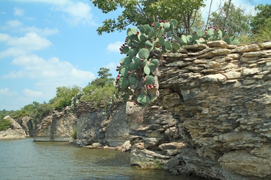
Beautiful Lake Bridgeport is located in is located in Wise and Jack Counties, upstream from Eagle Mountain Lake on the West Fork of the Trinity River. It has a unique rocky coastline,…
Year(s) Constructed: 1961-1965 Count(ies): Henderson and Kaufman Conservation Pool: 322.00 100 Year Flood Elevation: 323.50 Length (miles): 18 Width (miles): 8.5 Shoreline (miles): 220.26 Maximum Depth (ft): 70.6 Maximum Flood Elevation:…

After recently completing its Blue Zones Project Worksite Pledge, the Tarrant Regional Water District (TRWD) in Fort Worth has been named a Blue Zones Project Approved™ Worksite. TRWD is proud…
[fusion_text] Friday, August 26, 2016 4 PM data Lake Bridgeport Current elevation is 836.63 ft-msl (normal conservation pool = 836.00 ft-msl). The first habitable structure is at 839.02 ft-msl, Highway…
TRWD has been named the 2014 recipient of the Association of Dam Safety Officials (ASDSO) National Rehabilitation Project of the Year Award. The district is being recognized for its rehabilitation…
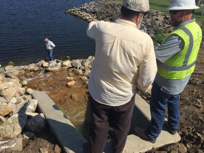
People don’t think about dams needing maintenance, but a lot can happen to those solid structures as temperatures, humidity and water levels increase and decrease. Staying ahead of any potential…

Record rains in 2015 have nearly pushed TRWD’s reservoirs to their limits three times during the last six months. Managing those rapidly rising flood waters in and around our…

Love the Trinity River as much as we do? Help us take care of one of Fort Worth’s greatest attractions by becoming a Riverkeeper through TRWD’s Adopt-A-River Program. The Tarrant…

Click on the link for more information about the September 6, 2016 tax-rate-agenda-agenda-9-6-16
[fusion_text] Friday, August 26, 2016 4 PM data Lake Bridgeport Current elevation is 836.63 ft-msl (normal conservation pool = 836.00 ft-msl). The first habitable structure is at 839.02 ft-msl, Highway…
© 2026 Tarrant Regional Water District