Reduce the risk of flooding in our communities with dependable flood damage reduction infrastructure and operations.
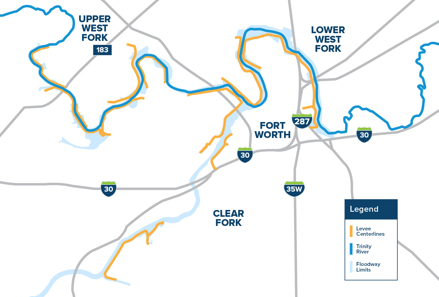
We manage an extensive floodway system that protects Fort Worth.
The system encompasses Lake Bridgeport, Eagle Mountain Lake and 27 miles of floodway levees built by the U.S. Army Corps of Engineers. These structures work together to provide vital flood protection to area residents and businesses and protect billions of dollars of property behind the levee system.
Watch how the system works
The floodway levees along the Trinity River protect hundreds of thousands of Fort Worth residents and more than $1.2 billion in assets.
Fort Worth Floodway System
History of the Trinity Floodway
The flood of 1949, which many consider to be the worst in Fort Worth’s history, took the lives of 10 citizens, left more than 13,000 homeless, and destroyed hundreds of homes and businesses along the Clear and West Forks of the Trinity.This devastating flood event changed the course of Fort Worth’s history, and led to the creation of the 27-mile Fort Worth Floodway that protects the city today. Designed and built by the U.S. Army Corps of Engineers in the 1950s, 60s and 70s, the levees have been maintained and operated by TRWD’s operations personnel for the last 70 years.
Taxing District
Do you own property within TRWD’s taxing district? The best way to find out is by looking at your tax bill from the Tarrant Appraisal District. If you see the tax code 223 REGIONAL WATER DISTRICT on your statement, you own within our boundary.
Interactive TRWD Taxing District MapInteractive TRWD Taxing District Map
Tax Rate InformationTax Rate Information
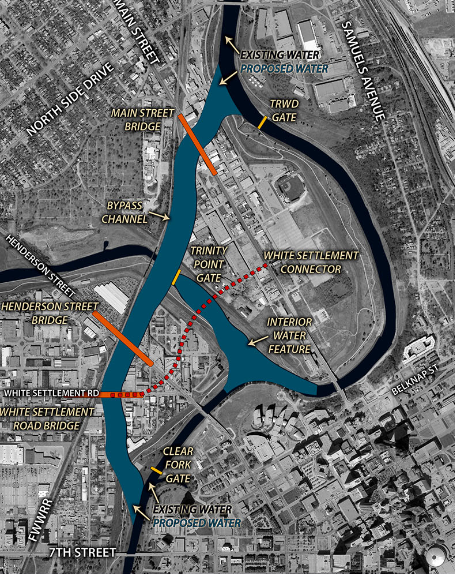
Central City Flood Control Project
TRWD is a local sponsor of the Central City Flood Control Project, which is being designed and built by the U.S. Army Corps of Engineers. This vital project addresses Fort Worth’s flood risks that are a result of a rapidly growing population, which has tripled in size since the current levee system was built in 1960. The two main components of the flood control project are: the rerouting of a section of the Trinity River just north of downtown and modifying Gateway Park on the east side of the city to better manage flood events in a manner that will also restore the area. Those efforts will provide much-needed flood protection to over 2,400 acres of Fort Worth neighborhoods valued at over $2 billion.