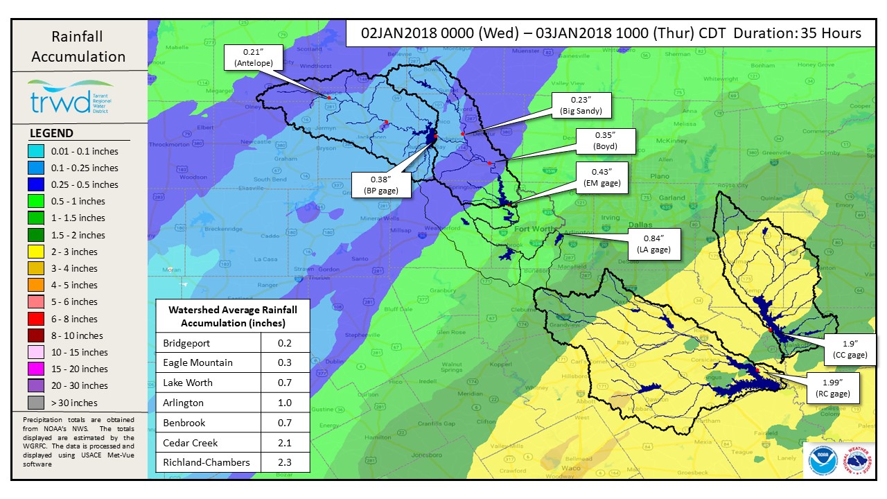
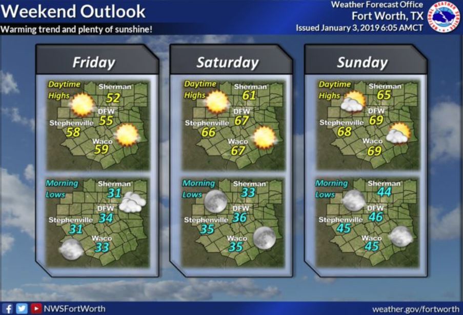
TRWD staff continues to monitor conditions in the TRWD reservoir watersheds 24 hours a day. A map showing cumulative rainfall amounts in the TRWD watersheds since January 2 at midnight is provided in Graphic 1, below. The majority of the rain has moved eastward out of the TRWD watersheds, and conditions are anticipated to be dry through the weekend. See NWS guidance below in Graphic 2. Currently all TRWD reservoirs are above conservation level, and discharges are being made to return the pools to their conservation level.
Current lake levels can be viewed on the TRWD Home Page. The blog will be updated periodically with additional information. Please check back.
Graphic-1. 35-Hour Cumulative Rainfall
Graphic-2. NWS Guidance
*Lake Worth is owned and operated by the City of Fort Worth. See City of Fort Worth news feed for updates on Lake Worth.
Please call the Flood Hotline for further information.
817-720-4296.
If prompted to leave a message, the flood monitor on duty will return your call within 30 minutes.