Heavy rainfall fell over TRWD East Texas (ET) lakes (Richland-Chambers and Cedar Creek) last night. Both ET lakes are above conservation and releasing flood waters. Additional rain will require spillway adjustments. The West Fork lakes (Bridgeport and Eagle Mountain) have plenty of room to store the runoff generated by the rain. This could help replenishing our WF lakes, which have been lower in comparison to our ET lakes. TRWD staff will be monitoring conditions over the duration of this rain event and flood gate operations at the ET lakes will be adjusted accordingly.
Outlook
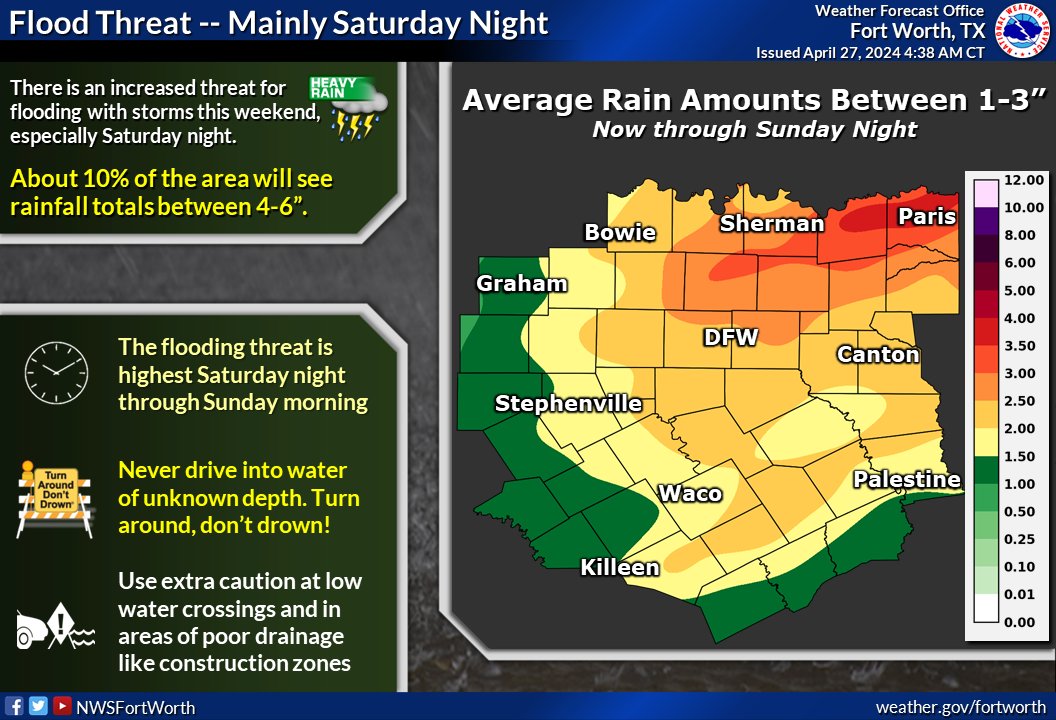
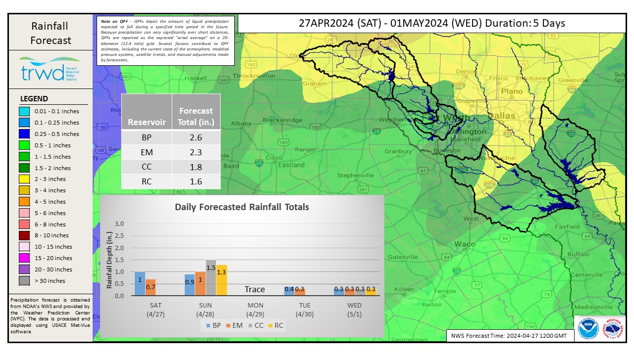
Additional heavy rain (1.5-1.8″) is expected this weekend at the ET lakes that will likely require spillway adjustments. The West Fork lakes are expected to get around 2.5″ of rain. There is an increased risk for flooding, particularly tonight into tomorrow. See Graphic-1 for additional information on this upcoming rain event. See the NWS rainfall forecast for the next 5 days in Graphic 2.
Next update will come Sunday morning after conditions are assessed following the rain. Until then have a wonderful day!
Graphic-1. NWS Guidance
Graphic-2. NWS 5-Day Rainfall Forecast
Follow our partners at the National Weather Service (NWS) and the River Forecast Center (RFC) for the latest information regarding weather and river conditions, respectively.
Current TRWD lake conditions are shown below. Be sure to subscribe to receive e-mail notification of any new Lake Level Blog posts. You can also follow @TRWD_News on X (formerly known as Twitter) to receive Lake Level blog notifications.
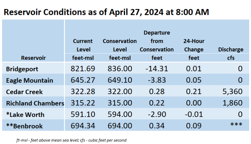
*Lake Worth is owned and operated by the City of Fort Worth. See the City of Fort Worth news feed and NWS forecast page for updates on Lake Worth.
**Benbrook Lake is owned and operated by the U.S. Army Corps of Engineers. ***See Benbrook Lake Home Page for current discharge.
Current lake levels can be found in a variety of locations including TRWD.com, the TRWD watershed data viewer trwd.onerain.com, or download the TRWD Lake Level App for iOS or Android.
Please call the Flood Hotline for further information.
817-720-4296
If prompted to leave a message, the flood monitor on duty will return your message within 30 minutes.
Posted by VdO