Bottom Line:
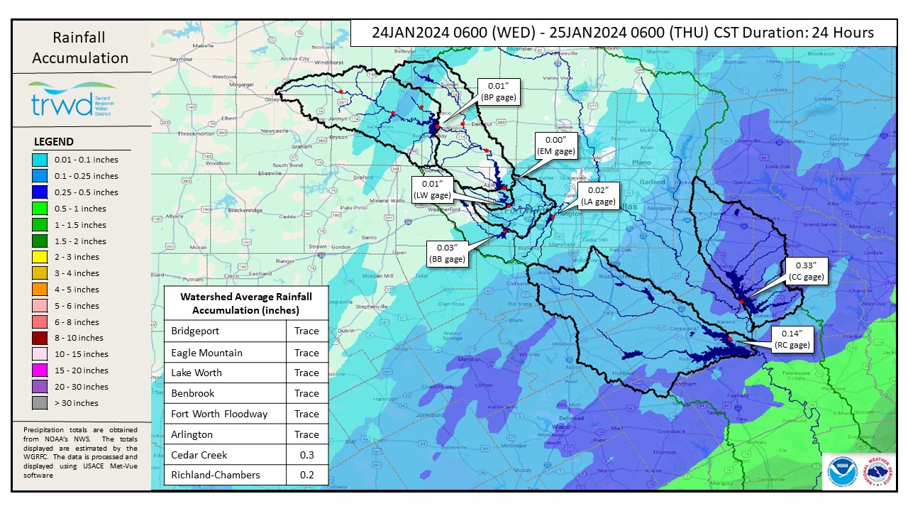
- The overnight rain in the Cedar Creek and Richland-Chambers watersheds was relatively light and will not have much additional impact on these lakes. See Graphic-1 for a map of rain totals.
- Cedar Creek is nearing its peak elevation for this event, which is in the ballpark of 322.3 ft-msl.
- Richland-Chambers continues to rise and has potential to fill tomorrow afternoon.
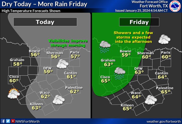
- The next rain chance comes tomorrow with the arrival of a cold front that is expected to bring 0.5 to 1 inch of rain to the Bridgeport and Eagle Mountain area. See Graphic-2 for NWS Guidance.
Flood discharges are on-going at Cedar Creek and will continue as the level is brought back to conservation pool (el. 322.0). TRWD staff will continue to monitor watershed conditions and evaluate spillway operations at the TRWD lakes.
Current TRWD lake conditions are shown below. Updates regarding flood discharges from TRWD lakes will be posted to the Lake Level Blog. Additional updates regarding lake conditions will be provided as conditions dictate. Be sure to subscribe to receive e-mail notification of any new Lake Level Blog posts.
Follow our partners at the National Weather Service (NWS) and the River Forecast Center (RFC) for the latest information regarding weather and river conditions, respectively.
*Please be advised that forecasts and projections are subject to change, and TRWD reservoir operations are based on observed rainfall conditions.
Graphic-1. 24-Hour Rainfall Totals
Graphic-2. NWS Guidance
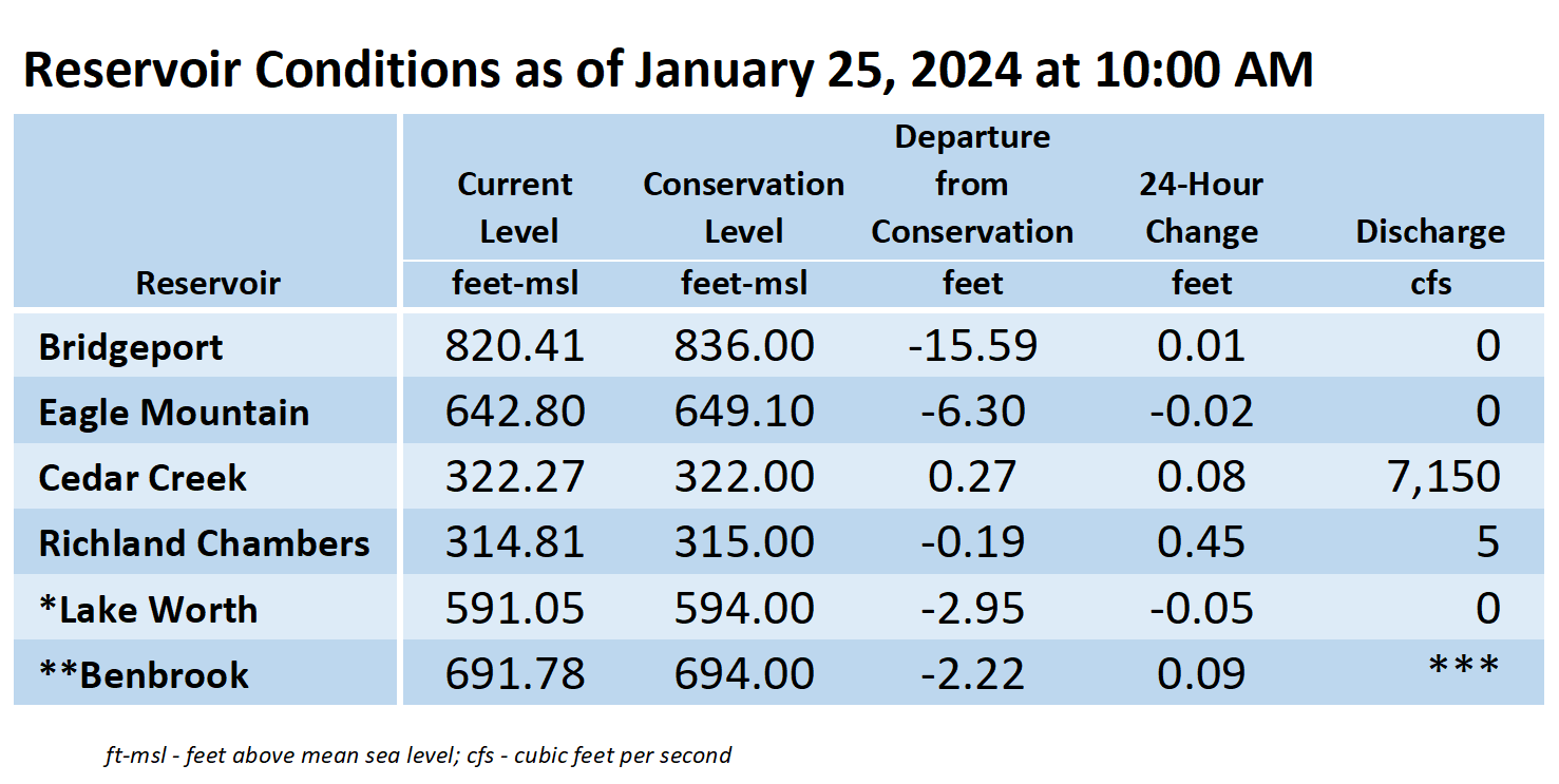
*Lake Worth is owned and operated by the City of Fort Worth. See the City of Fort Worth news feed and NWS forecast page for updates on Lake Worth.
**Benbrook Lake is owned and operated by the U.S. Army Corps of Engineers. ***See Benbrook Lake Home Page for current discharge.
Current lake levels can be found in a variety of locations including TRWD.com, the TRWD watershed data viewer trwd.onerain.com, or download the TRWD Lake Level App for iOS or Android.
Please call the Flood Hotline for further information.
817-720-4296
If prompted to leave a message, the flood monitor on duty will return your message within 30 minutes.
Posted by CO