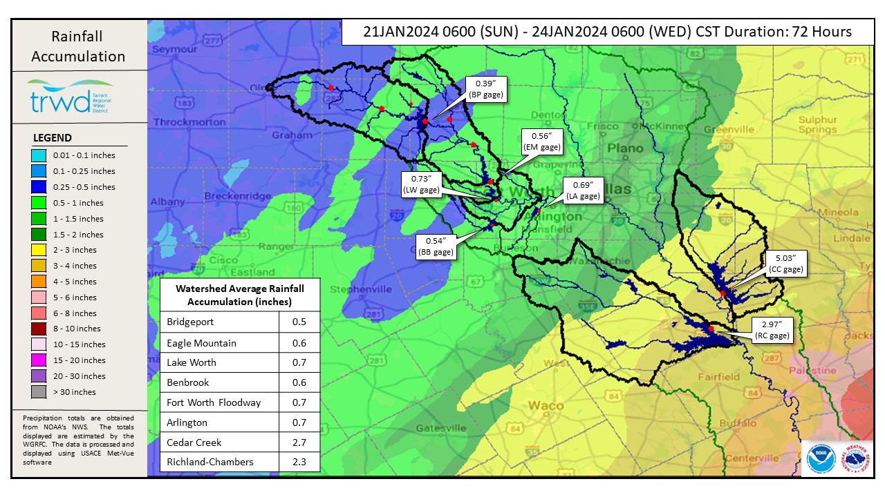
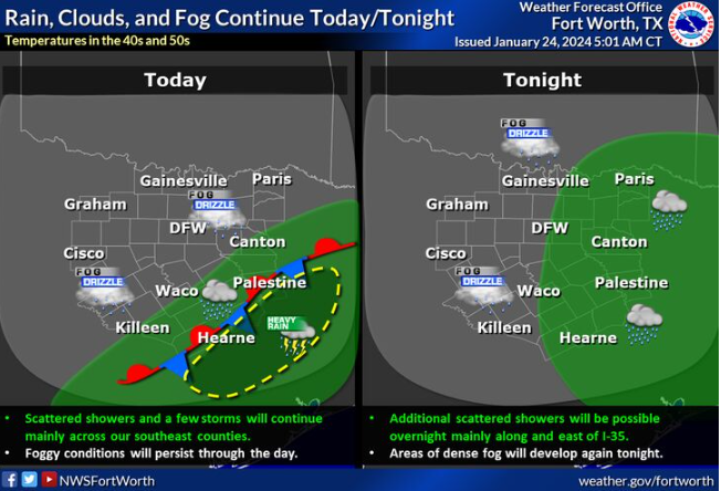
Bottom Line: The heaviest rainfall last night fell southeast of the Cedar Creek and Richland-Chambers watersheds. Graphic-1 below shows the 72-Hour Rainfall Accumulation map for the TRWD service area. An additional 0.5” or so of rainfall is expected to trickle in Over the next few days. See Graphic-2 for NWS Guidance.
Cedar Creek Reservoir received enough rain to fill the lake past full (elev. 322.0). Reservoir staff initiated spillway operations early Wednesday morning to begin returning the lake level to 322.0. The reservoir is expected to peak a half foot or less over conservation in the next few days depending on spillway operations and additional rainfall.
Richland-Chambers continues to rise. It is still too early to know for certain but there is a chance it will reach full (elev. 315.0) later this week/weekend or come very close. TRWD will continue to monitor conditions and will initiate spillway operations at Richland-Chambers as necessary.
Current TRWD lake conditions are shown below. Updates regarding flood discharges from TRWD lakes will be posted here. Additional updates regarding lake conditions will be provided as conditions dictate. Be sure to subscribe to receive e-mail notification of any new Lake Level Blog posts.
Please follow our partners at the National Weather Service (NWS) and the River Forecast Center (RFC) for the latest information regarding weather and river conditions, respectively.
*Please be advised that forecasts and projections are subject to change, and TRWD reservoir operations are based on observed rainfall conditions.
Graphic-1. 72-Hour Rainfall Accumulation
Graphic-2. NWS Guidance
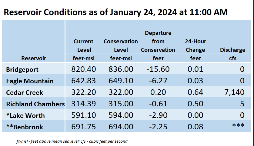
*Lake Worth is owned and operated by the City of Fort Worth. See the City of Fort Worth news feed and NWS forecast page for updates on Lake Worth.
**Benbrook Lake is owned and operated by the U.S. Army Corps of Engineers. ***See Benbrook Lake Home Page for current discharge.
Current lake levels can be found in a variety of locations including TRWD.com, the TRWD watershed data viewer trwd.onerain.com, or download the TRWD Lake Level App for iOS or Android.
Please call the Flood Hotline for further information.
817-720-4296
If prompted to leave a message, the flood monitor on duty will return your message within 30 minutes.
Posted by ASL