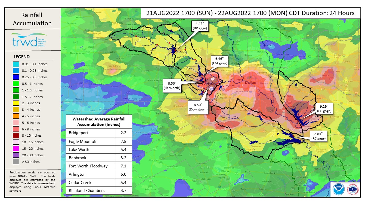
TRWD staff continues to monitor conditions at the reservoirs. A lot of rain over the weekend and especially in the last 24-hours, see Graphic 1 for totals. The bulk of the heavy rain in Tarrant County fell below the reservoirs meaning it will not make its way to Bridgeport or Eagle Mountain. Cedar Creek received nearly than 10″ right at the lake and an average of 5.4″ in the watershed. The dry watershed conditions are limiting the impacts of all this rain as a majority of the rain will be lost to infiltration. Cedar Creek is expected to continue climbing and can could possibly reach as high as elevation 319. That said, Cedar Creek is not expected to fill at this time. The same is true at the other TRWD lakes, Bridgeport, Eagle Mountain and Richland-Chambers are not expected to fill at this time either. Keep up with lake levels at TRWD.com or at the TRWD OneRain site and remain weather aware by following the National Weather Service (NWS) River Forecast Center (RFC). This will be the last post for this event.
Graphic-1. 24-Hour Rain Totals
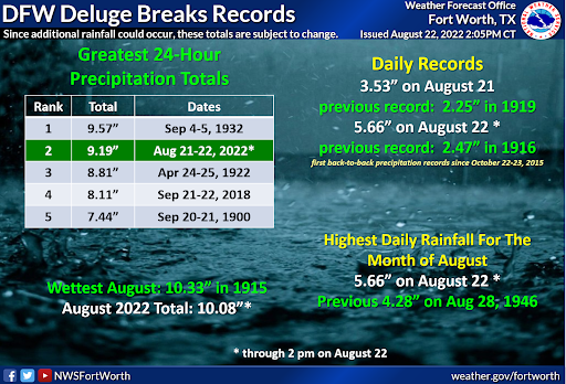
Graphic-2. NWS Rain Records
Reservoir Conditions
Current reservoir conditions are shown below. All reservoirs are currently below conservation level meaning they are less than full.
Please be advised that forecasts and projections are subject to change, and TRWD reservoir operations are based on observed rainfall conditions. Additional updates will be provided as conditions dictate. Be sure to subscribe to receive e-mail notification of any new Lake Level Blog posts. You can also follow @TRWD_News on Twitter to receive Lake Level blog notifications.
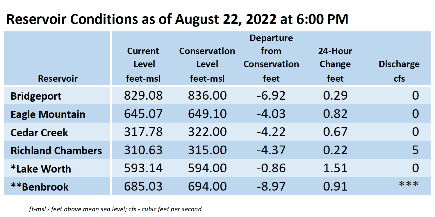
*Lake Worth is owned and operated by the City of Fort Worth. See the City of Fort Worth news feed and NWS forecast page for updates on Lake Worth.
**Benbrook Lake is owned and operated by the U.S. Army Corps of Engineers. ***See Benbrook Lake Home Page for current discharge.
Current lake levels can be found in a variety of locations including TRWD.com, the TRWD watershed data viewer trwd.onerain.com, or download the TRWD Lake Level App for iOS or Android. You may also follow the NWS and the River Forecast Center (RFC) for the latest information regarding weather and river conditions, respectively. You can also check out this YouTube video to see what OneRain is all about!
Please call the Flood Hotline for further information.
817-720-4296
If prompted to leave a message, the monitor on duty will return your message within 30 minutes.
Posted by CO.