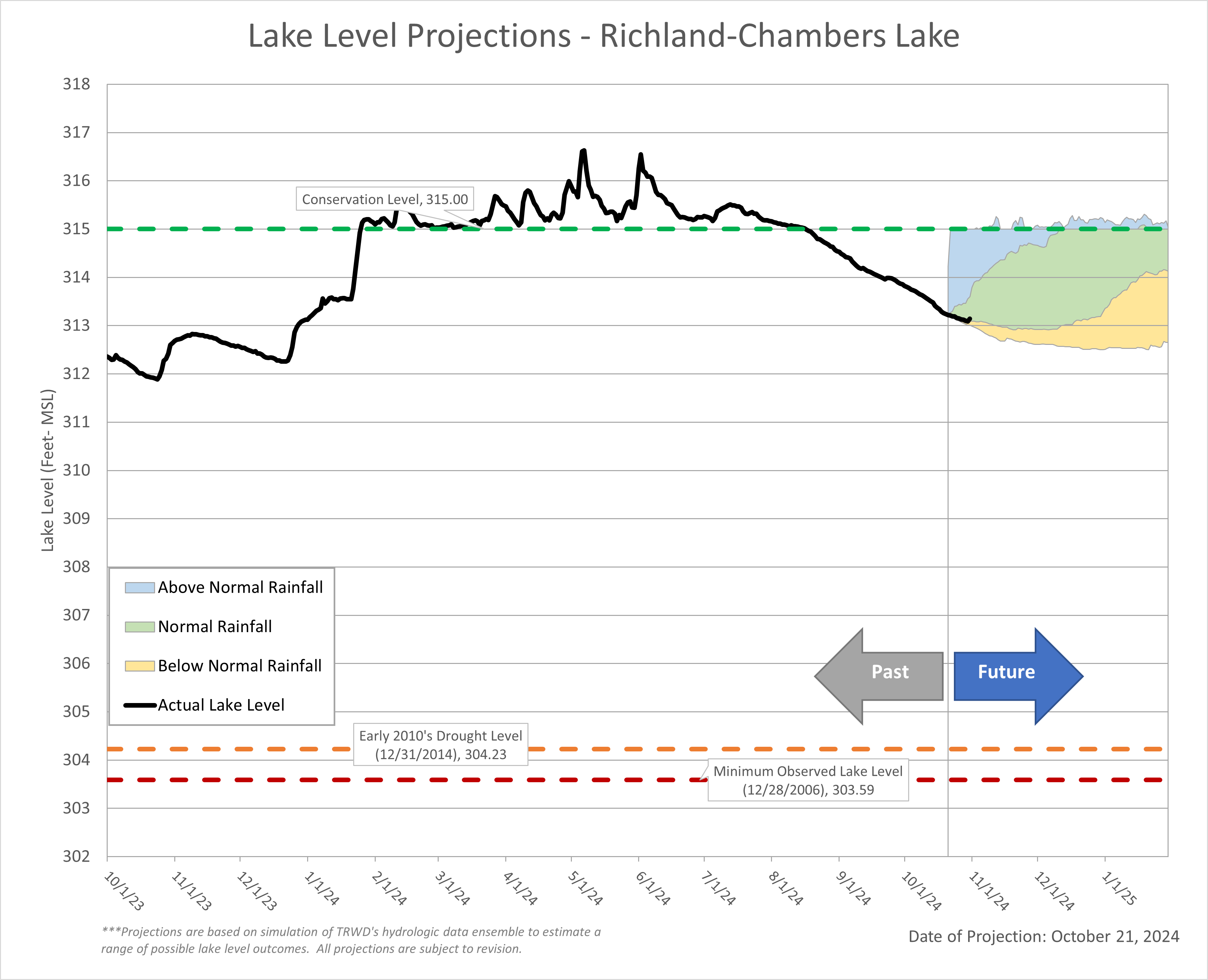
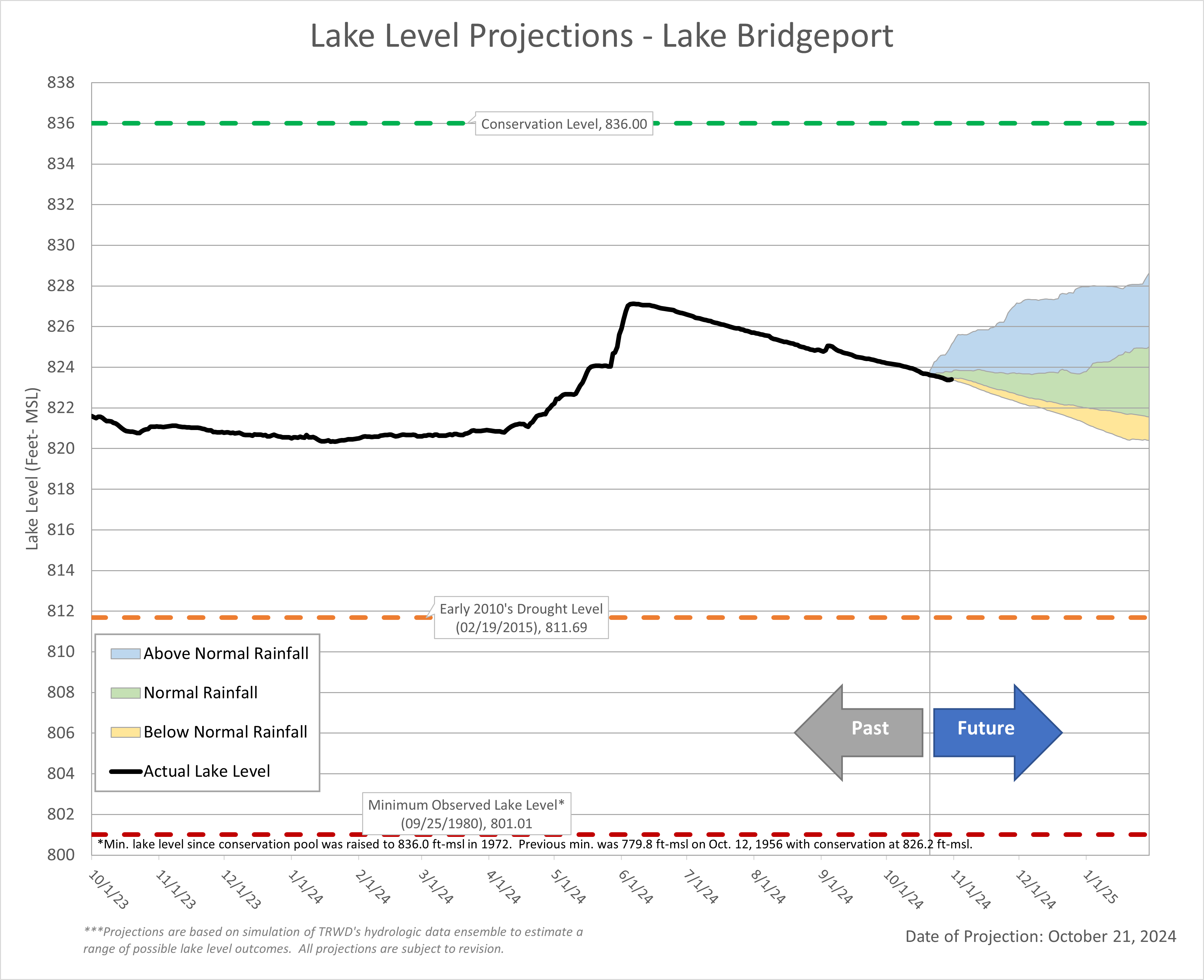
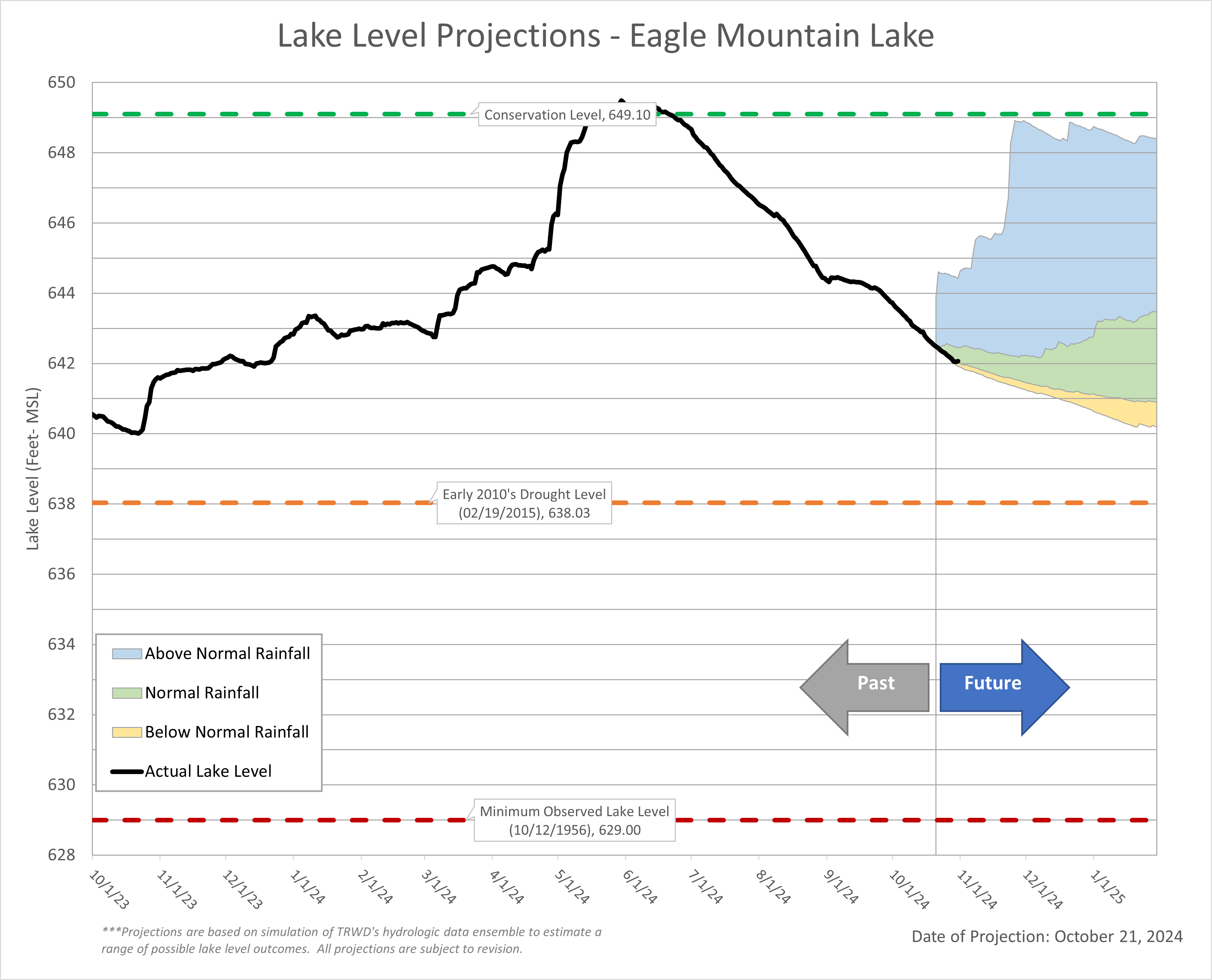
October was a rough month for water supply! Lack of rain, above normal temperatures, and high demands were responsible for a 3.7% decline in the TRWD system storage over the last 30-days. On the bright side system storage is at 84%, up six points compared to 78% one year ago. TRWD’s Meteorologist, Courtney Jalbert, provides information on what we can expect in terms of rainfall and temperatures going into the next couple of months and their impacts to lake levels in the “From our Meteorologist” section.
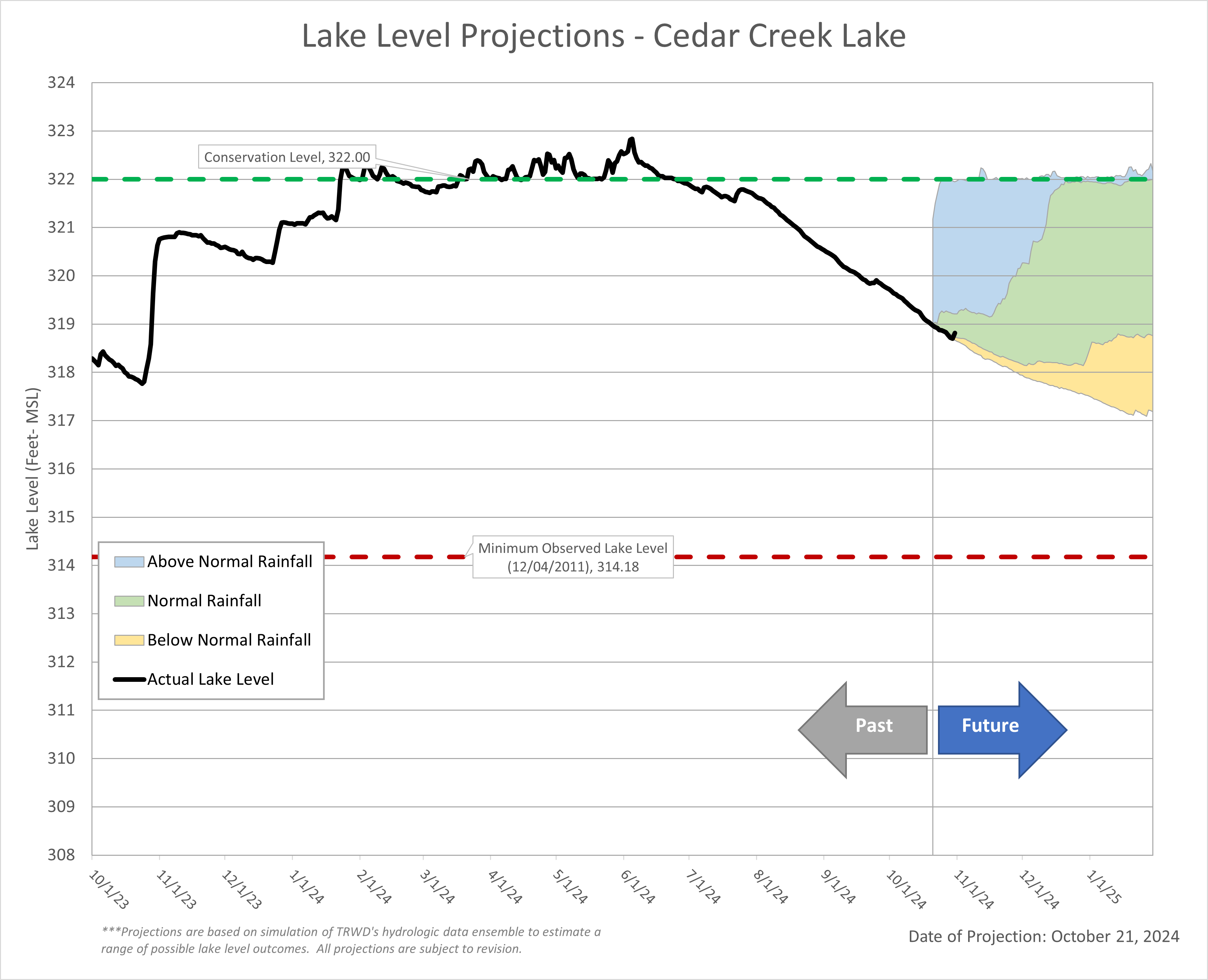
The latest lake level projections are shown below. You will also find:
- Links to historical lake level plots
- Last month’s projections compared to what actually happened
Thank you for following the Lake Level Blog and check back next month for more projections.
From our Meteorologist
October Summary…
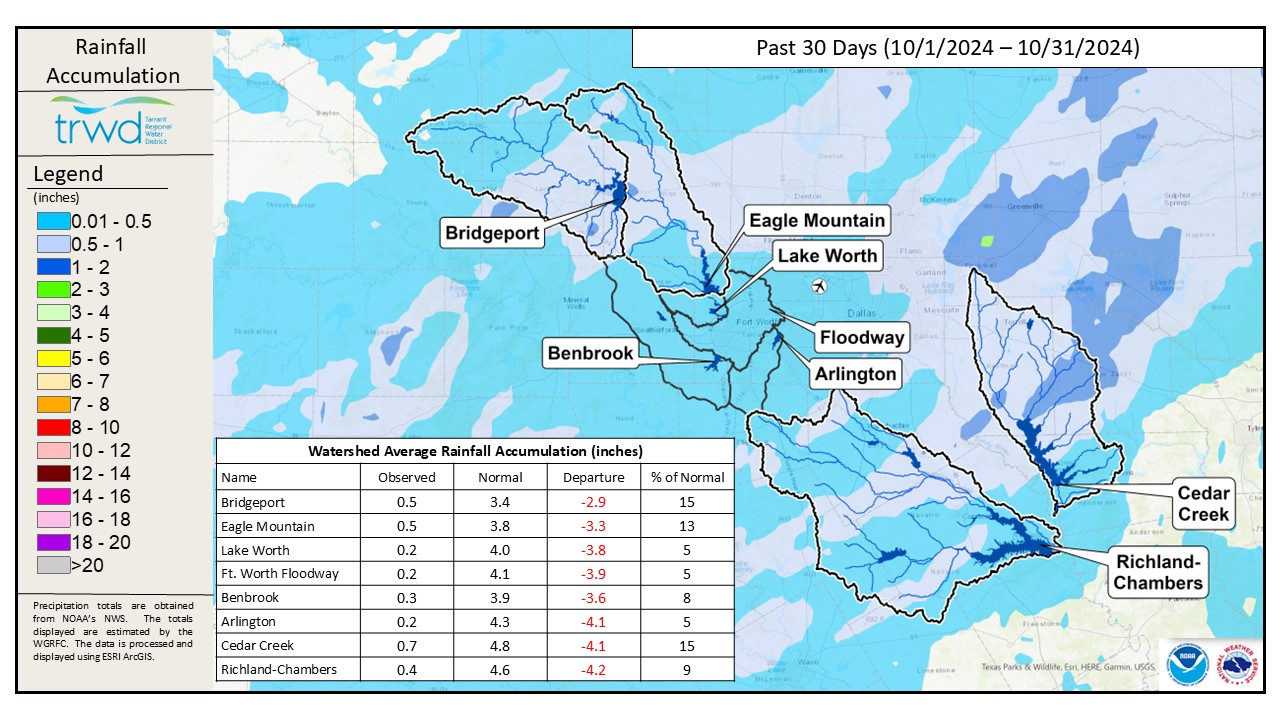
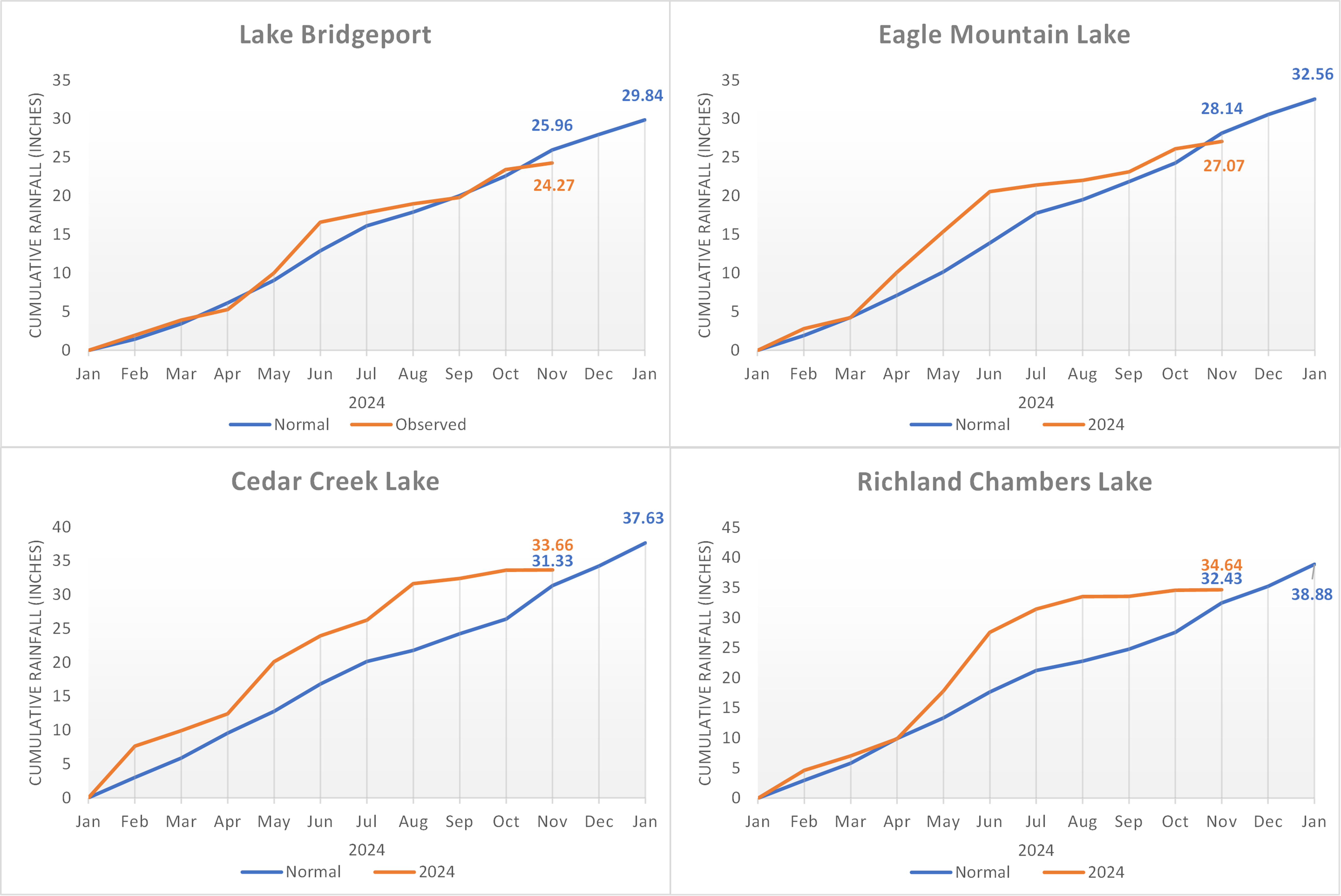
October was incredibly warm and dry. It seemed like summer held on with temperatures eight degrees above normal and no rain until the last day of the month for most of the region. DFW only recorded 0.21” of measurable rainfall on October 31st, making October 2024 the 9th driest on record. TRWD’s reservoirs followed the trend in only receiving rainfall the last day of October, with watershed averages ranging between 0.4″ to 0.7″. These numbers were considerably below normal as can be seen on the 30-Day Rainfall Totals map below.
30-Day Rainfall Totals
Drought intensity increased for almost all areas in North Texas with the absence of typical October rainfall. D2, Severe Drought, and D3 Extreme Drought categories have slowly crept into the region with the accumulation of rainfall deficits this fall as seen on the local drought intensity map.
TRWD Lake Rainfall Totals through October 31, 2024
Looking ahead…
North Texas is in store for some much-needed changes to the weather pattern in early November. With a more activated jet stream, especially in the early part of the month, a slightly above normal chance of precipitation is expected for the month of November, as seen in the 1-Month Precipitation Outlook. However, it looks like temperatures will remain warmer, on average, as indicated from the Climate Prediction Center 1-Month Outlook for temperatures.
Aside from early November, the prevailing conditions are expected to be warm and dry for the remainder of fall and early winter as seen in the latest climate models for the November-December-January Temperature Outlook and the November-December-January Precipitation Outlook. These conditions are partly due to the Pacific ENSO La Nina conditions emerging. The North Texas winter will continue the warm and dry pattern as La Nina is expected to persist through January to March of 2025.
Projections
Lake Bridgeport
Eagle Mountain Lake
Cedar Creek Lake
Richland-Chambers Lake
