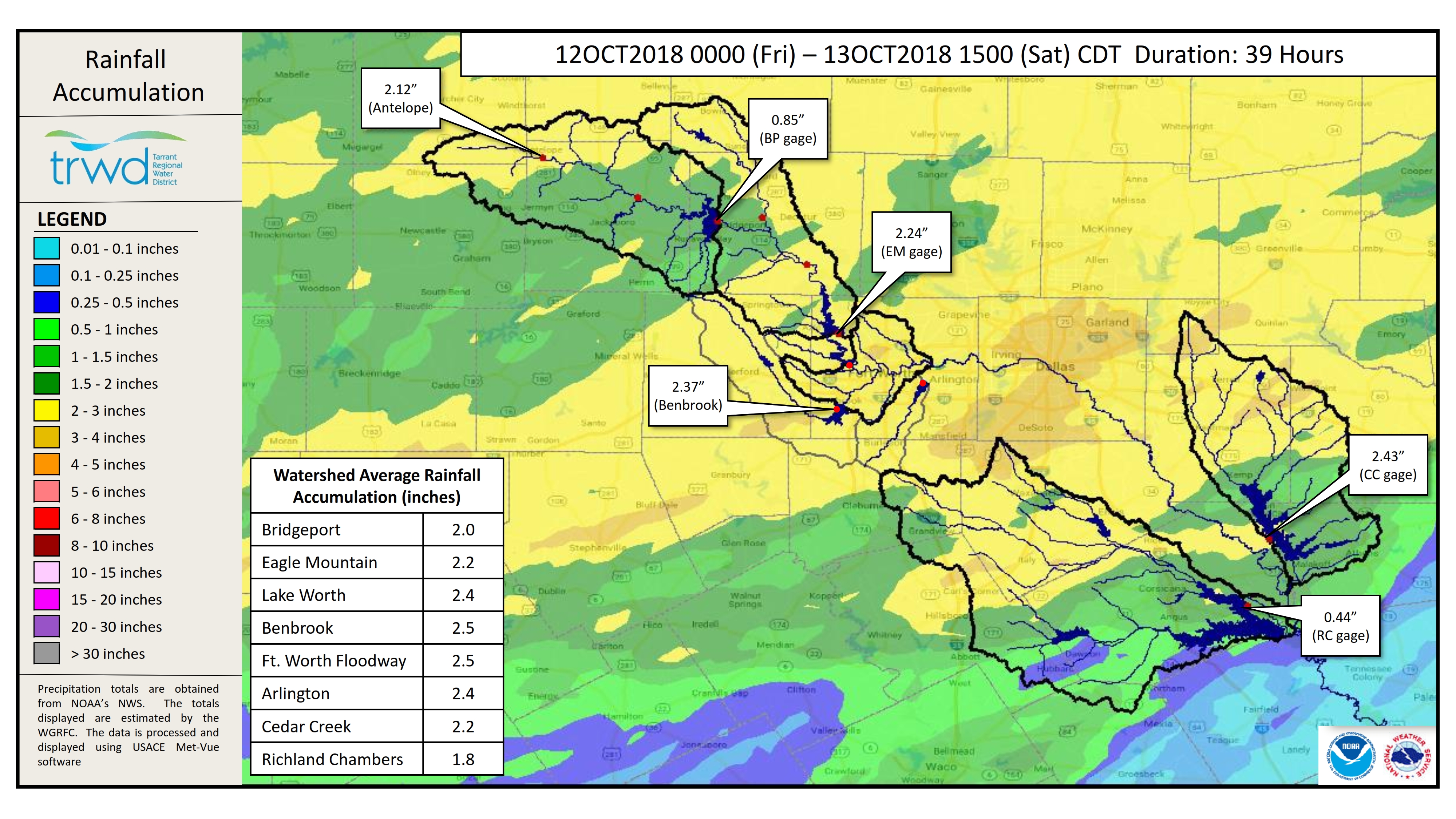
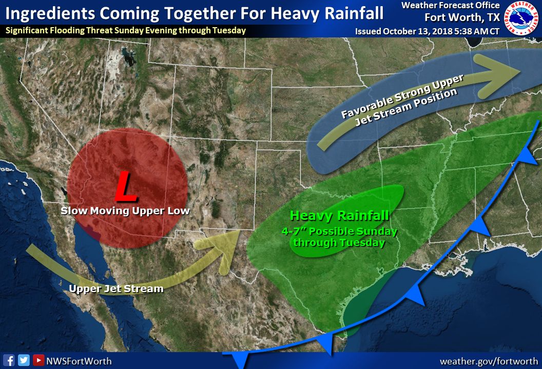
TRWD staff continues to monitor conditions in the TRWD reservoir watersheds 24 hours a day. Rainfall is coming to an end for the day. Graphic-1 shows the rainfall accumulation since 12 AM Friday morning. Overall 2-3 inches fell across the TRWD reservoir watersheds. The National Weather Service (NWS) is calling for another 4-7 inches of rain Sunday through Tuesday, see Graphic-2. Soils are saturated and any additional rainfall is expected to quickly turn to runoff.
River levels are on the rise at Jacksboro and Boyd. The NWS River Forecast Center has not issued a forecast or warning for minor flooding at these sites as of yet. Use the linked names above to follow the latest at these sites.
TRWD reservoir monitors are now expecting Eagle Mountain Lake to fill in the coming days as a result of today’s rainfall. It is also expected that Lake Worth, owned by the City of Fort Worth, will also fill as a result of today’s rainfall. Additional rainfall will expedite the time it will take for these lakes to fill. Current conditions at TRWD reservoirs are shown below. Please be advised that forecasts are subject to change and TRWD reservoir operations are based on observed rainfall conditions. Additional updates will be provided here if conditions dictate, please check back.
Graphic-1. Observed Rainfall Map
Graphic-2. NWS Center Guidance
The latest update of reservoir conditions follows:
Lake Bridgeport
- Current reservoir elevation – 830.83 ft-msl.
- Conservation level elevation – 836.00 ft-msl.
- Change in past 24 hours – +0.34 ft.
- Current discharge is 0 cfs.
Eagle Mountain Lake
- Current reservoir elevation – 648.44 ft-msl.
- Conservation level elevation – 649.10 ft-msl.
- Change in past 24 hours – +0.45 ft.
- Current release is 144 cfs.
Lake Worth (owned and operated by the City of Fort Worth)
- Current reservoir elevation – 593.01 ft-msl.
- Conservation level elevation – 594.00 ft-msl.
- Change in past 24 hours – +0.63 ft.
- Current discharge is 0 cfs.
- See City of Fort Worth news feed for updates on lake.
Cedar Creek
- Current reservoir elevation – 320.37 ft-msl.
- Conservation level elevation – 322.00 ft-msl.
- Change in past 24 hours – +0.11 ft.
- Current discharge is 0 cfs.
Richland-Chambers
- Current reservoir elevation – 314.10 ft-msl.
- Conservation level elevation – 315.00 ft-msl.
- Change in past 24 hours – +0.21 ft.
- Current release is 5 cfs (environmental flow).
Please call the Flood Hotline for further information.
817-720-4296.
If prompted to leave a message, the flood monitor on duty will return your call within 30 minutes.
*ft-msl – feet above mean sea level; cfs – cubic feet per second
Post based on conditions as of October 13, 2018, at 4:00 PM