Bottom Line
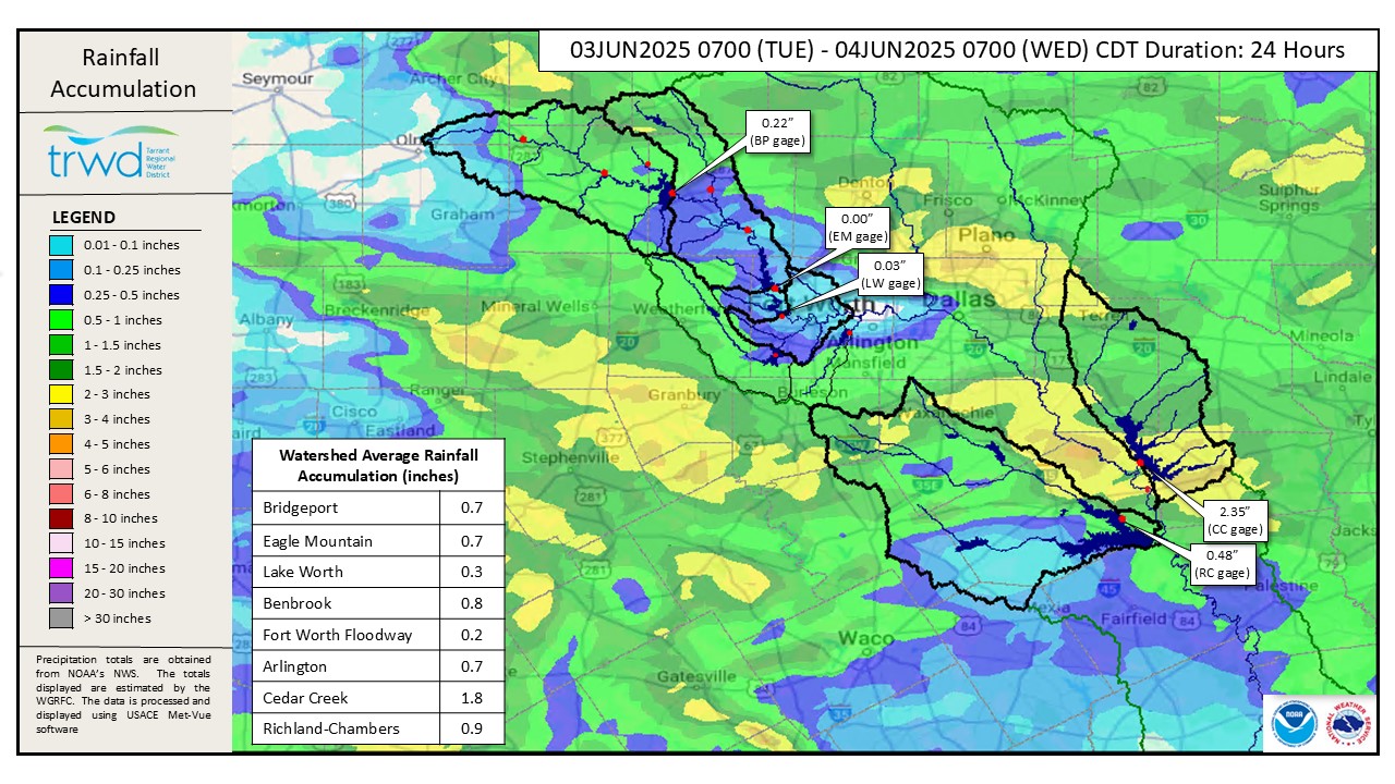
Spillway operations are ongoing at all four TRWD lakes. A line of thunderstorms pushed through the region last night, resulting in the rainfall totals shown in Graphic 1, below, for the 24-hour period ending at 7:00 am this morning. Overall, the TRWD watersheds received less than 1 inch of rain, except for the Cedar Creek watershed, which received almost 2 inches basin-wide, and over 3 inches near the southern end of the lake.
Projections
- Bridgeport: The lake elevation did not respond significantly due to local rainfall last night, and the pool continues to slowly decline. Spillway discharges will be adjusted as needed.
- Eagle Mountain: The lake elevation has increased by a little over 0.1′ due to last night’s rainfall and is expected to continue rising slightly due to increased inflows. Lake Worth has been holding fairly steady at about 0.6′ over conservation.
- Cedar Creek: The lake elevation increased by almost 0.4′ fairly quickly this morning, in response to locally heavy rainfall. Discharges were initiated this morning and have been increased as inflows to the lake increased.
- Richland-Chambers: Inflows to the lake are expected to increase from last night’s rain, along with a slight rise in the pool elevation. Discharges will be adjusted as necessary.
*Projections are subject to change and are based on past precipitation.
Looking Forward
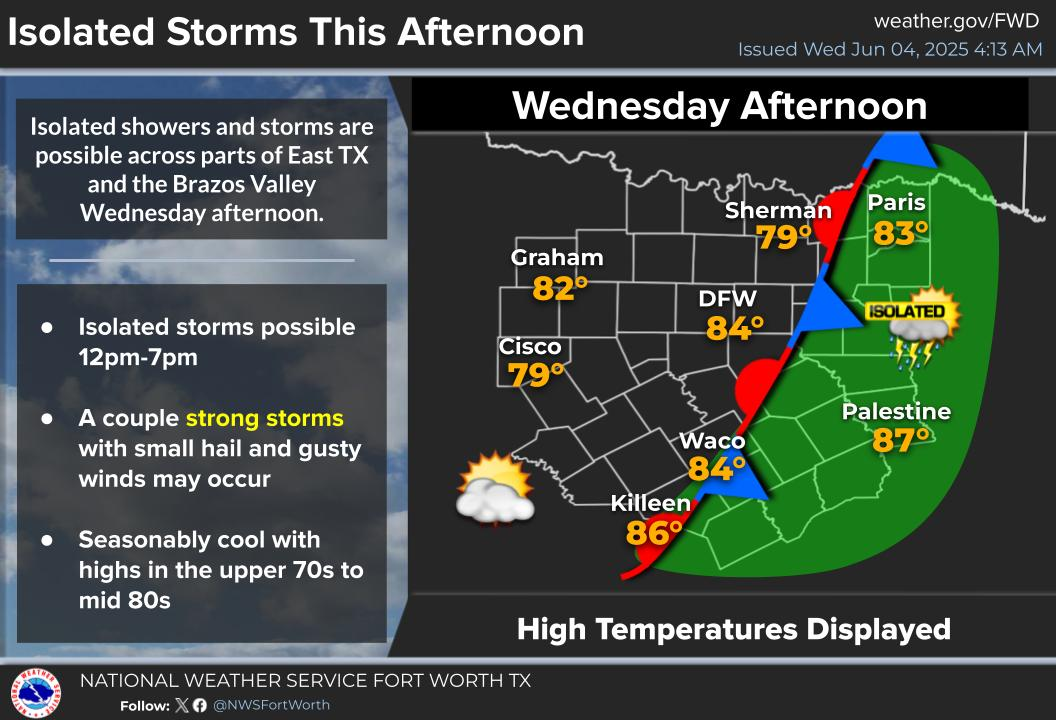
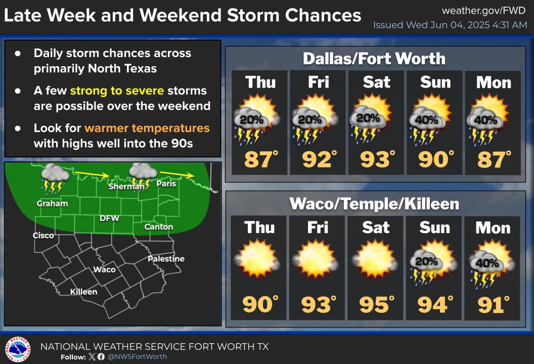
Isolated storms are possible this afternoon and early evening, with the primary focus being the Richland-Chambers and Cedar Creek watersheds. Beyond today, there are rain chances every day for the next five days, but overall totals are expected to be fairly low (0.2 inches or less each day). See NWS Guidance below in Graphics 2 and 3.
Next Update: The next Reservoir Monitoring Update will be posted as conditions warrant. TRWD staff will continue to monitor conditions 24/7 and are available to answer the flood line if there are any questions or concerns.
Graphic 1) Past 24 hour Observed Rainfall
Graphic 2) NWS Guidance – Wednesday
Graphic 3) NWS Guidance – Late Week and Weekend
Seasonal Lookback
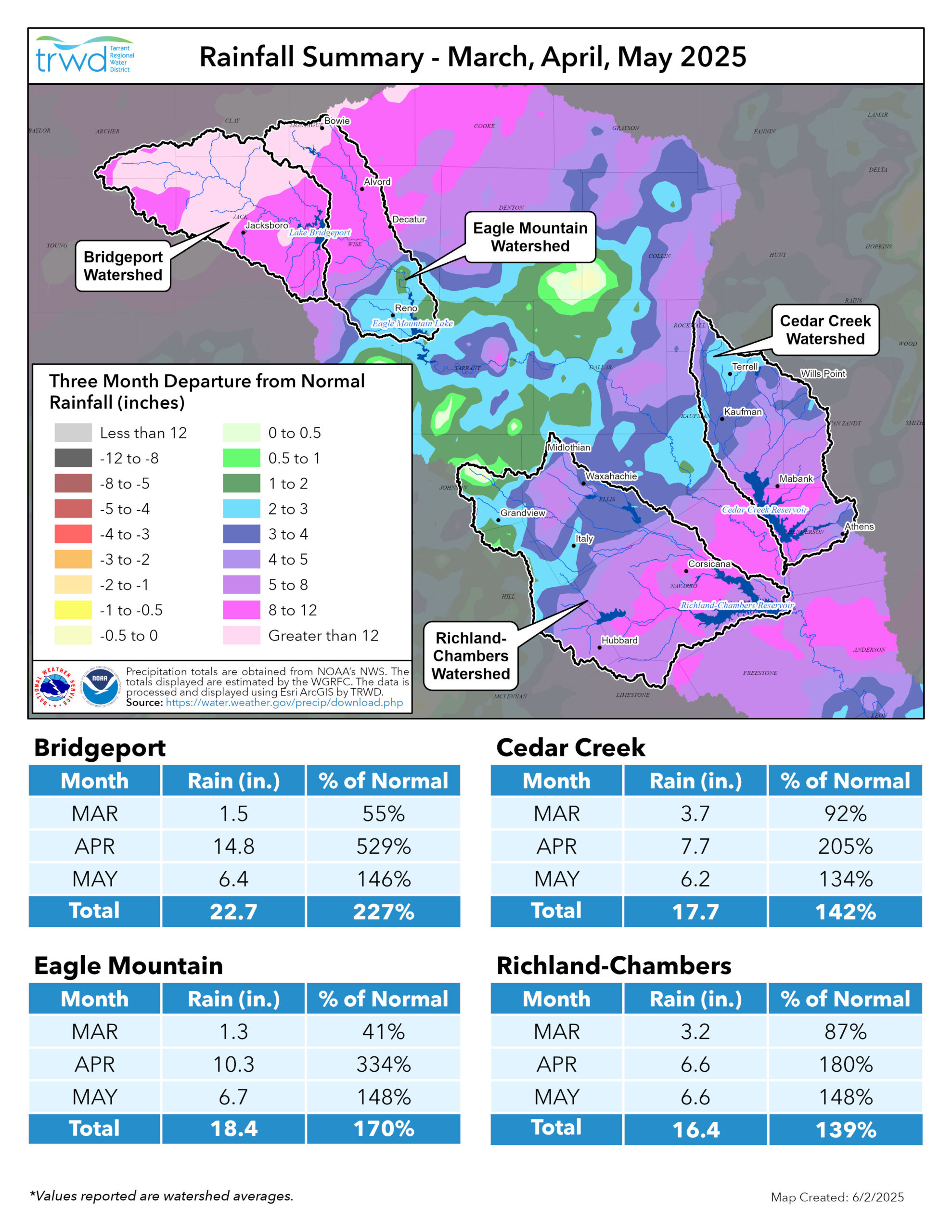
The region has received well above average rainfall for the past three months, with portions of the Bridgeport and Eagle Mountain watersheds receiving greater than 12 inches during that time period! A quarterly rainfall summary showing rainfall totals for March, April and May 2025, is included in Graphic 4.
Graphic 4) Quarterly Rainfall Summary
Current Lake Conditions
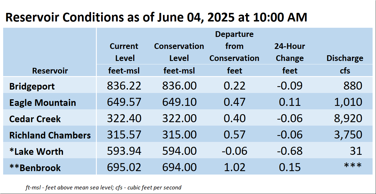
The information shown in the table above can also be found at trwd.onerain.com.
*Lake Worth is owned and operated by the City of Fort Worth. Please contact the City of Fort Worth and NWS forecast page for updates on Lake Worth.
**Benbrook Lake is owned and operated by the U.S. Army Corps of Engineers.
***See Benbrook Lake Home Page for current discharge.
Additional Information
TRWD staff will continue to monitor conditions and adjust flood discharges accordingly. Updates on reservoir conditions will be posted, and subscribers will receive email notifications of new blog posts. Also, visit our partners at the (NWS) and the River Forecast Center (RFC) for the latest information regarding weather and river conditions.
Contact Information
For questions, call the Flood Hotline at 817-720-4296 to leave a message for a TRWD Flood Team member.
Posted by NR.