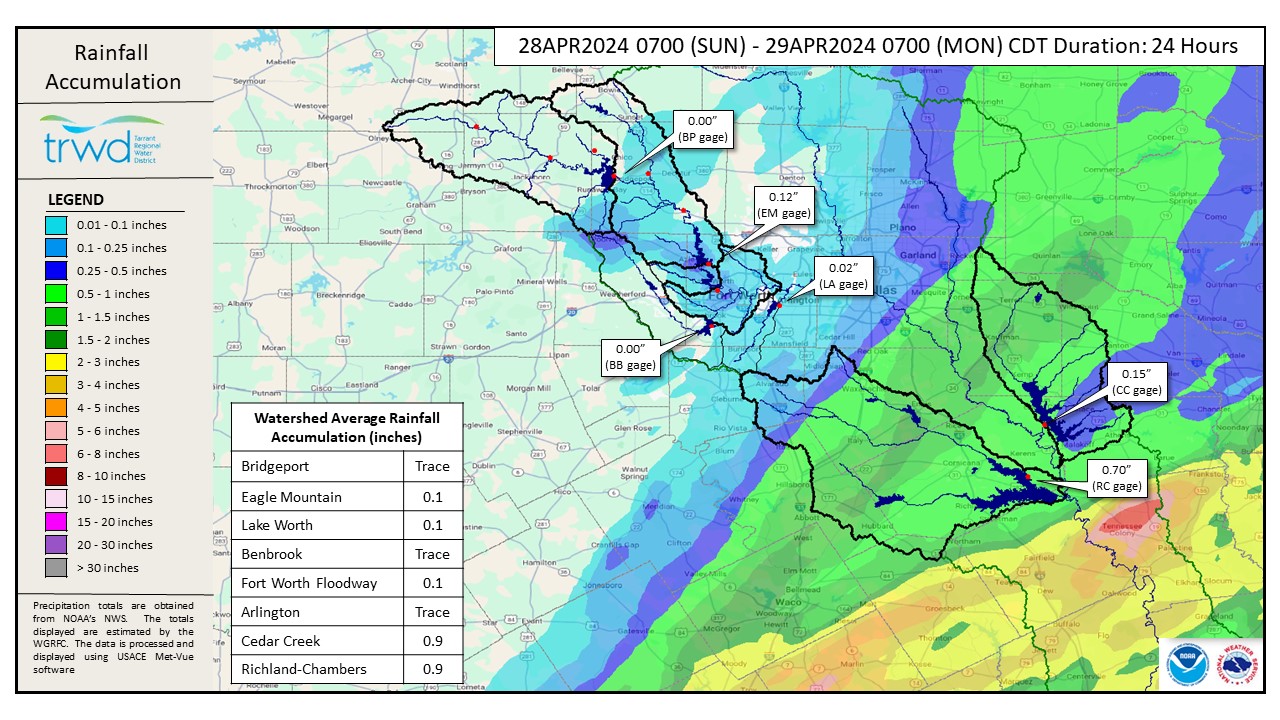
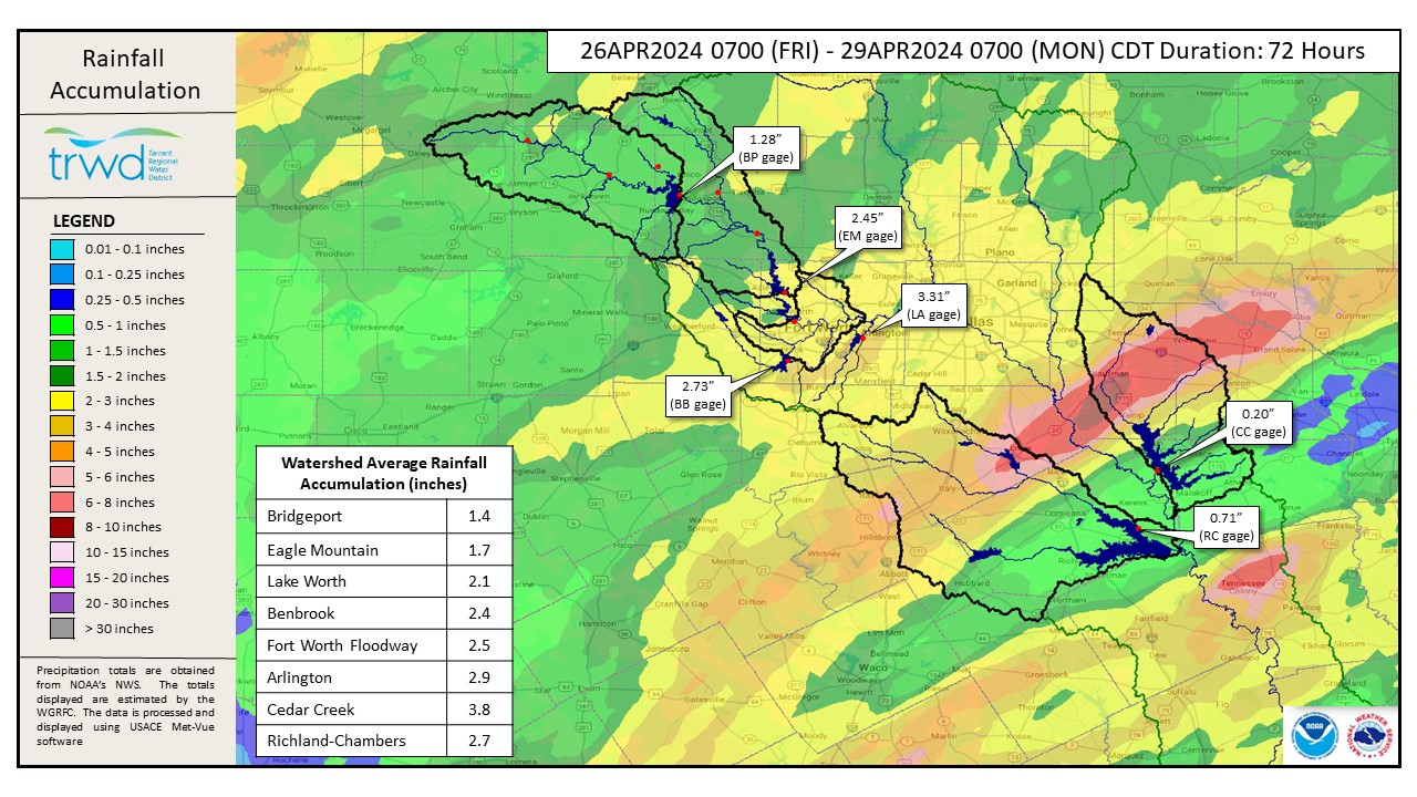
More rain in the already rain-soaked Cedar Creek (CC) and Richland-Chambers (RC) watersheds. See Graphic-1 for yesterday’s totals. Weekend rain totals can be seen in Graphic-2. The area between Kaufman and Kemp in the CC watershed received over 8″ of rain. This was the driver behind the frequent CC spillway changes over the weekend.
Flood Releases
In general, we are expecting both CC and RC to either recede or remain fairly constant over the next 24-hours as runoff from the weekend rainfall continues to flow into the lakes. Reservoir staff is monitoring this inflow to manage lake levels and downstream conditions as safe as possible.
Outlook
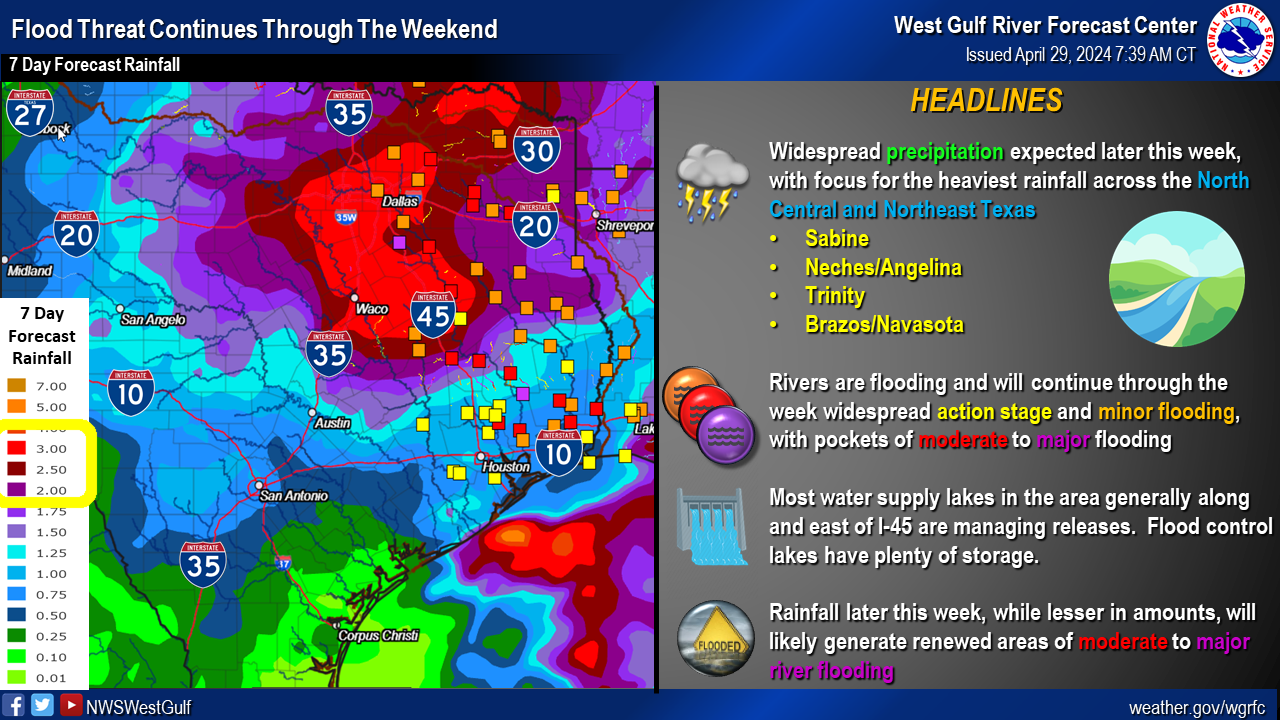
Graphic-3 is from the River Forecast Center and the forecasted rainfall depths for the week along with current and forecasted river conditions. Today and most of tomorrow should be a break from the rain. However, rain chances return on Wednesday.
This will be the final update for this event. Gate changes will continue to be posted to the Lake Level Blog. Next update will come when conditions warrant. Please subscribe or check back when lake levels are on the rise. Thanks!
Graphic-1. Rainfall Totals from the past 24-hours
Graphic-2. Weekend Rain Totals
Graphic-3. RFC Guidance
Follow our partners at the National Weather Service (NWS) and the River Forecast Center (RFC) for the latest information regarding weather and river conditions, respectively.
Current TRWD lake conditions are shown below. Be sure to subscribe to receive e-mail notification of any new Lake Level Blog posts. You can also follow @TRWD_News on X (formerly known as Twitter) to receive Lake Level blog notifications.
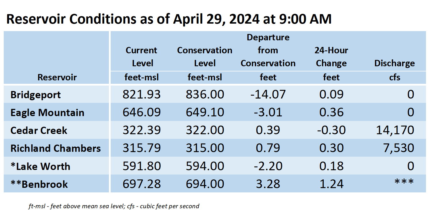
*Lake Worth is owned and operated by the City of Fort Worth. See the City of Fort Worth news feed and NWS forecast page for updates on Lake Worth.
**Benbrook Lake is owned and operated by the U.S. Army Corps of Engineers. ***See Benbrook Lake Home Page for current discharge.
Current lake levels can be found in a variety of locations including TRWD.com, the TRWD watershed data viewer trwd.onerain.com, or download the TRWD Lake Level App for iOS or Android.
Please call the Flood Hotline for further information.
817-720-4296
If prompted to leave a message, the flood monitor on duty will return your message within 30 minutes.
Posted by CO