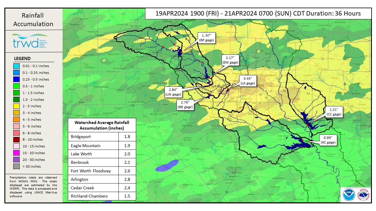
The TRWD watersheds received widespread rainfall since Friday night. Averages ranged from 1.5′ to 2.8′. See rainfall accumulation map in Graphic 1.
Reservoir Operations
*Projections below are based on conditions up to the time of publication. Additional rainfall and spillway operations past the time of publication are not accounted for in these projections.
Cedar Creek – Heavy rain in the northern portion of the Cedar Creek watershed, near Terrell and Kaufman, generated enough runoff to necessitate flood operations. Flood discharge from Cedar Creek is currently 7,160 cfs. Inflows is expected to continue as the areas upstream of the lake drain. Discharges will be adjusted as needed to accommodate the additional inflow.
Richland-Chambers – Water levels increased about a tenth of a foot since Friday. The amount of runoff generated from this rain has not necessitated additional flood releases, at this time.
Reservoir staff is monitoring conditions and will make updates to spillway operations as needed to safely pass the excess flood waters and return the reservoir back to conservation elevation. Updates regarding spillway gate changes from TRWD lakes will be posted to the Lake Level Blog as they occur.
Outlook
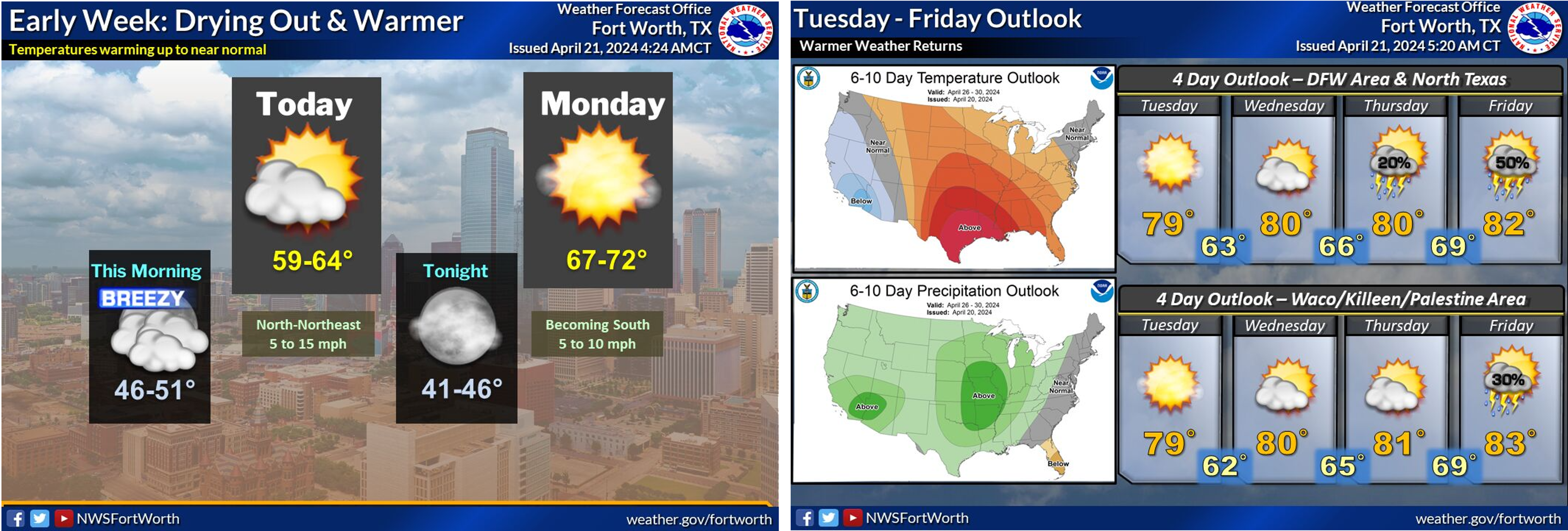
Dry conditions and a warm-up trend are expected this week until the next system arrives, see NWS guidance below. Rain chances are expected to return on Thursday.
This is the last update for this event. Please check the Lake Level Blog for future updates.
Follow our partners at the National Weather Service (NWS) and the River Forecast Center (RFC) for the latest information regarding weather and river conditions, respectively.
Current TRWD lake conditions are shown below. Be sure to subscribe to receive e-mail notification of any new Lake Level Blog posts. You can also follow @TRWD_News on X (formerly known as Twitter) to receive Lake Level blog notifications.
Graphic-1. 36-hour Rainfall Totals
Graphic-2. NWS Guidance
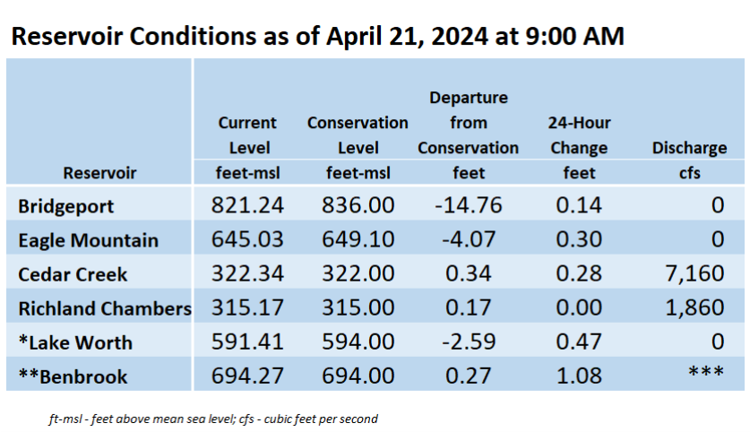
*Lake Worth is owned and operated by the City of Fort Worth. See the City of Fort Worth news feed and NWS forecast page for updates on Lake Worth.
**Benbrook Lake is owned and operated by the U.S. Army Corps of Engineers. ***See Benbrook Lake Home Page for current discharge.
Current lake levels can be found in a variety of locations including TRWD.com, the TRWD watershed data viewer trwd.onerain.com, or download the TRWD Lake Level App for iOS or Android.
Please call the Flood Hotline for further information.
817-720-4296
If prompted to leave a message, the flood monitor on duty will return your message within 30 minutes.
Posted by VdO