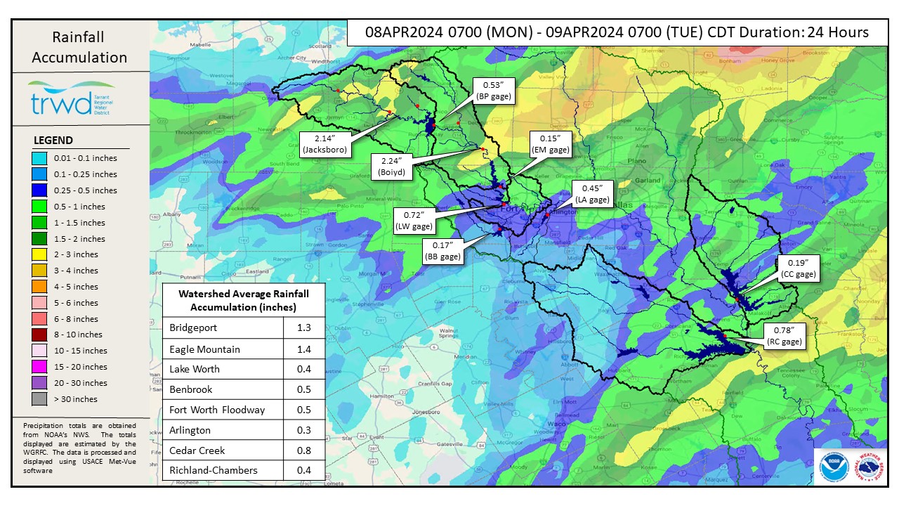
The TRWD watersheds received moderate rainfall Monday night. The Bridgeport and Eagle Mountain watersheds received above 1 inch on average across the area. The Richland-Chambers and Cedar Creek watersheds saw between 0.4 to 0.8 inches. A pocket of heavier rainfall fell just south of Richland-Chambers reservoir just missing the lake which is already at conservation capacity from previous rain events. See Graphic 1 below for a map of the rainfall depths from the past 24 hours.
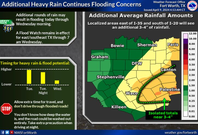
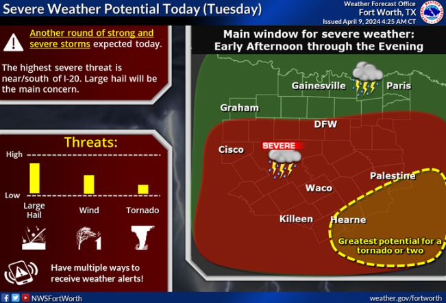
Additional rain is expected today. TRWD watersheds could see 1 to 2 inches across the area, with higher rainfall totals expected in East Texas near Richland-Chambers and Cedar Creek. Isolated totals up to 3 to 4 inches are possible. Severe weather is also possible. See NWS guidance below. Rain is expected to clear out by Wednesday morning.
Reservoir staff is monitoring conditions and will make updates to spillway operations as needed to safely pass the excess flood water and return the reservoir back to conservation elevation. Updates regarding spillway gate changes from TRWD lakes will be posted to the Lake Level Blog as they occur.
Current TRWD lake conditions are shown below. Be sure to subscribe to receive e-mail notification of any new Lake Level Blog posts. You can also follow @TRWD_News on X (formerly known as Twitter) to receive Lake Level blog notifications.
Follow our partners at the National Weather Service (NWS) and the River Forecast Center (RFC) for the latest information regarding weather and river conditions, respectively.
*Please be advised that forecasts and projections are subject to change, and TRWD reservoir operations are based on observed rainfall conditions.
Graphic-1. 24-hour Rainfall Totals
Graphic-2. NWS Guidance
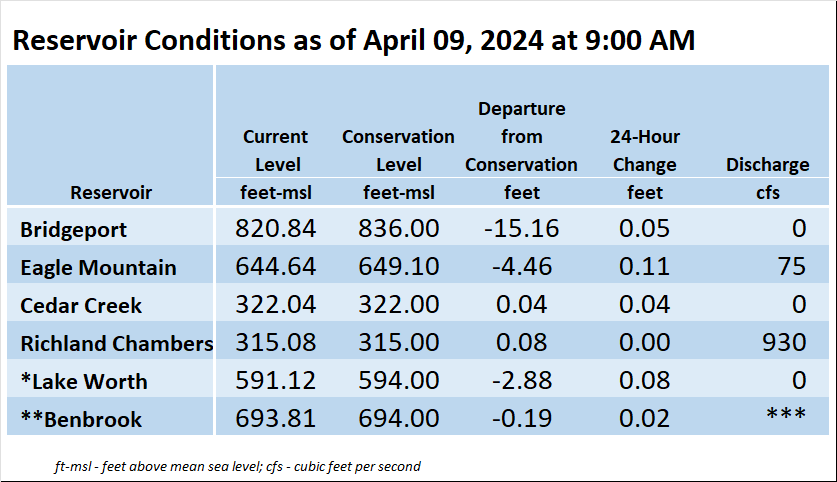
*Lake Worth is owned and operated by the City of Fort Worth. See the City of Fort Worth news feed and NWS forecast page for updates on Lake Worth.
**Benbrook Lake is owned and operated by the U.S. Army Corps of Engineers. ***See Benbrook Lake Home Page for current discharge.
Current lake levels can be found in a variety of locations including TRWD.com, the TRWD watershed data viewer trwd.onerain.com, or download the TRWD Lake Level App for iOS or Android.
Please call the Flood Hotline for further information.
817-720-4296
If prompted to leave a message, the flood monitor on duty will return your message within 30 minutes.
Posted by ASL