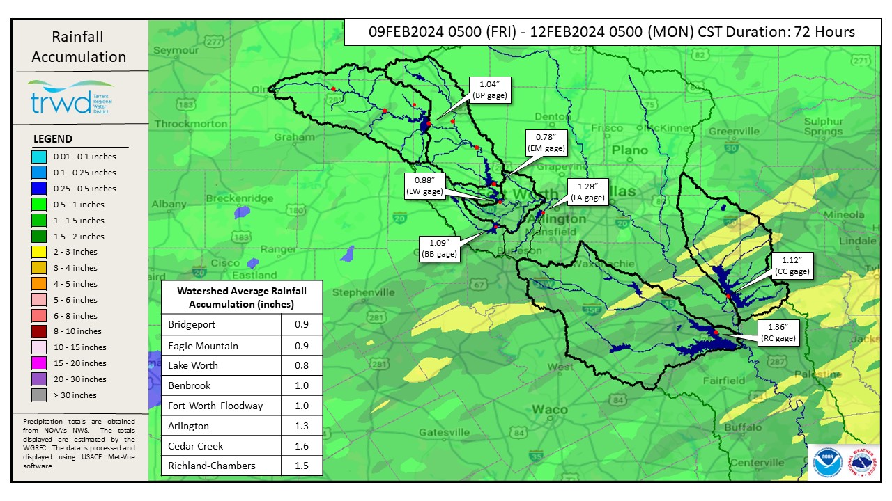
More rain in the TRWD watersheds over the weekend. About an inch across the Bridgeport and Eagle Mountain area. Once again, the Cedar Creek and Richland-Chambers area saw the greater totals; an inch and a half basin average with isolated areas in the 2 to 3-inch range. See Graphic-1 for a map of 24-hour rainfall totals.
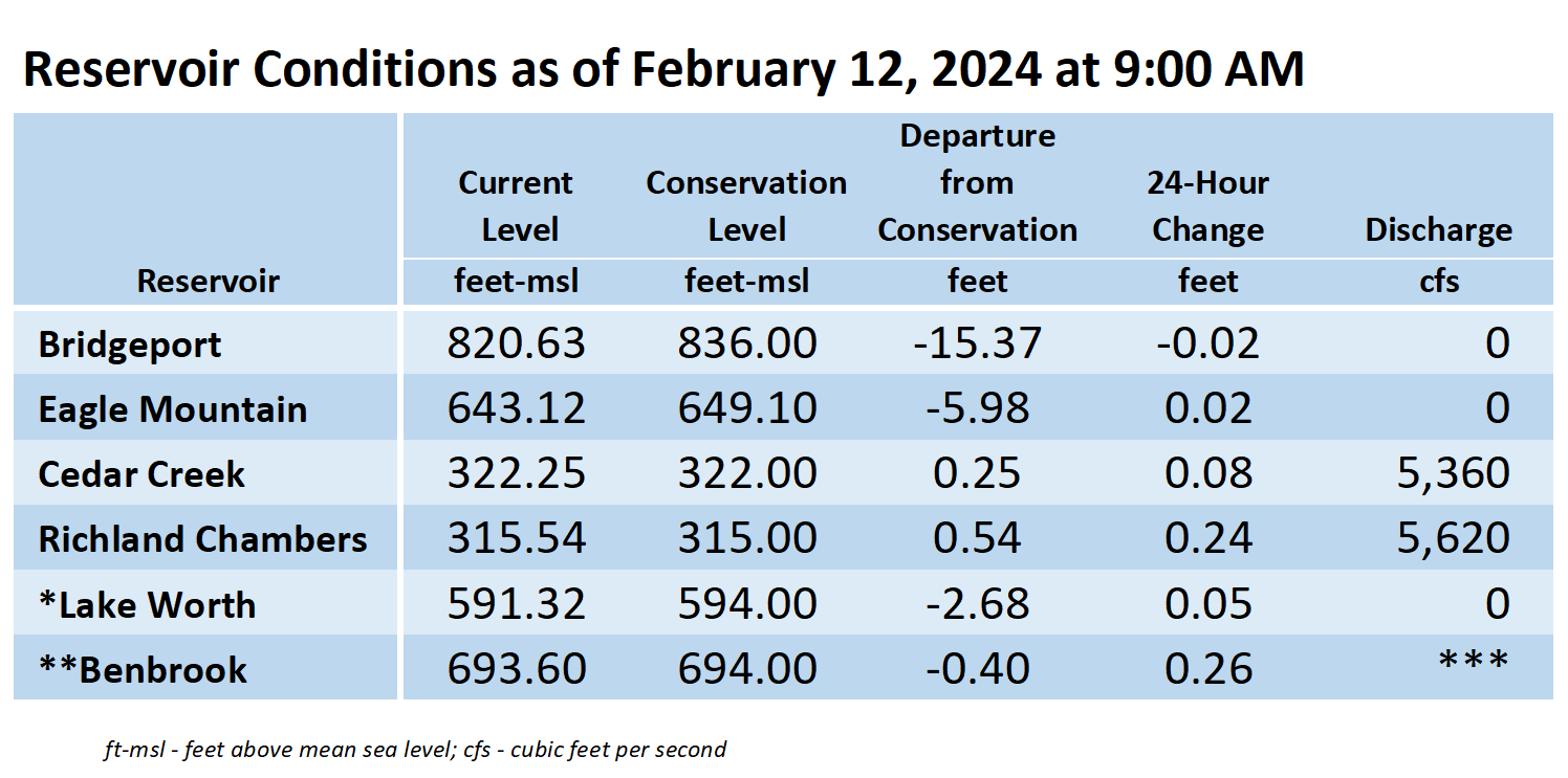
As a result of the rain, inflows have increased into Richland-Chambers and Cedar Creek Reservoirs and spillway operations are on-going to return the pools back below conservation. Cedar Creek is near its peak elevation for this event. Richland-Chambers lake is expected to rise a few more inches before cresting tomorrow; at this time, the pool level is not expected to get more than a foot above conservation.
Reservoir staff will be monitoring conditions and will make updates to spillway operations as needed to safely pass the excess flood water and return the reservoir back to conservation elevation. Updates regarding spillway gate changes from TRWD lakes will be posted to the Lake Level Blog as they occur.
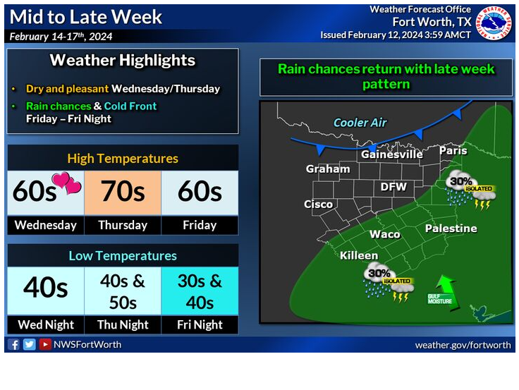
Dry and pleasnt weather conditions expected this week. Rain chances return on Friday. See Graphic 2 for the NWS guidance below.
Current TRWD lake conditions are shown below. This is the last update for this event. Be sure to subscribe to receive e-mail notification of any new Lake Level Blog posts. You can also follow @TRWD_News on X formerly known as Twitter to receive Lake Level blog notifications.
Follow our partners at the National Weather Service (NWS) and the River Forecast Center (RFC) for the latest information regarding weather and river conditions, respectively.
*Please be advised that forecasts and projections are subject to change, and TRWD reservoir operations are based on observed rainfall conditions.
Graphic-1. Weekend Rainfall Totals
Graphic-2. NWS Guidance
*Lake Worth is owned and operated by the City of Fort Worth. See the City of Fort Worth news feed and NWS forecast page for updates on Lake Worth.
**Benbrook Lake is owned and operated by the U.S. Army Corps of Engineers. ***See Benbrook Lake Home Page for current discharge.
Current lake levels can be found in a variety of locations including TRWD.com, the TRWD watershed data viewer trwd.onerain.com, or download the TRWD Lake Level App for iOS or Android.
Please call the Flood Hotline for further information.
817-720-4296
If prompted to leave a message, the flood monitor on duty will return your message within 30 minutes.
Posted by CRO