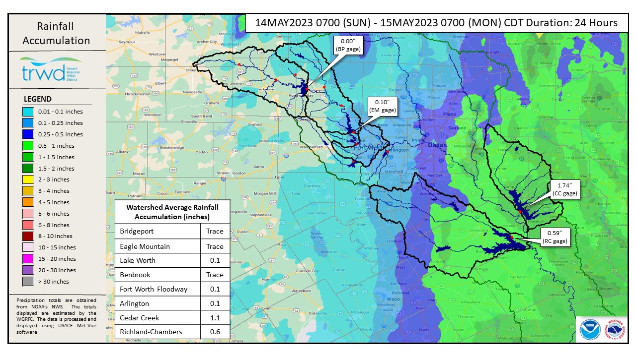
The rain is winding down in our area and conditions are stabilizing. Yesterday’s rain was concentrated in East Texas and Richland-Chambers and Cedar Creek received 0.6″ and 1.1″, respectively. Bridgeport and Eagle Mountain got little to no rain. See Graphic-1 for rainfall totals over the past 24 hours.
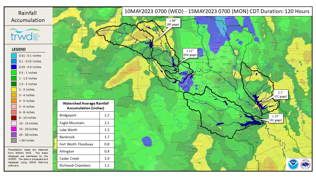
Graphic-2 shows the accumulated rainfall for this event (starting Wednesday morning to today). The watershed average for TRWD lakes ranged from 1.2″ to 2.2″. The northern part of the West Fork system and parts of the Cedar Creek watershed received the heaviest rain.
The flood threat at Richland-Chambers has passed, since we are not expecting the lake to fill at this time. However, the pool is only 0.46 ft below conservation (315 ft). The right amount of rain in the right location could push the lake above conservation. Discharge operations continues at Cedar Creek. The pool is currently 0.11 ft above conservation (322 ft) and pool is expected to recede soon, barring additional rainfall. Flood discharges at the East Texas lakes will be adjusted accordingly to return the lakes to conservation level.
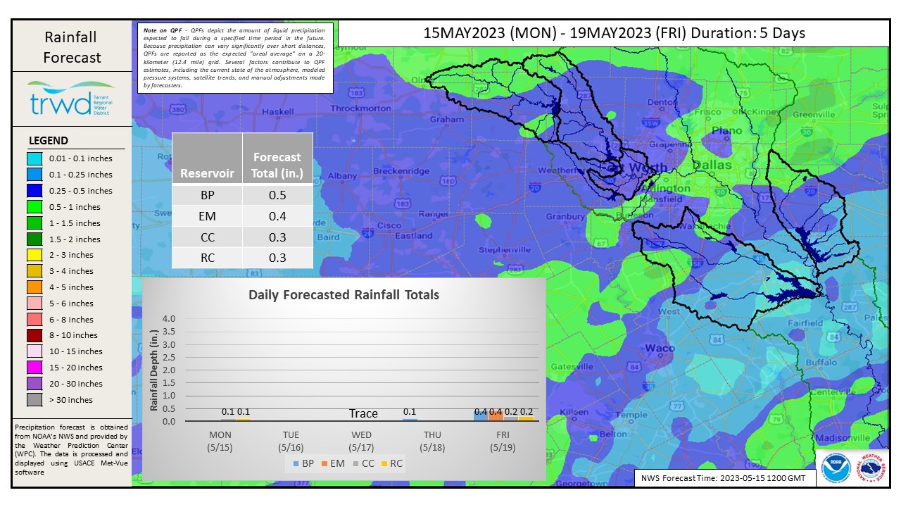
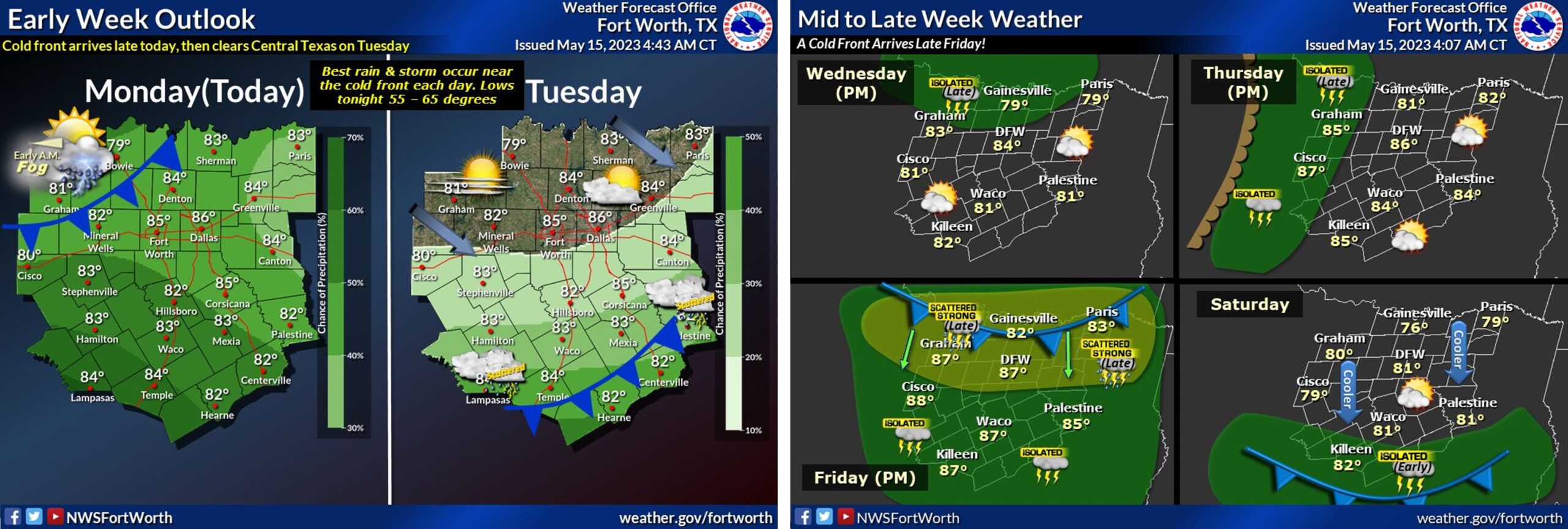
Graphic-3 below shows a map of rainfall expected in the TRWD watersheds over the next five days. There are small chances of rain multiple days during the workweek. Additional 0.3″ to 0.5″ are expected across TRWD watersheds. See Graphic-4 for NWS Guidance for additional details on the next system entering the area.
This will be the last update for this event. Next update will come when conditions warrant. Be sure to subscribe to the Lake Level Blog to receive updates straight to your email.
Current TRWD lake conditions are shown below. Updates regarding flood discharges from TRWD lakes will be posted here. Additional updates regarding lake conditions will be provided as conditions dictate. Be sure to subscribe to receive e-mail notification of any new Lake Level Blog posts. You can also follow @TRWD_News on Twitter to receive Lake Level blog notifications.
Please follow our partners at the National Weather Service (NWS) and the River Forecast Center (RFC) for the latest information regarding weather and river conditions, respectively.
*Please be advised that forecasts and projections are subject to change, and TRWD reservoir operations are based on observed rainfall conditions.
Graphic-1. 24-Hour Rainfall Totals
Graphic-2. 120-Hour Rainfall Totals
Graphic-3. 5-Day Expected Rainfall
Graphic-4. NWS Guidance
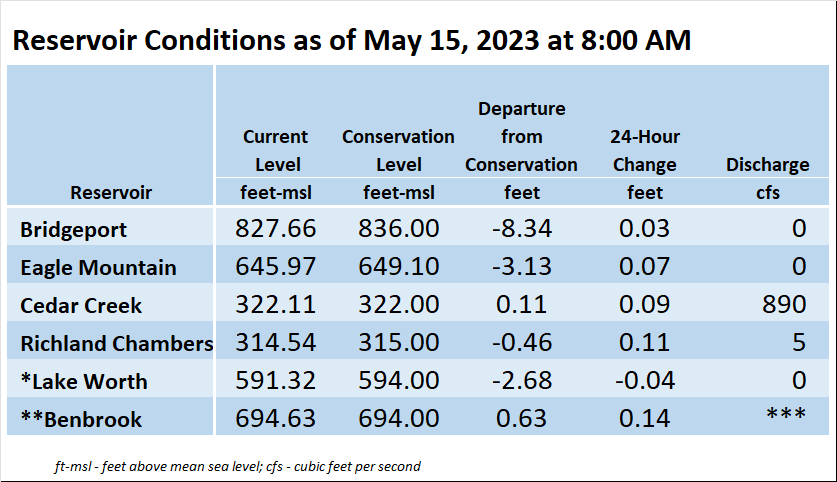
*Lake Worth is owned and operated by the City of Fort Worth. See the City of Fort Worth news feed and NWS forecast page for updates on Lake Worth.
**Benbrook Lake is owned and operated by the U.S. Army Corps of Engineers. ***See Benbrook Lake Home Page for current discharge. *Lake Worth is owned and operated by the City of Fort Worth. See the City of Fort Worth news feed for updates on Lake Worth.
Current lake levels can be found in a variety of locations including TRWD.com, the TRWD watershed data viewer trwd.onerain.com, or download the TRWD Lake Level App for iOS or Android.
Please call the Flood Hotline for further information.
817-720-4296
If prompted to leave a message, the flood monitor on duty will return your message within 30 minutes.
Posted by VdO