Soils are primed from the past rainfall events, there is significant rain in the forecast and TRWD lakes will receive inflows from runoff if the forecast pans out. The focus on flood will be at our East Texas lakes. Richland-Chambers is only 0.6 ft below conservation level (315 ft) and there is a chance for the lake to fill in next few days if rains materialize. Over at Cedar Creek, reservoir staff started flood discharges last night and additional operations are expected as rains materialize over the weekend. The goal is to return the lake to its conservation level of 322 ft. We will also be watching our West Fork lakes (Bridgeport and Eagle Mountain), since most of the forecast rain is concentrated in that region. Eagle Mountain Lake is 3.3 ft below the conservation level of 649.1 ft. Floods cannot be ruled out at Eagle Mountain, but there is a chance. The right amount of rain over the right place can bring the pool close to conservation.
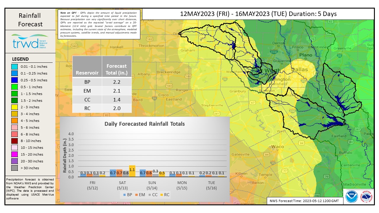
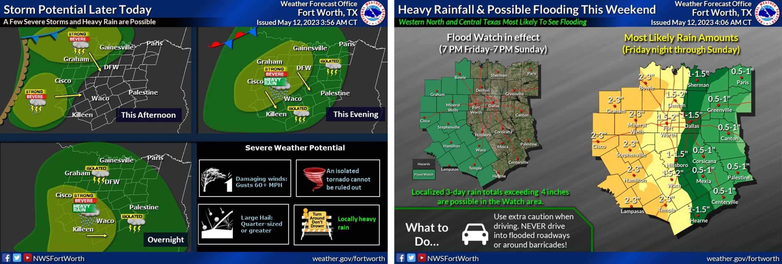
Graphic-1 below shows a map of rainfall expected at the TRWD watersheds in the next five days. See Graphic-2 for NWS Guidance on timing and potential of the rain over the weekend. TRWD will continue to monitor conditions and will adjust operations at Cedar Creek as needed to safely return the lake level to 322.0.
Current TRWD lake conditions are shown below. Updates regarding flood discharges from TRWD lakes will be posted here. Additional updates regarding lake conditions will be provided as conditions dictate. Be sure to subscribe to receive e-mail notification of any new Lake Level Blog posts. You can also follow @TRWD_News on Twitter to receive Lake Level blog notifications.
Please follow our partners at the National Weather Service (NWS) and the River Forecast Center (RFC) for the latest information regarding weather and river conditions, respectively.
*Please be advised that forecasts and projections are subject to change, and TRWD reservoir operations are based on observed rainfall conditions.
Graphic-1. Expected Rainfall
Graphic-2. NWS Guidance
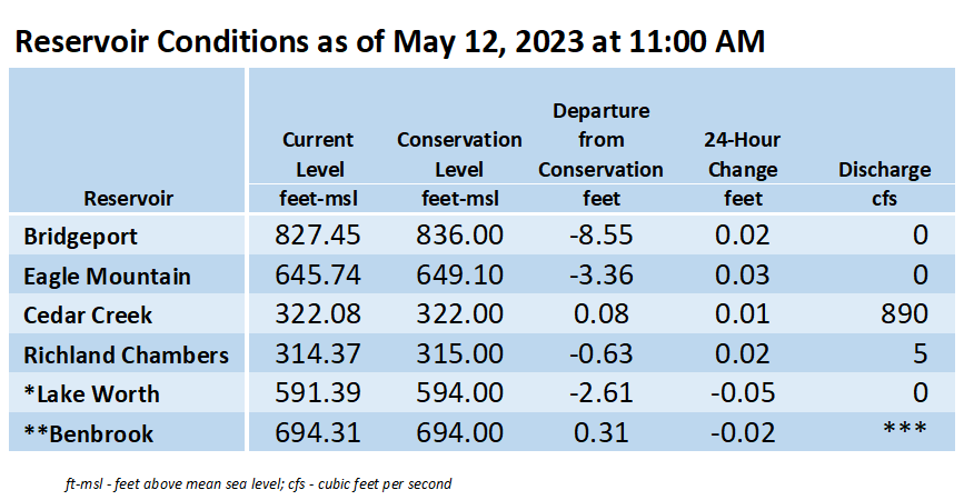
*Lake Worth is owned and operated by the City of Fort Worth. See the City of Fort Worth news feed and NWS forecast page for updates on Lake Worth.
**Benbrook Lake is owned and operated by the U.S. Army Corps of Engineers. ***See Benbrook Lake Home Page for current discharge. *Lake Worth is owned and operated by the City of Fort Worth. See the City of Fort Worth news feed for updates on Lake Worth.
Current lake levels can be found in a variety of locations including TRWD.com, the TRWD watershed data viewer trwd.onerain.com, or download the TRWD Lake Level App for iOS or Android.
Please call the Flood Hotline for further information.
817-720-4296
If prompted to leave a message, the flood monitor on duty will return your message within 30 minutes.
Posted by VdO