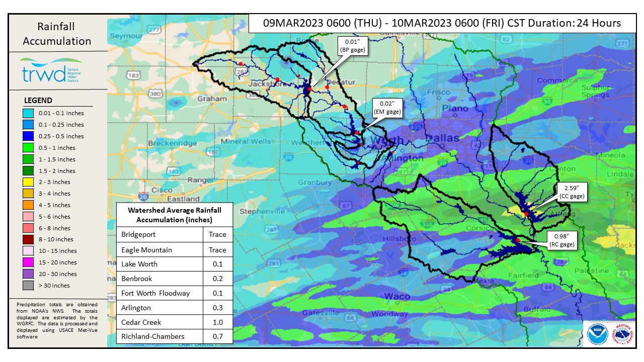
Bottom Line: Cedar Creek Reservoir received nearly 3 inches of rain last night, enough to fill the lake past full (elv. 322.0). Reservoir staff initiated spillway operations late last night to begin returning the lake level to 322.0.
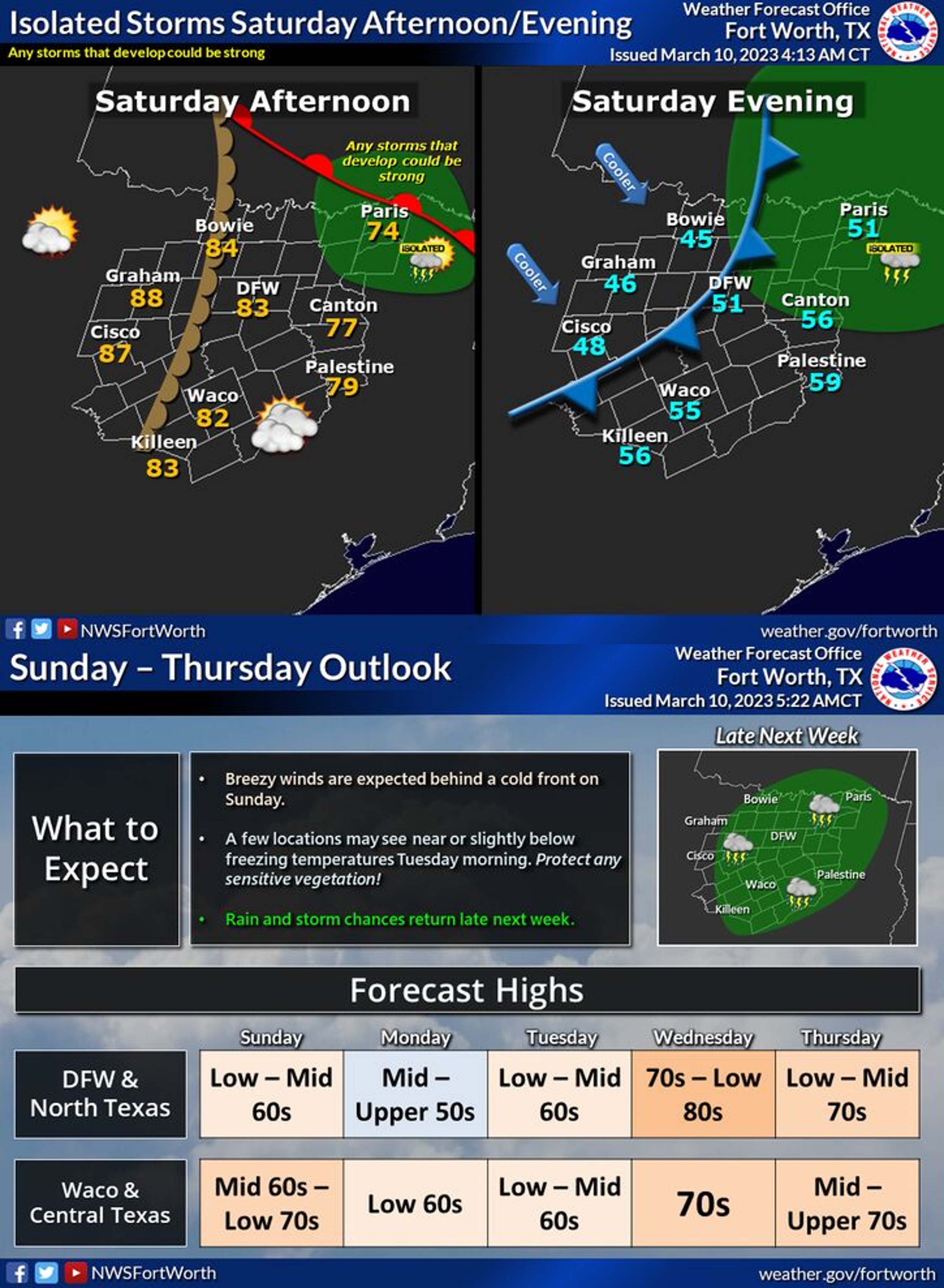
Graphic-1 below shows a map of rainfall totals for the last 24-hours. Rain has moved out of the area and the weekend is expected to be mostly rain free, see Graphic-2 for NWS Guidance. TRWD will continue to monitor conditions and will adjust operations at Cedar Creek as needed to safely return the lake level to 322.0.
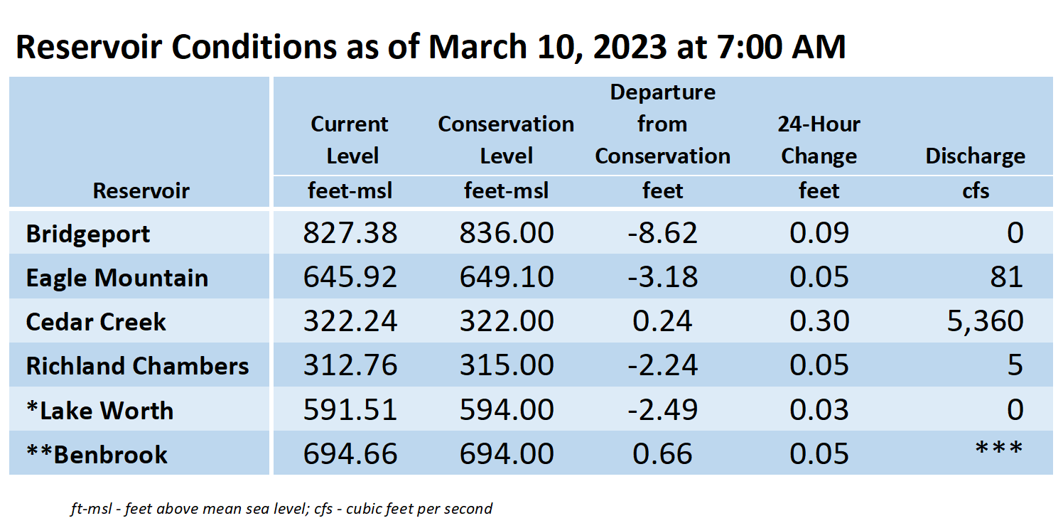
Current TRWD lake conditions are shown below. The release from Eagle Mountain is for water supply purposes. Updates regarding flood discharges from TRWD lakes will be posted here. Additional updates regarding lake conditions will be provided as conditions dictate. Be sure to subscribe to receive e-mail notification of any new Lake Level Blog posts. You can also follow @TRWD_News on Twitter to receive Lake Level blog notifications.
Please follow our partners at the National Weather Service (NWS) and the River Forecast Center (RFC) for the latest information regarding weather and river conditions, respectively.
*Please be advised that forecasts and projections are subject to change, and TRWD reservoir operations are based on observed rainfall conditions.
Graphic-1. 24-Hour Rainfall Totals
 Graphic-2. NWS Forecast Outlook
 *Lake Worth is owned and operated by the City of Fort Worth. See the City of Fort Worth news feed and NWS forecast page for updates on Lake Worth.
**Benbrook Lake is owned and operated by the U.S. Army Corps of Engineers. ***See Benbrook Lake Home Page for current discharge. *Lake Worth is owned and operated by the City of Fort Worth. See the City of Fort Worth news feed for updates on Lake Worth.
Current lake levels can be found in a variety of locations including TRWD.com, the TRWD watershed data viewer trwd.onerain.com, or download the TRWD Lake Level App for iOS or Android.
Please call the Flood Hotline for further information.
817-720-4296
If prompted to leave a message, the flood monitor on duty will return your message within 30 minutes.
Posted by CO