Weather Update
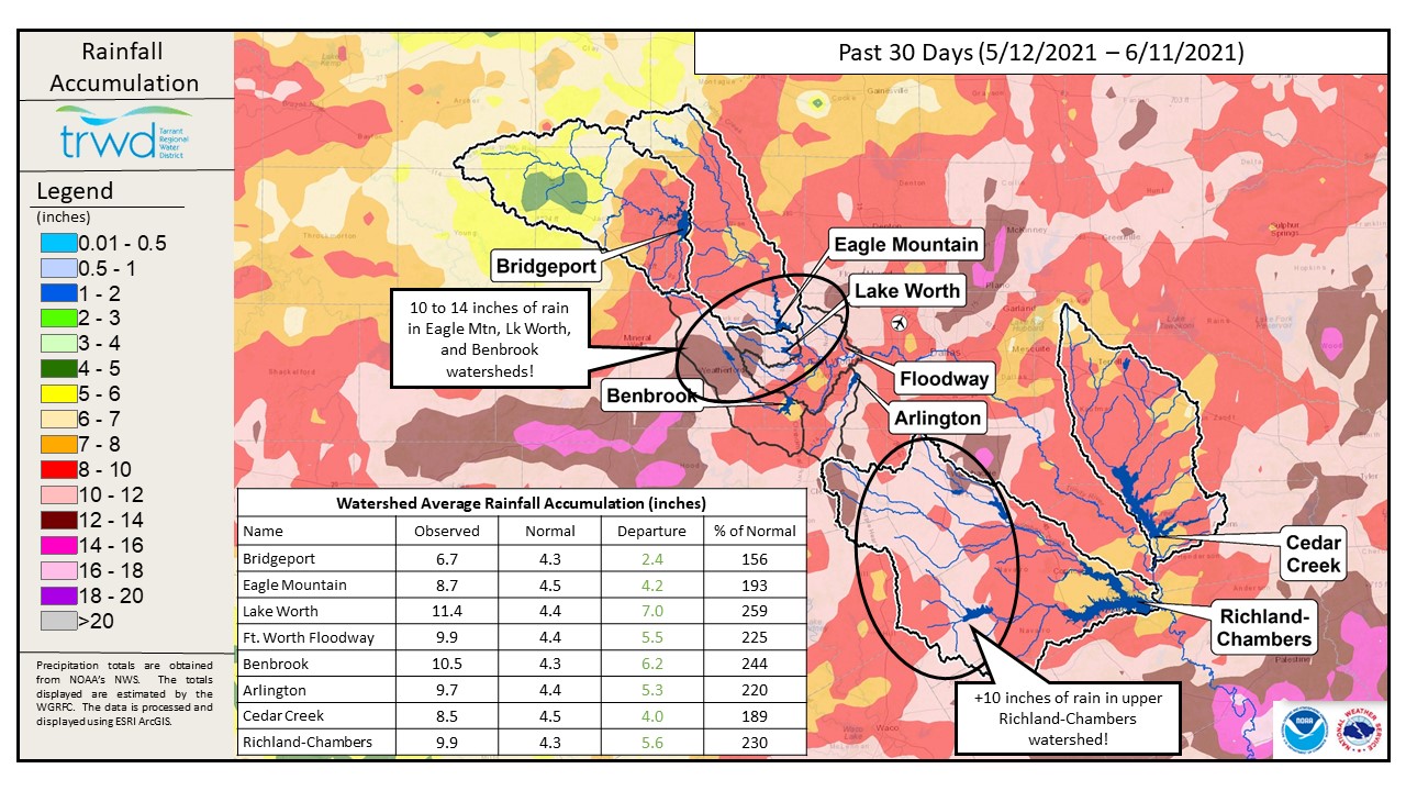
TRWD continues to monitor reservoir conditions 24 hours a day. No rain fell in the TRWD watersheds in the past 24 hours. There is a chance of isolated storms early tomorrow morning as a system approaches from the north. It is also possible this system dissipates before reaching the Red River, see Graphic-1 for National Weather Service (NWS) guidance. Aside from this disturbance the long term outlook is generally dry conditions. The past few weeks have been notable in terms of rainfall. Graphic-2 is a map showing the 30-Day rain totals for the TRWD watersheds. While the TRWD watersheds missed out on the heaviest totals, there was over 16″ south of Palestine, there were totals over 12 inches in the Eagle Mountain and Lake Worth watersheds. The upper half of the Richland-Chambers watershed saw over 10 inches. Nearly the entire TWRD watershed area received 200% of the normal amount of rainfall, or in other words twice the rain the area is expected to receive.
Reservoir Conditions
Current reservoir conditions are shown below. All TRWD reservoirs continue to make flood discharges and will do so until the pools are at or near conservation pool level. It should be noted that Bardwell Lake and Navarro Mills Lake, the two US Army Corps of Engineers reservoirs in the Richland-Chambers watershed, are well into their flood pools as they have been holding back flood water the past month as prescribed by their polices. These lakes have started to release water from their flood pools as downstream conditions allow. It is expected to take 2 to 3 weeks for the flood pools to be emptied. In turn, Richland-Chambers will continue to discharge to allow this water to pass through. More information on the status of the US Army Corps lakes can be found here. Staff will continue to monitor conditions and make discharges as needed to safely move excess water through the system. Updates to lake status and flood discharges will be posted here.
Please be advised that forecasts and projections are subject to change, and TRWD reservoir operations are based on observed rainfall conditions. Current lake levels can be found in a variety of locations including TRWD.com, the TRWD watershed data viewer trwd.onerain.com, or download the TRWD Lake Level App for iOS or Android. You may also follow the NWS and the River Forecast Center (RFC) for the latest information regarding weather and river conditions, respectively.
This will be the last Reservoir Monitoring Update until rainfall that can potentially impact the lake levels makes a return to the forecast. Any changes in discharge will continue to be posted to the Lake Level Blog. Be sure to subscribe to the Lake Level Blog or follow @TRWD_News on Twitter to receive notification of any new posts.
Graphic-1. NWS Guidance – Early Saturday Rain Chances?

Graphic-2. 30-Day Observed Rain Totals
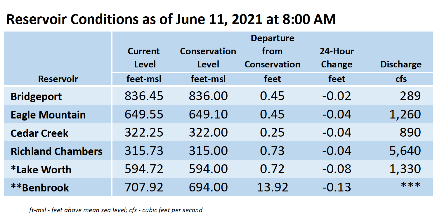
*Lake Worth is owned and operated by the City of Fort Worth. See the City of Fort Worth news feed and NWS forecast page for updates on Lake Worth.
**Benbrook Lake is owned and operated by the U.S. Army Corps of Engineers. ***See Benbrook Lake Home Page for current discharge.
****Please visit TRWD’s new watershed data viewer at www.trwd.onerain.com . You can see the same rain, stream, and lake gages the Flood Team monitors during an event. You can also check out this YouTube video to see what it is all about!
Please call the Flood Hotline for further information.
817-720-4296
If prompted to leave a message, the flood monitor on duty will return your message within 30 minutes.
Posted by CO.