Weather Update
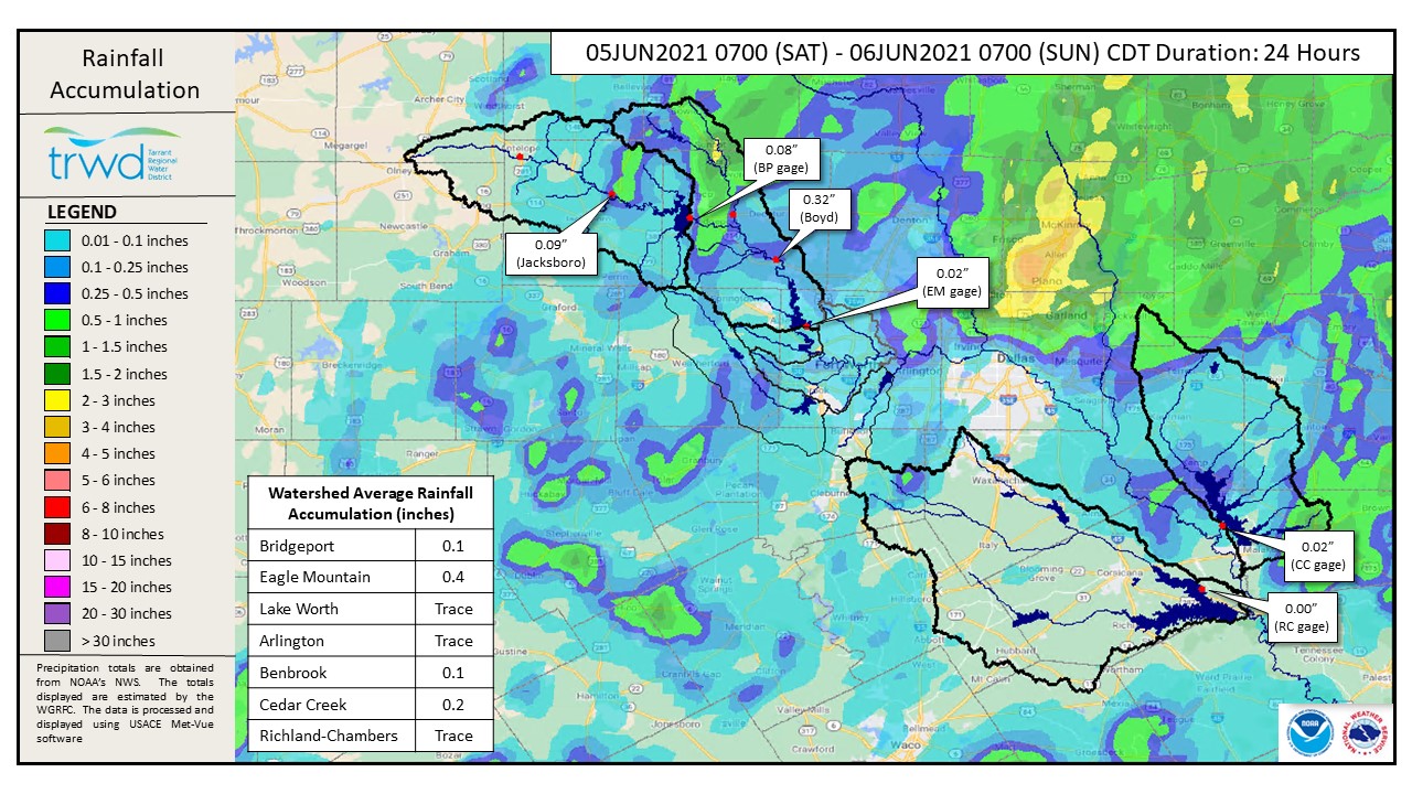
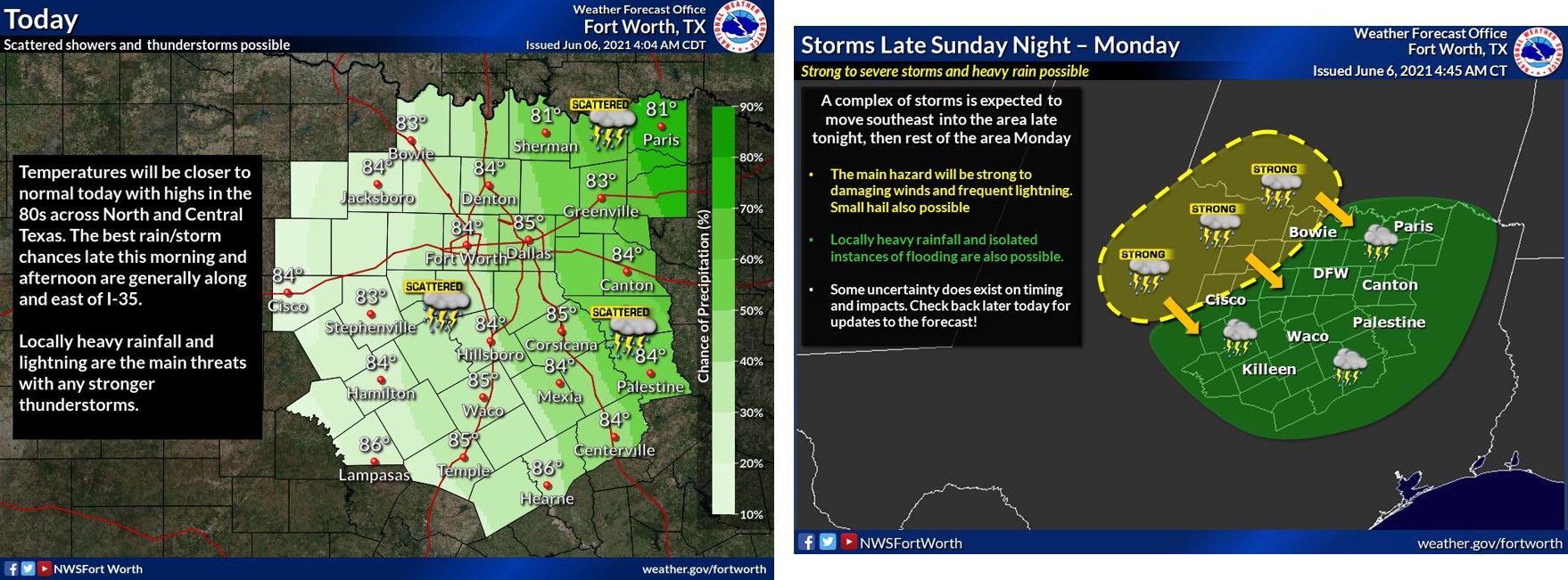
TRWD continues to monitor reservoir conditions 24 hours a day. The Upper Trinity watersheds saw a number of local storms in the last 24h, with rain amounts varying from 0.02 inches over Eagle Mountain Lake to over 2 inches over the Brushy Creek area (northeast TRWD service area). Richland-Chambers watershed saw little to no rain while Cedar Creek watershed averaged 0.2 inches of rain. See Graphic-1 for 24-hour totals. Rain chances today are greater along and east of I-35 with local heavy rainfall possible. Chances continue overnight through Monday as a complex of storms coming from the northwest move southeast bringing heavy storms. See Graphic-2 for National Weather Service (NWS) guidance. Looking into the week, rain chances continue into Tuesday mainly east of I-35, but could be coming to an end starting Wednesday.
Reservoir Conditions
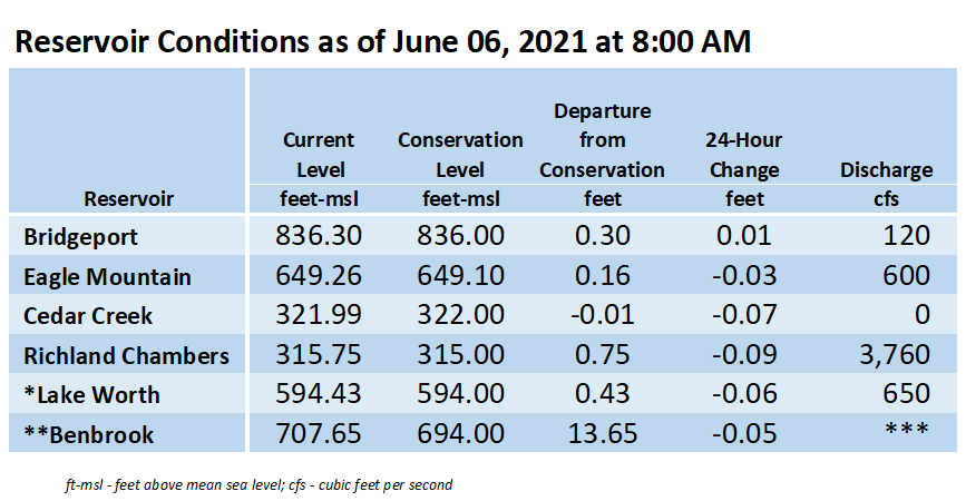
Current reservoir conditions are shown below. Bridgeport, Eagle Mountain, and Richland-Chambers continue to discharge. Cedar Creek pool has reached conservation and discharges were stopped overnight. Staff will continue to monitor conditions and make discharges as needed to safely move excess water through the system. Updates to lake status and flood discharges will be posted here.
Please be advised that forecasts and projections are subject to change, and TRWD reservoir operations are based on observed rainfall conditions. The next update will come this evening, unless conditions dictate otherwise. Please check back. You can also follow @TRWD_News on Twitter to receive notification of any new posts to this Lake Level blog.
Current lake levels can be found in a variety of locations including TRWD.com, the TRWD watershed data viewer trwd.onerain.com, or download the TRWD Lake Level App for iOS or Android. You may also follow the NWS and the River Forecast Center (RFC) for the latest information regarding weather and river conditions, respectively.
Graphic-1. 24-Hour Rain Totals
Graphic-2. NWS Guidance – Storms Today and Tomorrow
*Lake Worth is owned and operated by the City of Fort Worth. See the City of Fort Worth news feed and NWS forecast page for updates on Lake Worth.
**Benbrook Lake is owned and operated by the U.S. Army Corps of Engineers. ***See Benbrook Lake Home Page for current discharge.
****Please visit TRWD’s new watershed data viewer at www.trwd.onerain.com . You can see the same rain, stream, and lake gages the Flood Team monitors during an event. You can also check out this YouTube video to see what it is all about!
Please call the Flood Hotline for further information.
817-720-4296
If prompted to leave a message, the flood monitor on duty will return your message within 30 minutes.
Posted by VdO.