The past few weeks of rain have left the TRWD watersheds near saturation and prone to runoff. In other words, the majority of the rain that falls in the TRWD watersheds will make its way to one of the reservoirs. With more rain in the upcoming forecast, be sure to monitor lake levels and continue following this Lake Level blog for any updates regarding the TRWD reservoirs. Current lake levels can be found in a variety of locations including TRWD.com, the TRWD watershed data viewer trwd.onerain.com, or download the TRWD Lake Level App for iOS or Android. You may also follow the National Weather Service (NWS) and the River Forecast Center (RFC) for the latest information regarding weather and river conditions, respectively.
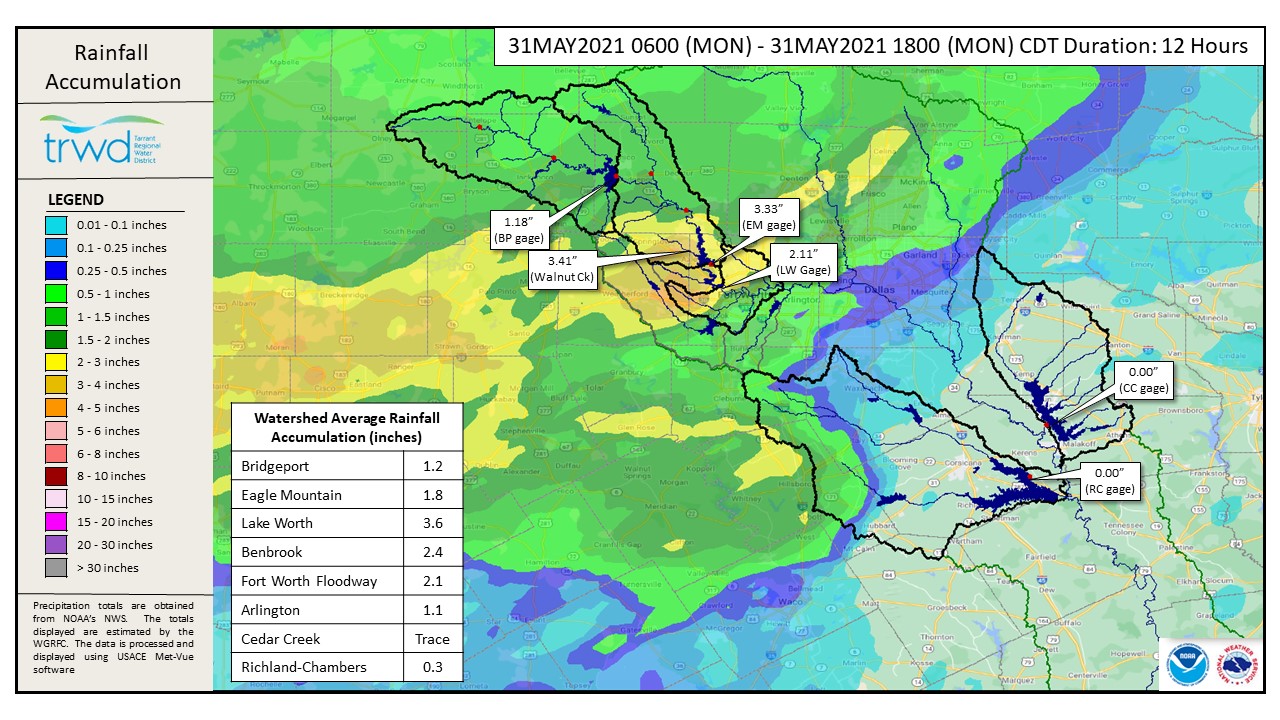
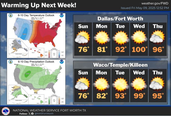
TRWD continues to monitor reservoir conditions 24 hours a day. There has been significant rainfall in the Eagle Mountain and Lake Worth watersheds over the past 12 hours. See Graphic-1 for rain totals for the 12-hour period ending at 6:00 p.m. this evening. Rainfall has mostly cleared out of the Eagle Mountain and Bridgeport area for the night. There is still a chance for heavy rainfall this evening in the Cedar Creek and Richland-Chambers area. Scattered showers are expected tomorrow. See Graphic-2 for NWS guidance on tomorrow’s rain chances. Heavier rainfall chances return Wednesday.
Current reservoir conditions are shown below. Discharges from Eagle Mountain were increased today in response to heavy rain in the watershed, particularly in the Walnut Creek area on the west side of the lake. Inflow from today’s rain creates the potential for Eagle Mountain to reach a peak elevation of approximately 651 feet-msl by morning. Richland-Chambers and Cedar Creek continue to make flood discharges. Bridgeport remains below conservation level; however, it is expected to fill due to today’s rain. Staff will continue to monitor conditions and make discharges as needed to safely move excess water through the system. Updates to lake status and flood discharges will be posted here.
Please be advised that forecasts and projections are subject to change, and TRWD reservoir operations are based on observed rainfall conditions. The next update will come tomorrow morning, unless conditions dictate otherwise. Please check back.
Graphic-1. 12-Hour Rainfall Accumulation
 Graphic-2. NWS Guidance – Tomorrow’s Rain Chances
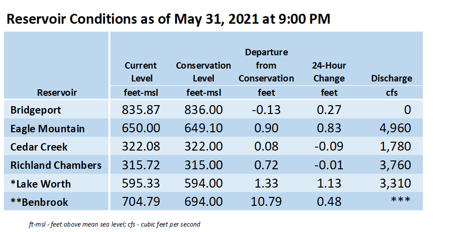
*Lake Worth is owned and operated by the City of Fort Worth. See the City of Fort Worth news feed and NWS forecast page for updates on Lake Worth.
**Benbrook Lake is owned and operated by the U.S. Army Corps of Engineers. ***See Benbrook Lake Home Page for current discharge.
****Please visit TRWD’s new watershed data viewer at www.trwd.onerain.com . You can see the same rain, stream, and lake gages the Flood Team monitors during an event. You can also check out this YouTube video to see what it is all about!
Please call the Flood Hotline for further information.
817-720-4296
If prompted to leave a message, the flood monitor on duty will return your message within 30 minutes.
Posted by NR.