The past few weeks of rain have left the TRWD watersheds near saturation and prone to runoff. In other words, the majority of the rain that falls in the TRWD watersheds will make its way to one of the reservoirs. With more rain in the upcoming forecast, be sure to monitor lave levels and continue following this Lake Level blog for any updates regarding the TRWD reservoirs. Current lake levels can be found in a variety of locations including TRWD.com, the TRWD watershed data viewer trwd.onerain.com, or download the TRWD Lake Level App in the Apple Store. You may also follow the National Weather Service (NWS) and the River Forecast Center (RFC) for the latest information regarding weather and river conditions, respectively.
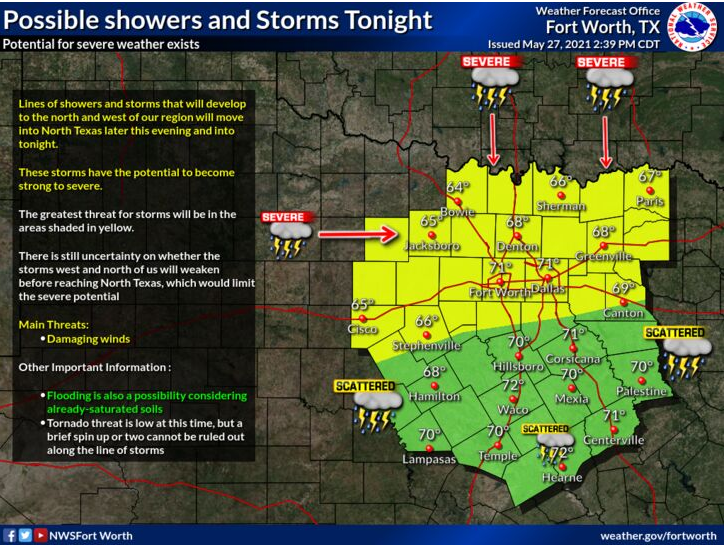
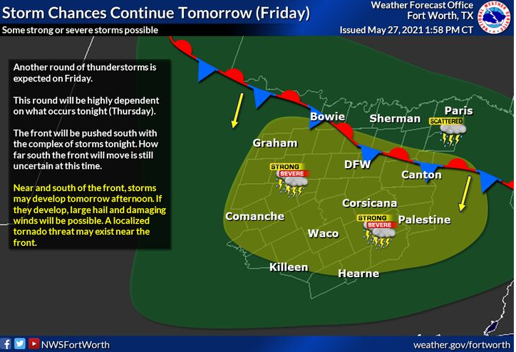
TRWD continues to monitor reservoir conditions 24 hours a day. No rainfall was recorded in the TRWD watersheds today; however, there is a possibility of showers and storms overnight tonight, with another round of storms expected on Friday. See National Weather Service guidance below in Graphic-1 and Graphic-2.
Current reservoir conditions are shown below. Richland-Chambers and Cedar Creek continue to make flood discharges. Discharges from Eagle Mountain are continuing, but were decreased this afternoon. Bridgeport remains below conservation level and and no discharges are being made at this time. Staff will continue to monitor conditions and make discharges as needed to safely move excess water through the system. Updates to lake status and flood discharges will be posted here.
Please be advised that forecasts and projections are subject to change, and TRWD reservoir operations are based on observed rainfall conditions. The next update will come tomorrow morning, unless conditions dictate otherwise. Please check back.
***Please visit TRWD’s new watershed data viewer at www.trwd.onerain.com . You can see the same rain, stream, and lake gages the Flood Team monitors during an event. You can also check out this YouTube video to see what it is all about!
Graphic-1. NWS Guidance – Rainfall Chances Tonight
Graphic-2. NWS Guidance – Friday Storm Chances
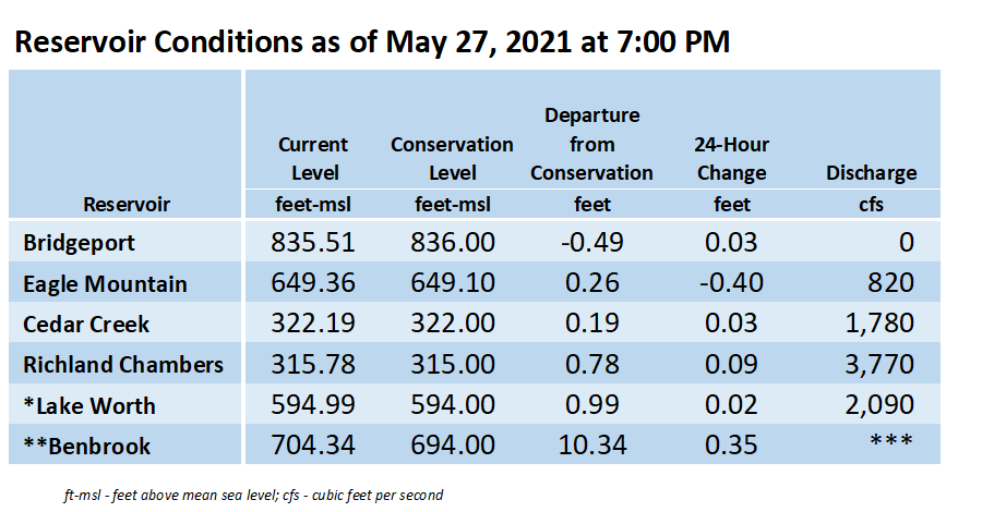 **Benbrook Lake is owned and operated by the U.S. Army Corps of Engineers. ***See Benbrook Lake Home Page for current discharge. *Lake Worth is owned and operated by the City of Fort Worth. See the City of Fort Worth news feed and NWS forecast page for updates on Lake Worth.
Please call the Flood Hotline for further information.
817-720-4296
If prompted to leave a message, the flood monitor on duty will return your message within 30 minutes.
Posted by NR .