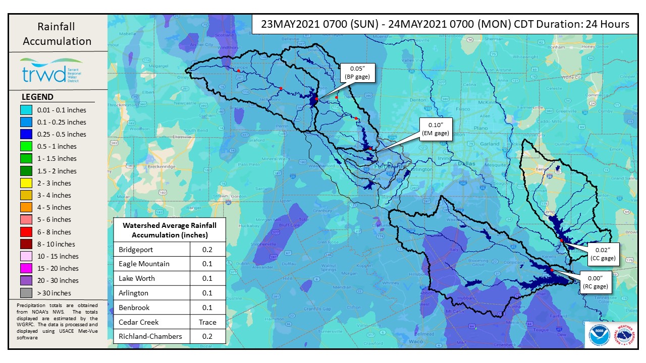
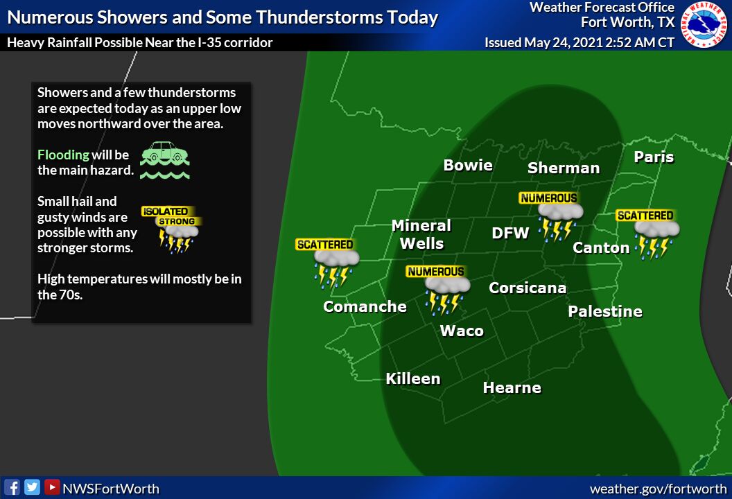
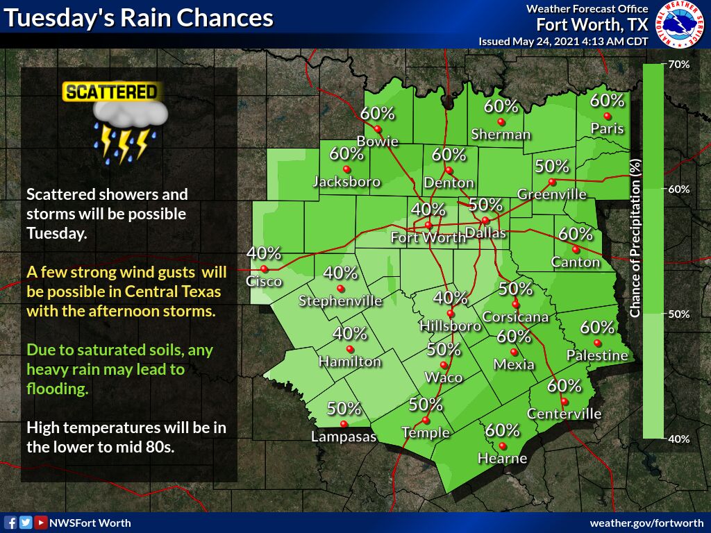
TRWD continues to monitor reservoir conditions 24 hours a day. A small amount of rain was recorded in the TRWD service area in the past 24 hours, with only traces of rain in Cedar Creek and Richland-Chambers watersheds and less than 1/4 inch of rain in Eagle Mountain and Bridgeport watersheds. See Graphic-1 for rainfall totals for the 24-hour period ending at 7:00 am this morning. National Weather Service (NWS) guidance for today shows additional rain with numerous showers and strong storms is possible today through Tuesday. See Graphic-2 for National Weather Service guidance on expected rainfall today. See Graphic-3 for NWS guidance on expected rainfall for Tuesday.
Current reservoir conditions are shown below. Richland-Chambers, Cedar Creek and Eagle Mountain continue to make flood discharges. Bridgeport is below conservation level with no flood discharges being made at this time. Staff will continue to monitor conditions and make discharges as needed to safely move excess water through the system. Updates to lake status and flood discharges will be posted here.
Please continue to follow the National Weather Service (NWS) and the River Forecast Center (RFC) for the latest information regarding weather and river conditions, respectively.
Please be advised that forecasts and projections are subject to change, and TRWD reservoir operations are based on observed rainfall conditions. The next update will come tomorrow morning, unless conditions dictate otherwise. Please check back.
***Please visit TRWD’s new watershed data viewer at www.trwd.onerain.com . You can see the same rain, stream, and lake gages the Flood Team monitors during an event. You can also check out this YouTube video to see what it is all about!
Graphic-1. Rainfall Accumulation for the Past 24 hours
Graphic-2. NWS Guidance on Today’s Rainfall
Graphic-3. NWS Guidance on Tuesday’s Rainfall
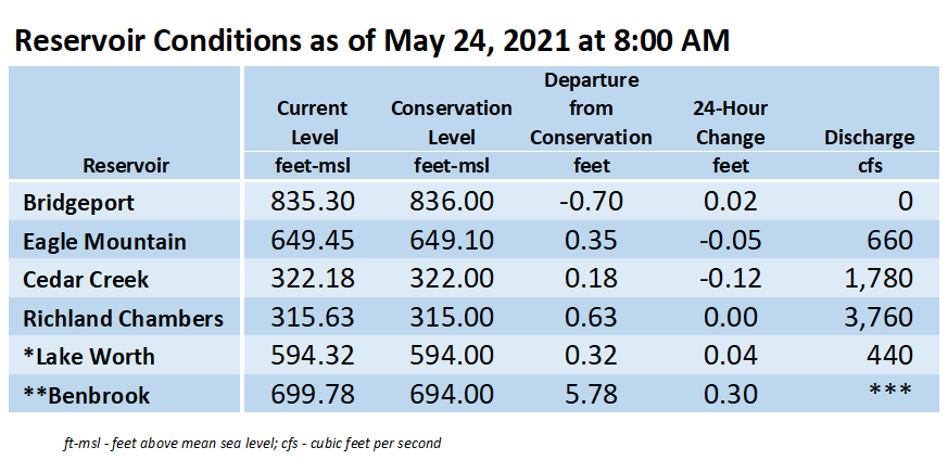
**Benbrook Lake is owned and operated by the U.S. Army Corps of Engineers. ***See Benbrook Lake Home Page for current discharge. *Lake Worth is owned and operated by the City of Fort Worth. See the City of Fort Worth news feed for updates on Lake Worth.
Please call the Flood Hotline for further information.
817-720-4296
If prompted to leave a message, the flood monitor on duty will return your message within 30 minutes.
Posted by VdO.