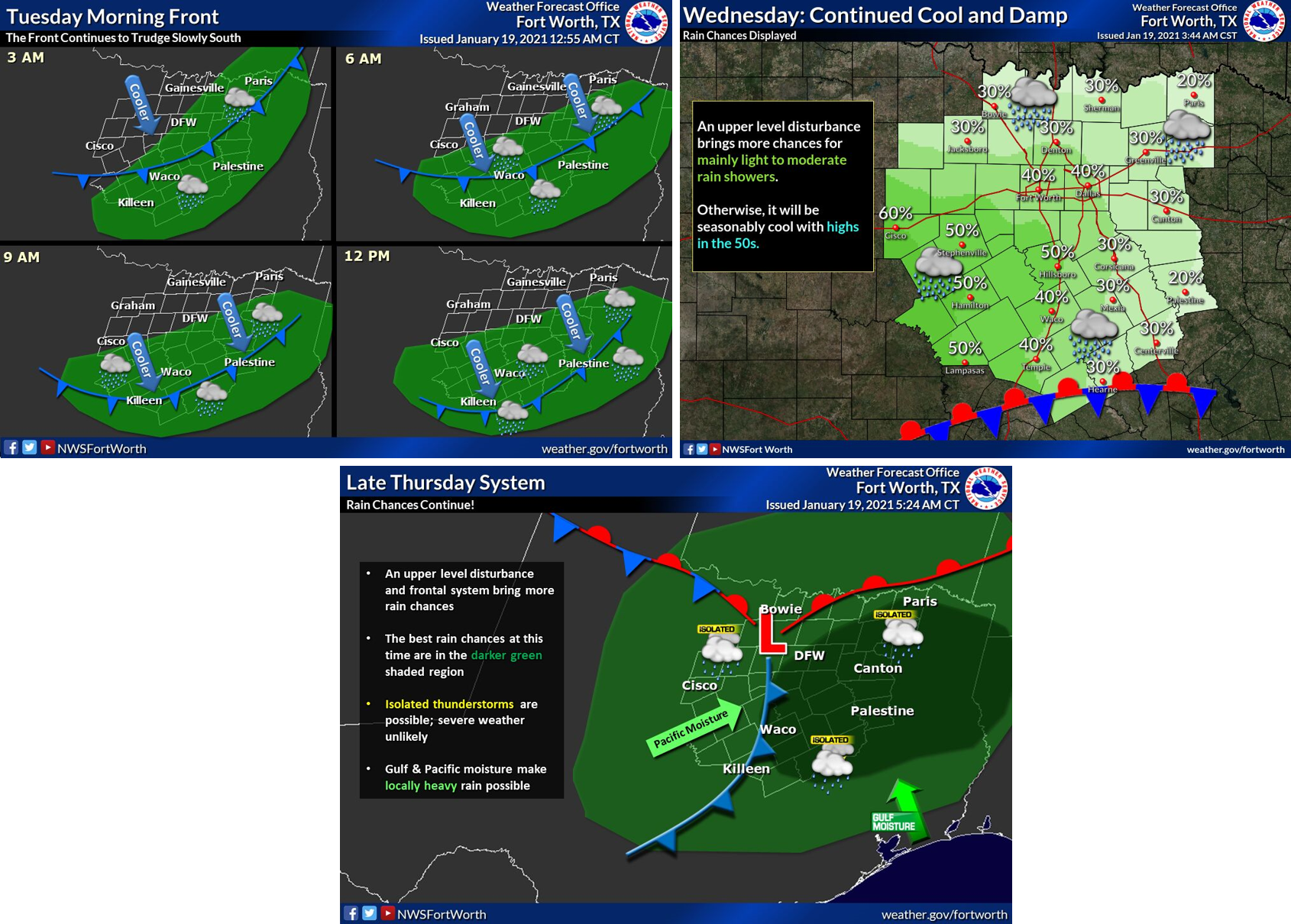
TRWD continues to monitor reservoir conditions 24 hours a day. Rainfall has returned to the TRWD reservoir watersheds. National Weather Service (NWS) guidance in Graphic-1 covers what to expect over the next three days. Overall, the rainfall is expected to be relatively light. However there is the possibility of isolated pockets of heavy rain, especially today and Thursday. Rainfall totals over the next three days are expected to be less than a half inch in the Bridgeport/Eagle Mountain area and about an inch in the Cedar Creek/Richland-Chambers area. Damp soils and dormant vegetation will accelerate runoff generation in the Cedar Creek/Richland-Chambers area.
Currently, TRWD reservoirs are not making flood discharges. Eagle Mountain is making a low level water supply release. See the table below for current reservoir conditions. Updates to lake status and flood discharges will be posted here.
Please be advised that forecasts and projections are subject to change, and TRWD reservoir operations are based on observed rainfall conditions. With rainfall out of the forecast for the week, this will be the final Reservoir Monitoring Update until conditions dictate otherwise.
Graphic-1. NWS Rainfall Guidance
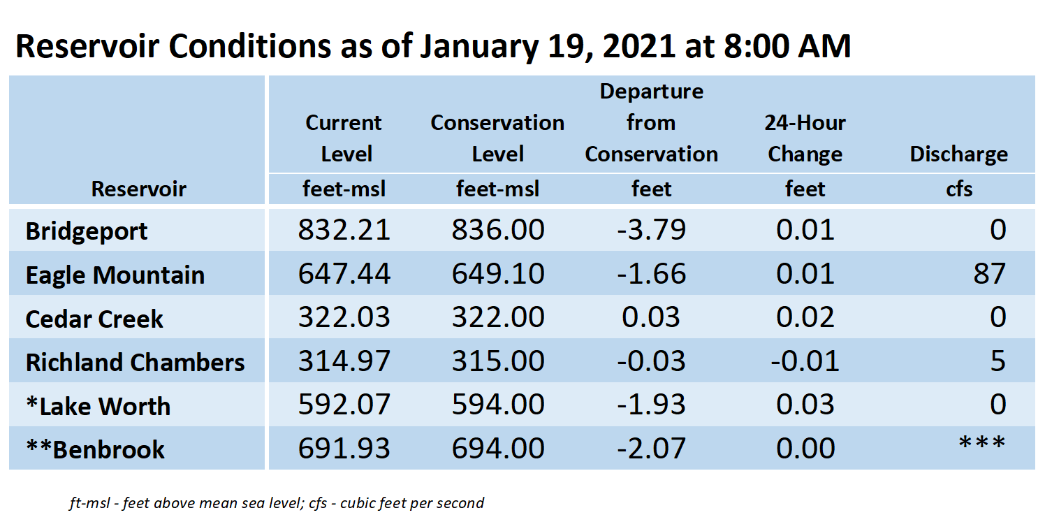
**Benbrook Lake is owned and operated by the U.S. Army Corps of Engineers. ***See Benbrook Lake Home Page for current discharge. *Lake Worth is owned and operated by the City of Fort Worth. See the City of Fort Worth news feed for updates on Lake Worth.
Please call the Flood Hotline for further information.
817-720-4296
If prompted to leave a message, the flood monitor on duty will return your message within 30 minutes.
Posted by CO.