November started off drier than usual across North Texas, but the story changed toward the end of the month. A series of rain events delivered 2 to 5 inches of precipitation, pushing conditions from below-normal to above-normal rainfall overall. Temperatures were also noteworthy—November averaged about 6.5°F warmer than normal, making it one of the warmer Novembers in recent years. Thanks to the late-month rainfall, lake levels saw a modest boost, especially in the West Fork reservoirs (Eagle Mountain and Bridgeport). This helped keep system storage near 90%, a healthy level for this time of year.
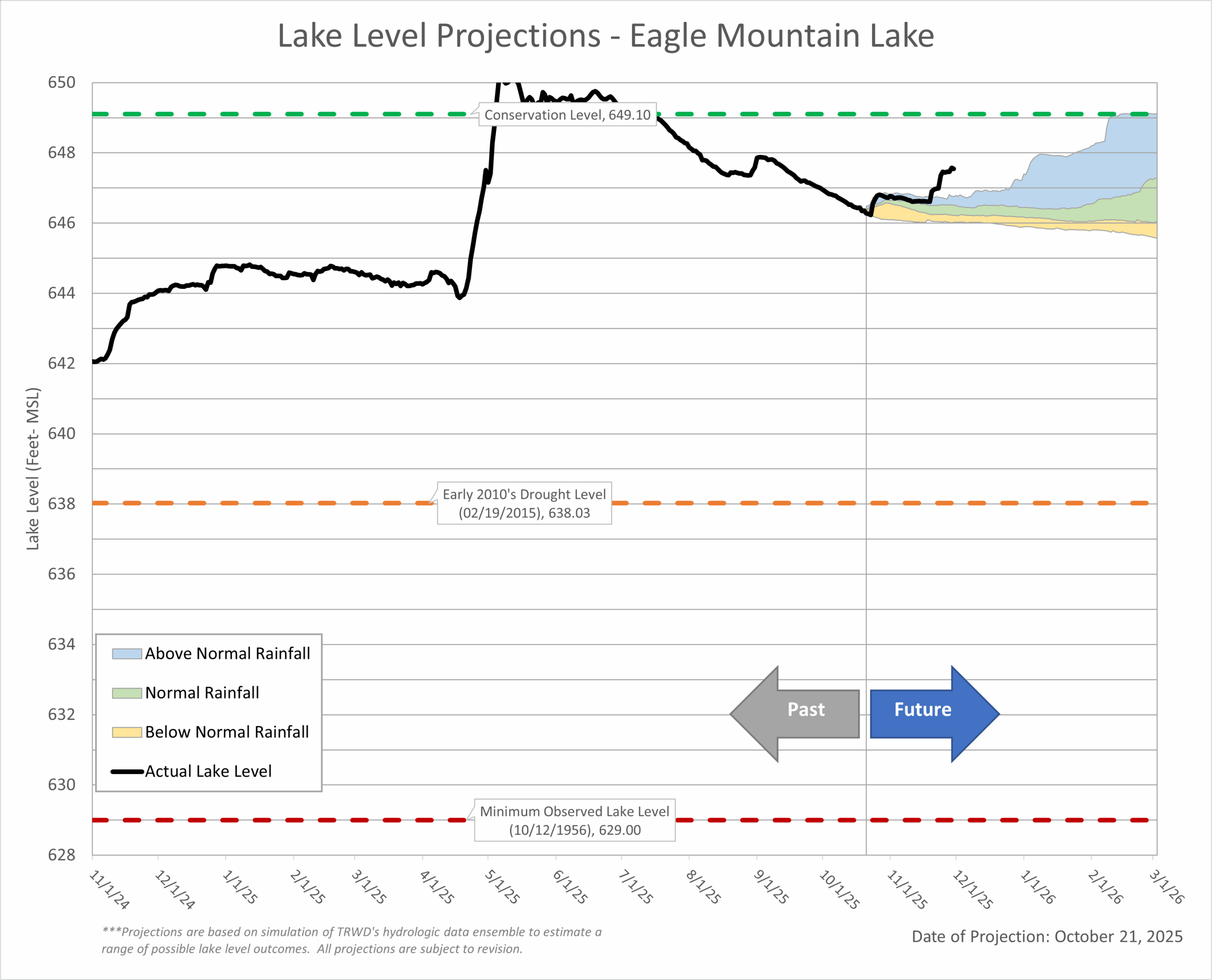
As we move into the coming weeks, conditions are expected to stay on the dry side, so lake levels will likely dip a bit. The good news? Cooler weather means less water demand and slower evaporation. Plus, with vegetation going dormant, the ground won’t soak up as much moisture—so any rain we do get has a better shot at turning into runoff. Bottom line: lake levels will decline, but the drop should be gradual.
Highlights:
- Temperature: November was warm, averaging 6.5°F above normal, with 22 out of 30 days exceeding normal temperatures.
- Rainfall: TRWD reservoirs received 2 to 5 inches of rain in November, mostly toward the end of the month, which is above the monthly average. (See the 30-Day Percent of Normal Rainfall map below.)
- Drought Conditions: With the recent rain, parts of North Texas are now free of drought, but most of the region is currently in the D0 Abnormally Dry category, as shown in the latest NWS Drought Monitor .
Looking Ahead:
- La Niña Influence: A weak La Niña will persist through winter. This typically brings warmer and drier conditions to Texas.
- Rainfall: Equal to below chances for normal rainfall are expected through March.
- Temperatures: Equal to above chances for normal temperatures are expected going forward; mild winter ahead with occasional cold snaps.
- Looking Further: A transition from La Niña to ENSO-neutral is expected in the next couple of months. El Niño development is possible next year, which could bring wetter conditions.
Note: ENSO, or the El Niño-Southern Oscillation, is a recurring climate pattern that influences global weather. It has two main phases: El Niño, which often brings wetter conditions, and La Niña, which typically leads to drier and warmer weather in Texas, especially during fall and winter. This shift is important for water resource planning, as it can affect rainfall and reservoir levels.
Stay Informed by Checking Out the Following:
- TRWD’s quarterly watershed protection newsletter, The Tributary
- The latest lake level projections (see below).
- Links to historical lake level plots.
- Past projections compared to actual outcomes.
Thank you for following the Lake Level Blog. Check back next month for more updates!
TRWD Watershed Rainfall
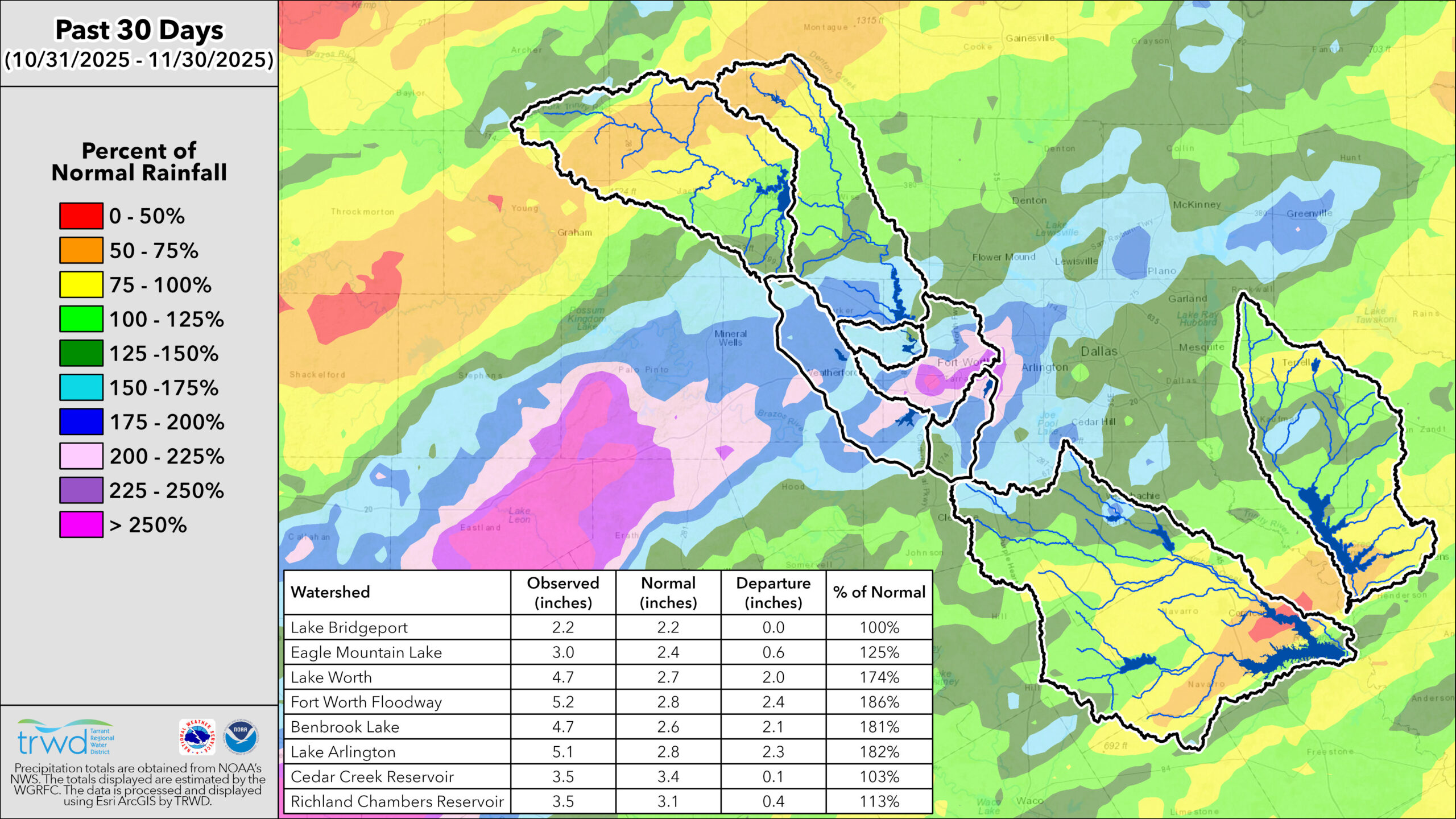
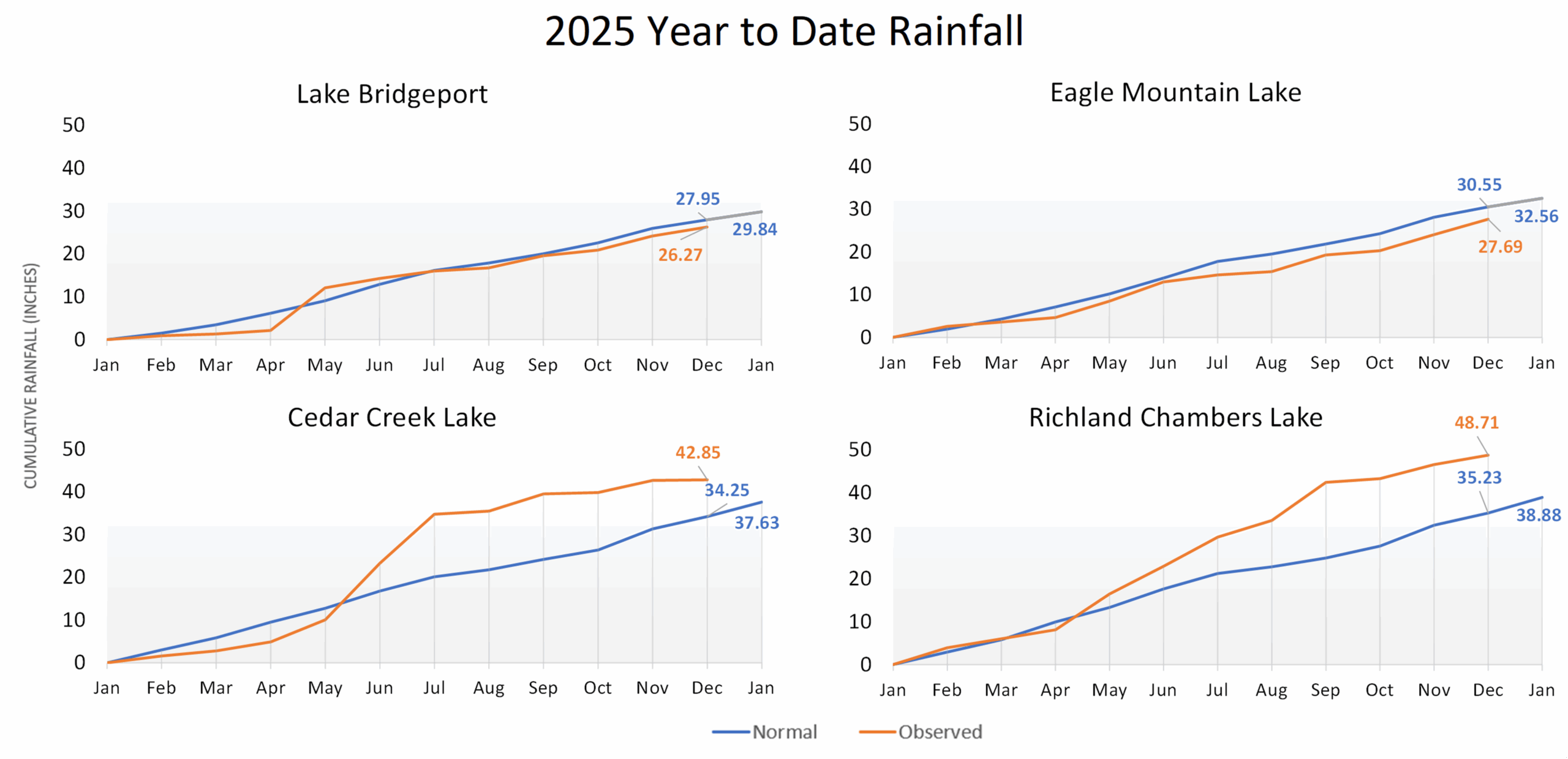
TRWD Lake Rainfall Totals through November 30, 2025
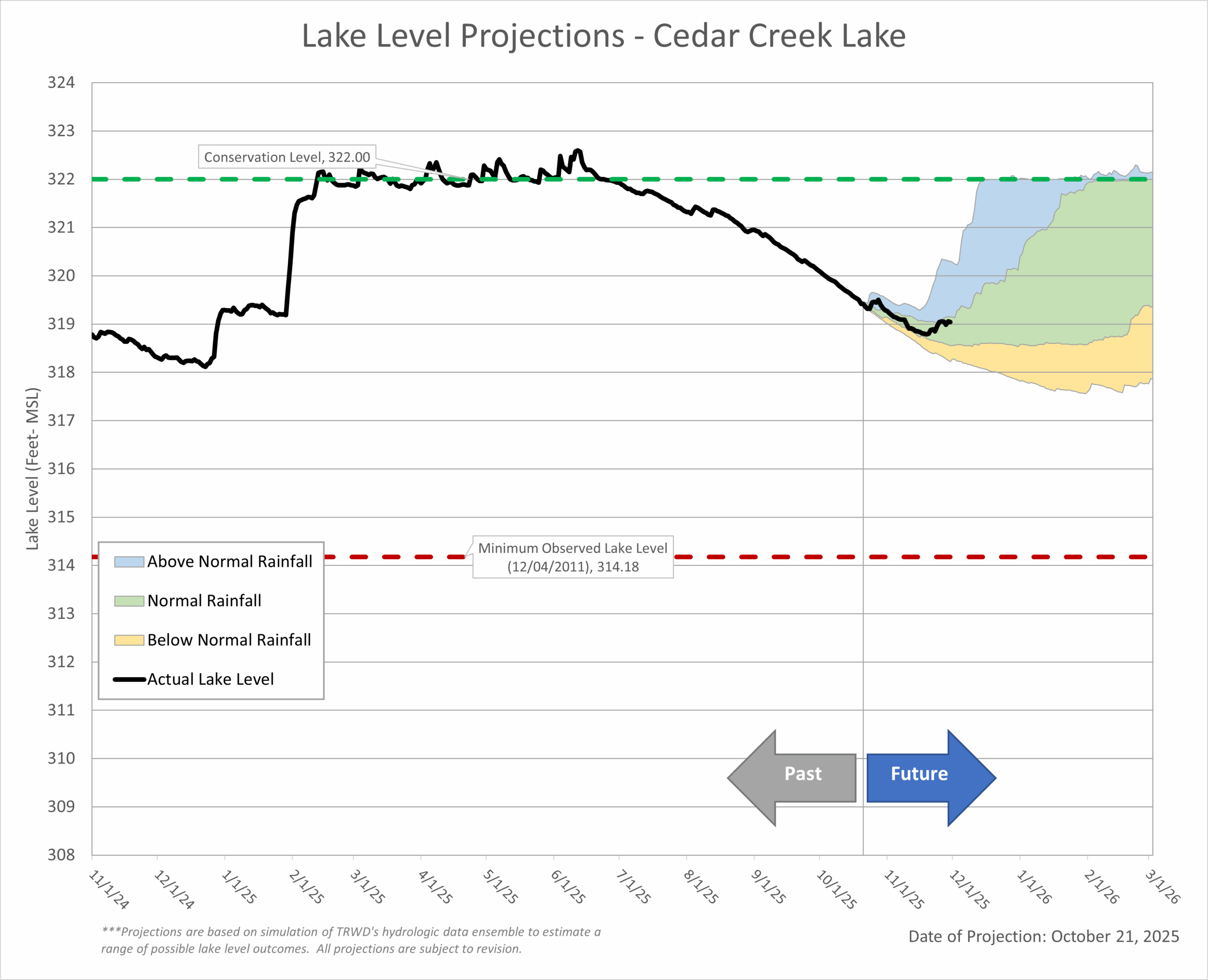
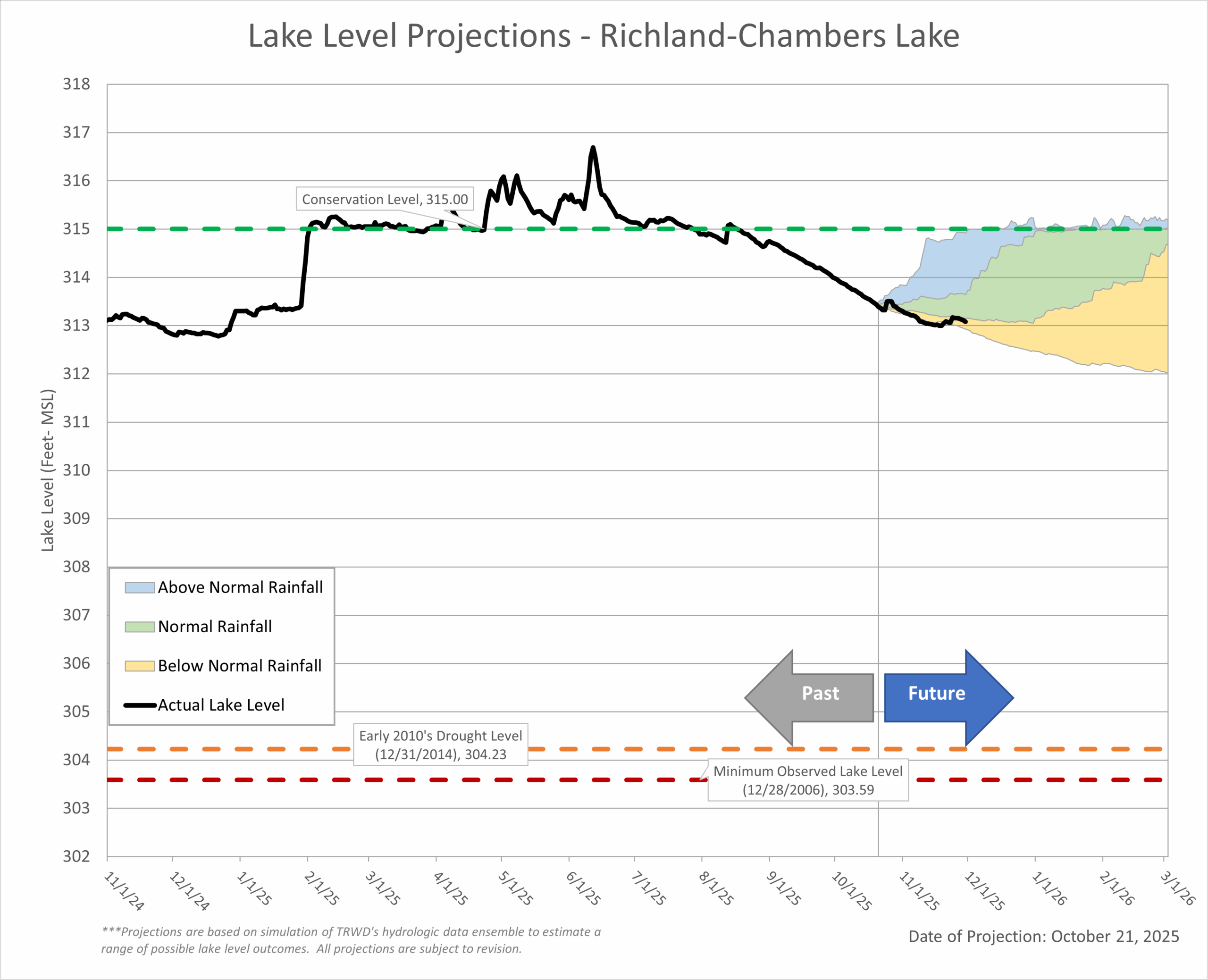
Lake Level Projections
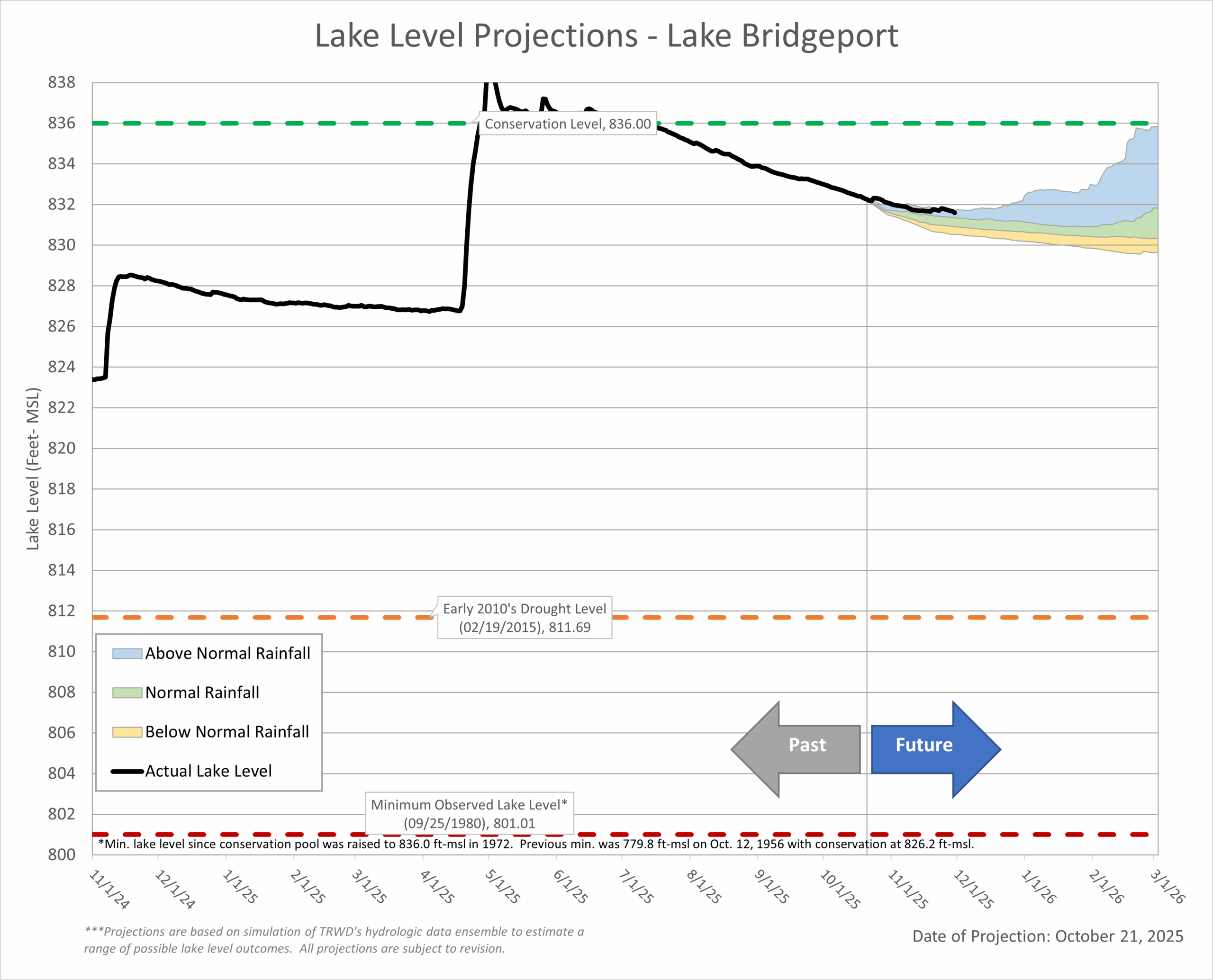 Last Month’s Projection | Historical Lake Levels
 Last Month’s Projections | Historical Lake Levels
 Last Month’s Projection | Historical Lake Levels
 Last Month’s Projection | Historical Lake Levels
Acknowledgments:
- Weather and Climate Insights: Special thanks to Vini de Oliveira.
- Reservoir Projections: A big thank you to Vini de Oliveira for his timely reservoir projections.
- Rainfall Analysis: Appreciation goes to Ashley Lowrie for her thorough analysis of observed rainfall.
- Editorial Review: Special thanks to Victoria Cason for her thorough editorial review.