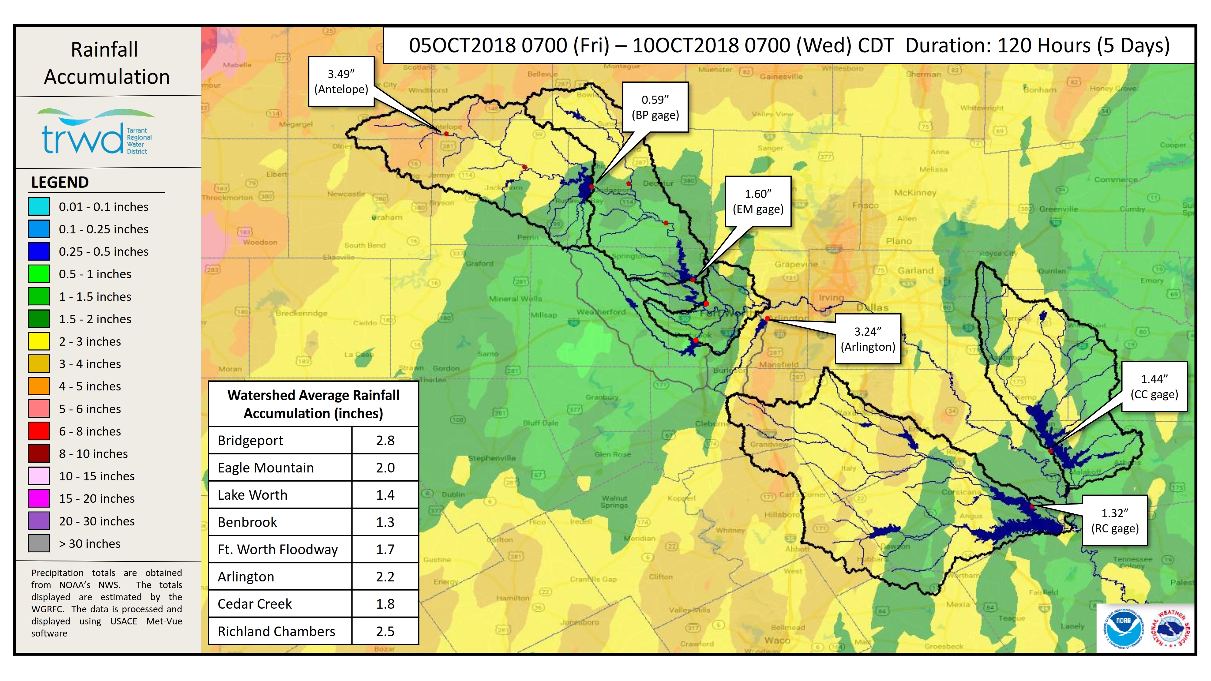
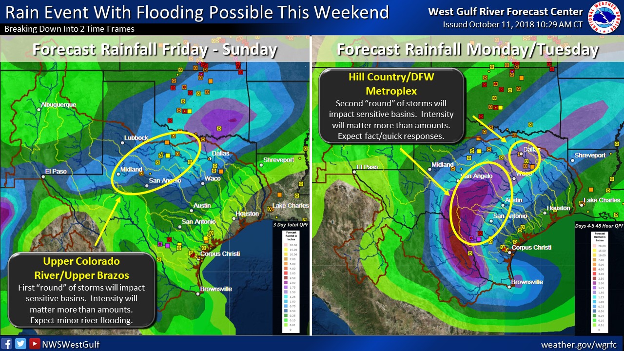
It has been a wet week for the TRWD reservoir watersheds. See Graphic-1 below for a map showing the accumulated rainfall from over the past weekend and through Wednesday morning. From the map one can see the largest totals were in the Bridgeport and Richland-Chambers watersheds and as a result the levels at these reservoirs continue to climb. It is not expected that any of these reservoirs fill as runoff from the past 7 days continues to drain to the reservoirs. However, that could change with the additional rain being foretasted by the National Weather Service (NWS) for the next 5 days. The NWS River Forecast Center‘s latest briefing, seen in Graphic-2 below, is calling for potential minor river flooding. On Saturday 1-2 inches of rain is expected for the Bridgeport and Eagle Mountain watersheds with light rain lingering for the remainder of the weekend and into Tuesday. The Richland-Chambers and Cedar Creek watersheds are expected to receive about an inch per day on Saturday, Sunday, and Monday. With soil conditions at or near saturation it is expected that nearly all the rain that falls will turn to runoff and make its way to the reservoirs. Current conditions at TRWD reservoirs are shown below. At the moment, TRWD monitoring staff is not expecting TRWD reservoirs to fill, however the possibility is becoming more likely. TRWD staff continues to monitor conditions 24 hours a day. Please be advised that forecasts are subject to change and TRWD reservoir operations are based on observed rainfall conditions. Additional updates will be provided here if conditions dictate, please check back.
Graphic-1. 5-Day Observed Rainfall Map
Graphic-2. River Forecast Center Guidance
The latest update of reservoir conditions follows:
Lake Bridgeport
- Current reservoir elevation – 830.36 ft-msl.
- Conservation level elevation – 836.00 ft-msl.
- Change in past 24 hours – +0.09 ft.
- Current discharge is 0 cfs.
Eagle Mountain Lake
- Current reservoir elevation – 647.98 ft-msl.
- Conservation level elevation – 649.10 ft-msl.
- Change in past 24 hours – 0.00 ft.
- Current release is 144 cfs.
Lake Worth (owned and operated by the City of Fort Worth)
- Current reservoir elevation – 592.38 ft-msl.
- Conservation level elevation – 594.00 ft-msl.
- Change in past 24 hours – -0.04 ft.
- Current discharge is 0 cfs.
- See City of Fort Worth news feed for updates on lake
Cedar Creek
- Current reservoir elevation – 320.26 ft-msl.
- Conservation level elevation – 322.00 ft-msl.
- Change in past 24 hours – +0.04 ft.
- Current discharge is 0 cfs.
Richland-Chambers
- Current reservoir elevation – 313.68 ft-msl.
- Conservation level elevation – 315.00 ft-msl.
- Change in past 24 hours – +0.13 ft.
- Current release is 5 cfs (environmental flow)
Please call the Flood Hotline for further information.
817-720-4296.
If prompted to leave a message, the flood monitor on duty will return your call within 30 minutes.
*ft-msl – feet above mean sea level; cfs – cubic feet per second
Post based on conditions as of October 11, 2018, at 4:00 PM