Lake Level BlogUncategorized

General Statement of Monitoring Conditions

By April 19, 2018
Rainfall Forecast | TRWD

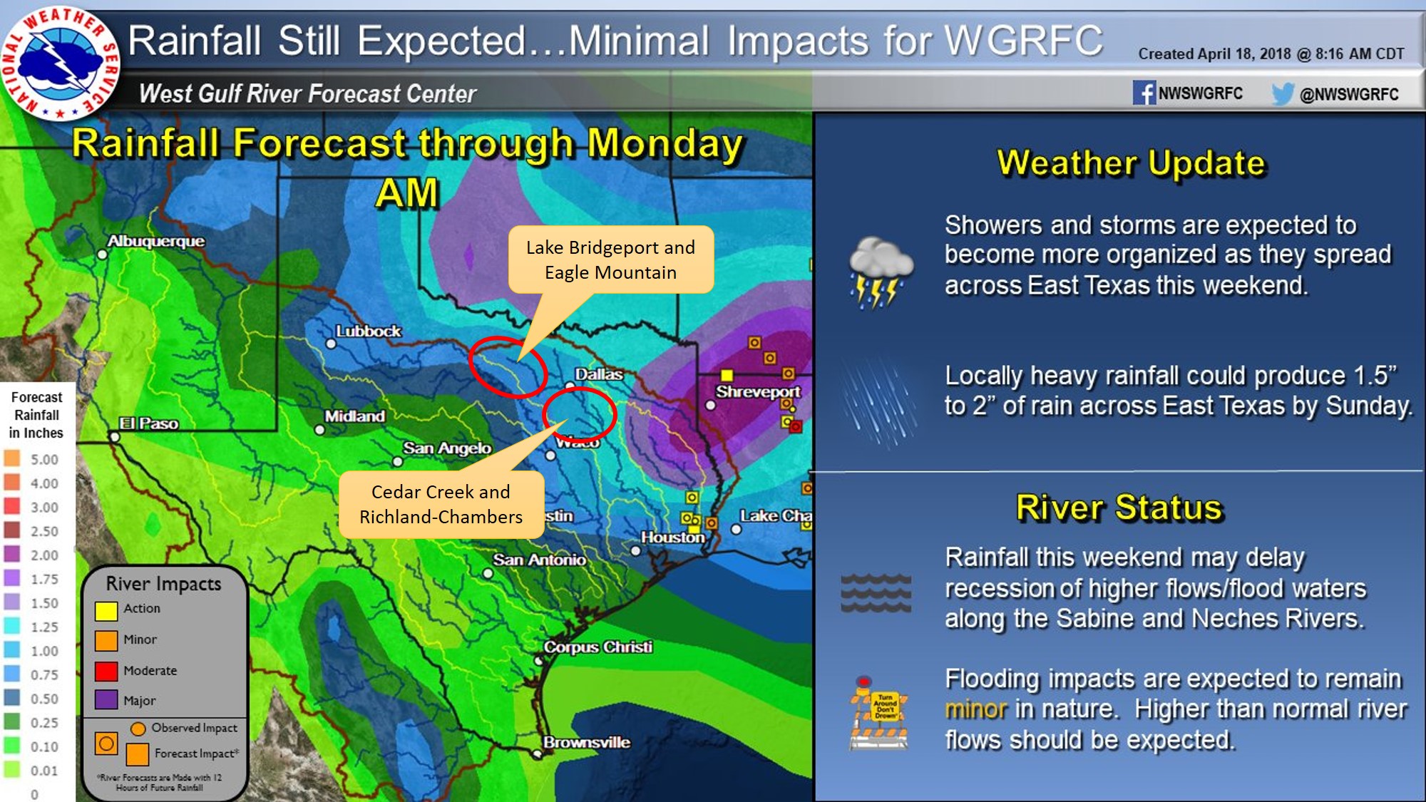
District reservoirs are currently at or near conservation level.  The National Weather Service (NWS) is forecasting widespread rainfall for the upcoming weekend.  The rainfall is expected to start Friday evening, continue through Saturday, and come to an end on Sunday.  Guidance from the NWS River Forecast Center is included below.  According to the graphic, District reservoirs are expected to receive about an inch of rainfall.  Please be advised that forecasts are subject to change and District reservoir operations are based on observed rainfall conditions.  TRWD staff is monitoring conditions 24 hours a day. Please check back as this event develops for further updates.

Please call the Flood Hotline for further information.

817-720-4296.

If prompted to leave a message, the flood monitor on duty will return your call within 30 minutes.

picture1

Lake Current Level Conservation Level* Level Difference**
Arlington 549.78 550.00 -0.22
Benbrook 693.27 694.00 -0.73
Bridgeport 821.08 836.00 -14.92
Cedar Creek 322.06 322.00 0.06
Eagle Mountain 644.73 649.10 -4.37
Lake Worth 590.90 594.00 -3.10
Richland-Chambers 315.23 315.00 0.23
*Conservation Level: The permitted level of water an entity is allowed to hold in a lake. Any amount above the conservation level is used for the temporary storage of flood waters and must be released downstream.
**Difference: Amount above or below conservation level.
For more information read our daily reports or the TRWD Lake Level Blog.

Check out the TRWD OneRain portal for a visualization of this information and more.

Stay connected with TRWD!

Sign up for our newsletter!

Newsletter Sign Up