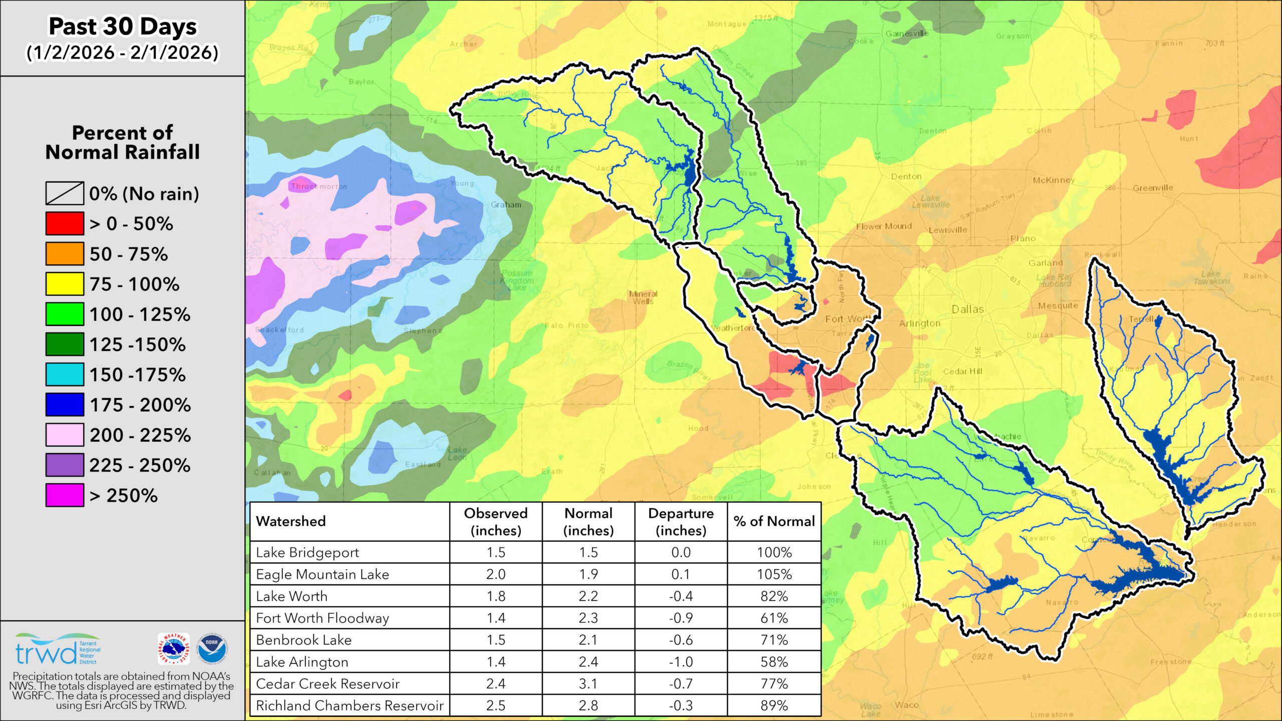
January continued the pattern we saw in December, beginning warm and dry across the TRWD service watersheds. The arrival of the winter storm dropped temperatures drastically, which kept the monthly average near normal level. Precipitation totaled 0.93 inches at DFW airport below the normal (2.53 inches). Despite another month of below-average precipitation, TRWD’s system storage has held steady over the past 30 days, and is currently around 88%, a healthy level for this time of year.
February is forecasted to be warmer and drier than normal, meaning rainfall is unlikely to significantly boost storage.
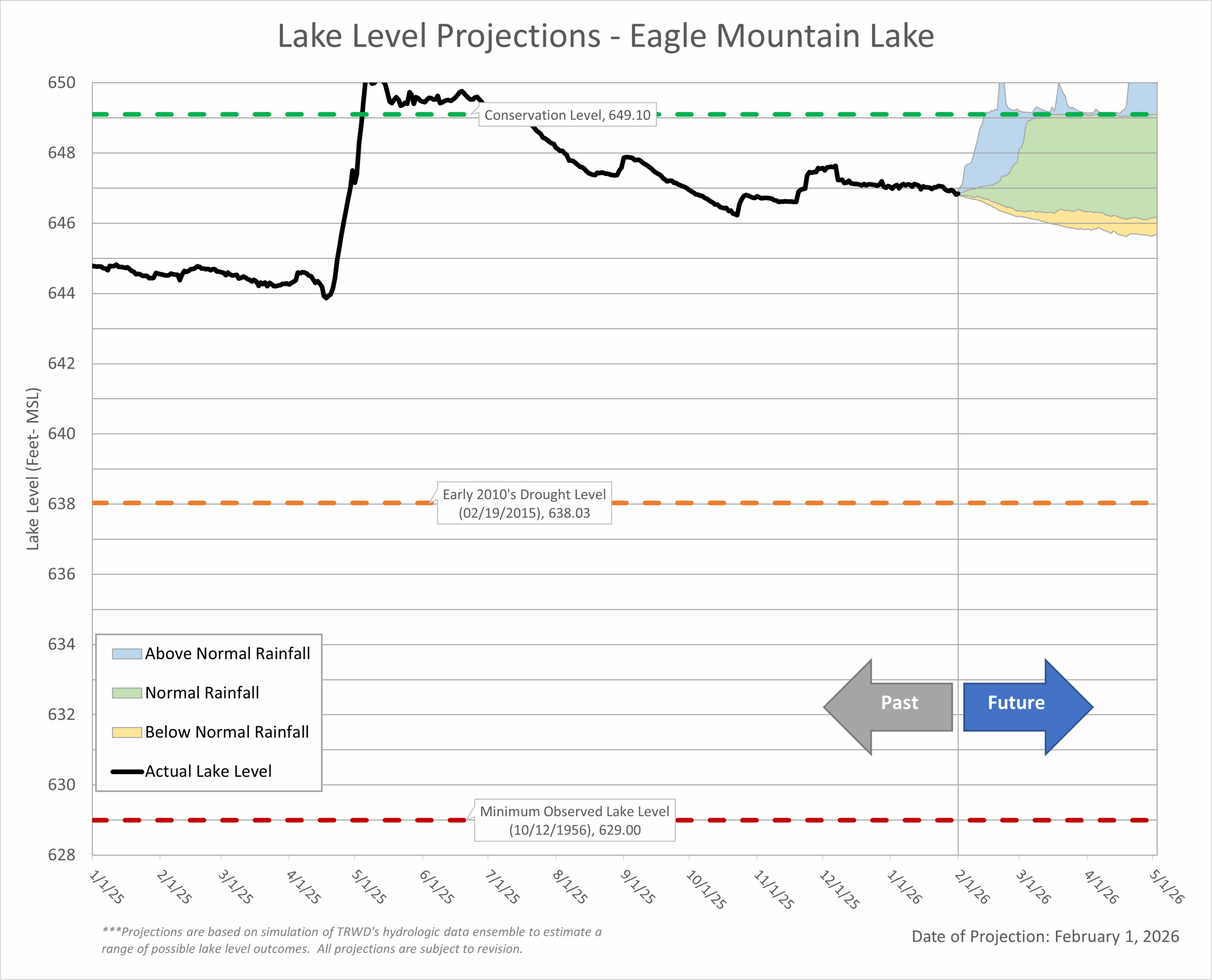
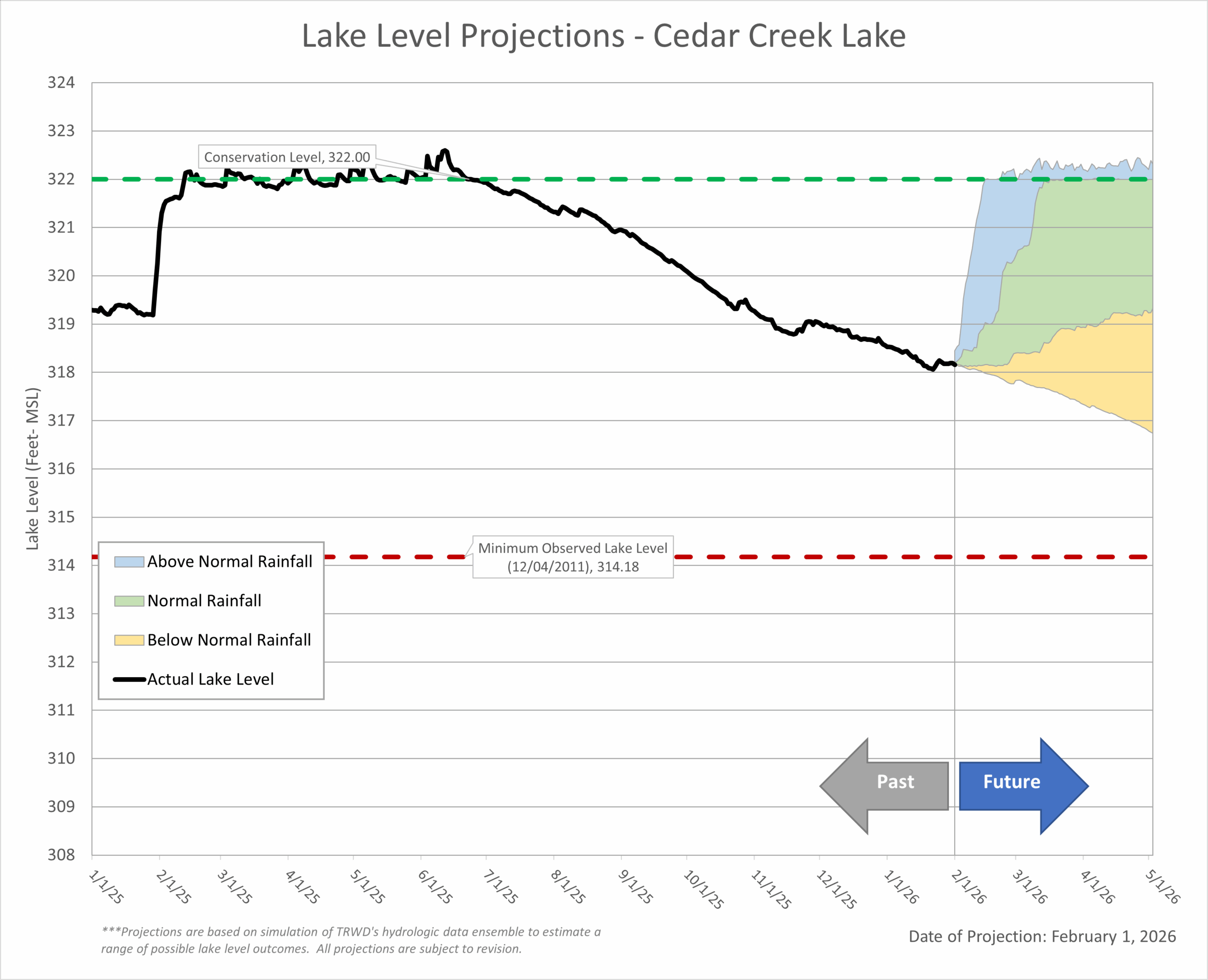
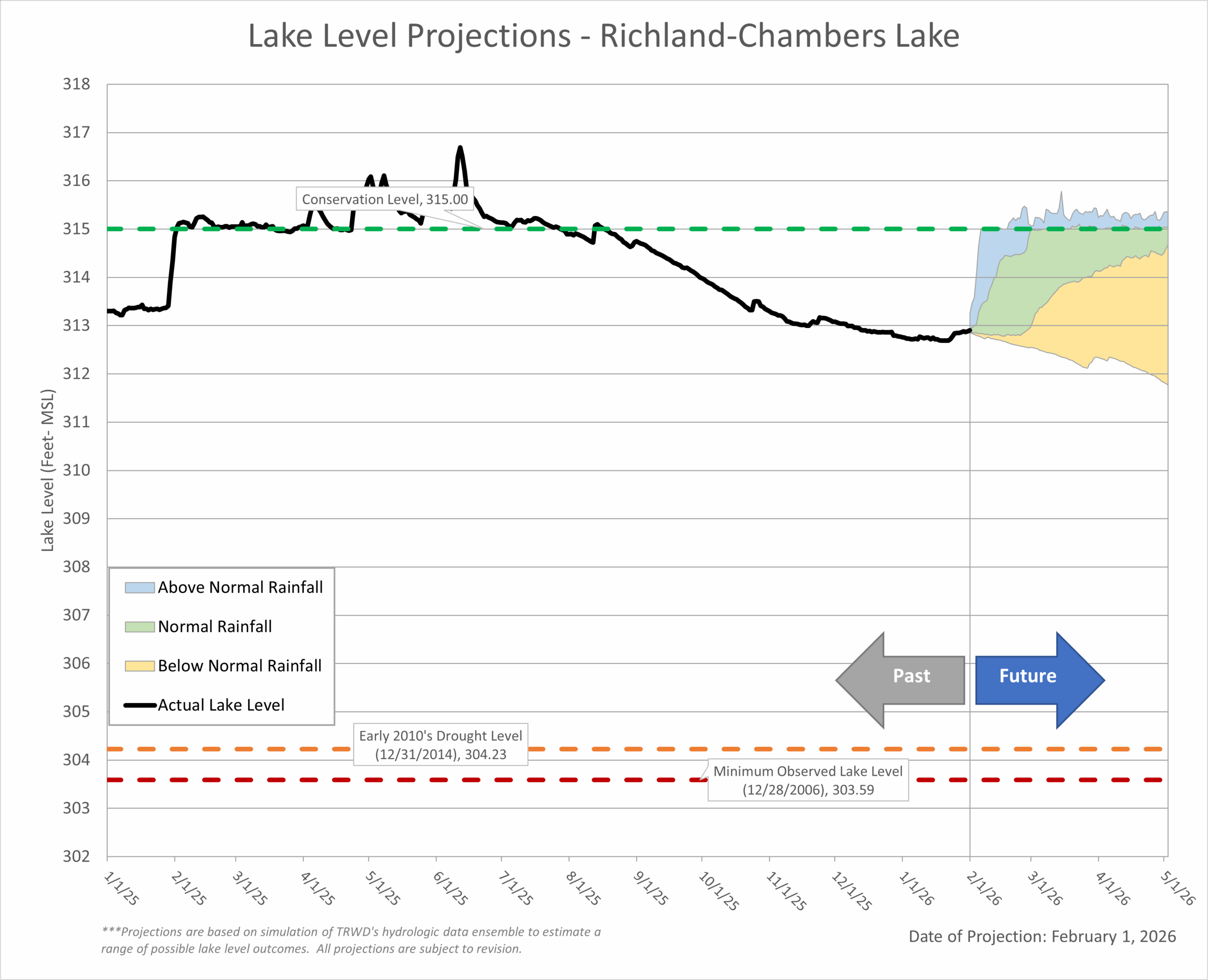
Bottom Line: Expect lake levels to follow the low end of the “Normal Rainfall” trend (green area on the Lake Level Blog Projection Plots), as water demands increase with higher temperatures.
January Highlights:
- Temperature: January started warm and dry, with temperatures reaching the 80s. With the arrival of the winter storm and Arctic air, the month ended at the normal temperature for DFW (46.3 F).
- Rainfall: Even though DFW received precipitation in the form of ice and snow, the totals for this event (0.93 inches) were not enough to reach the normal precipitation mark (2.53 inches).
- Drought Conditions: Due to limited rain across the region, most of the TRWD service area has now moved to the D0 (Abnormally Dry) and D1 (Moderate Drought) categories, as shown in the latest NWS Drought Monitor.
Looking Ahead:
- La Niña Influence: A La Niña condition is still present and will persist for a couple of months. This typically brings warmer and drier conditions to Texas.
- Rainfall: Below-normal rainfall is expected through March.
- Temperatures: Above-normal temperatures are expected going forward.
- Looking Further: A transition from La Niña to ENSO-neutral is expected in the spring. El Niño development is possible later in the year, which could bring wetter conditions.
Note: ENSO, or the El Niño-Southern Oscillation, is a recurring climate pattern that influences global weather. It has two main phases: El Niño, which often brings wetter conditions, and La Niña, which typically leads to drier and warmer weather in Texas, especially during fall and winter. This shift is important for water resource planning, as it can affect rainfall and reservoir levels.
Stay Informed by Checking Out the Following:
- TRWD’s quarterly watershed protection newsletter, The Tributary
- The latest Lake Level Projections (see below).
- Links to historical lake level plots.
- Past projections compared to actual outcomes.
Thank you for following the Lake Level Blog. Check back next month for more updates!
TRWD Watershed Rainfall
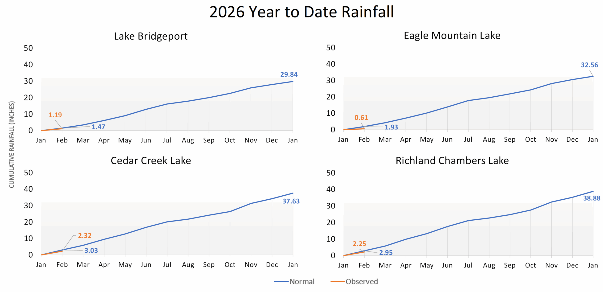
TRWD Lake Rainfall Totals through January 31, 2026
Lake Level Projections
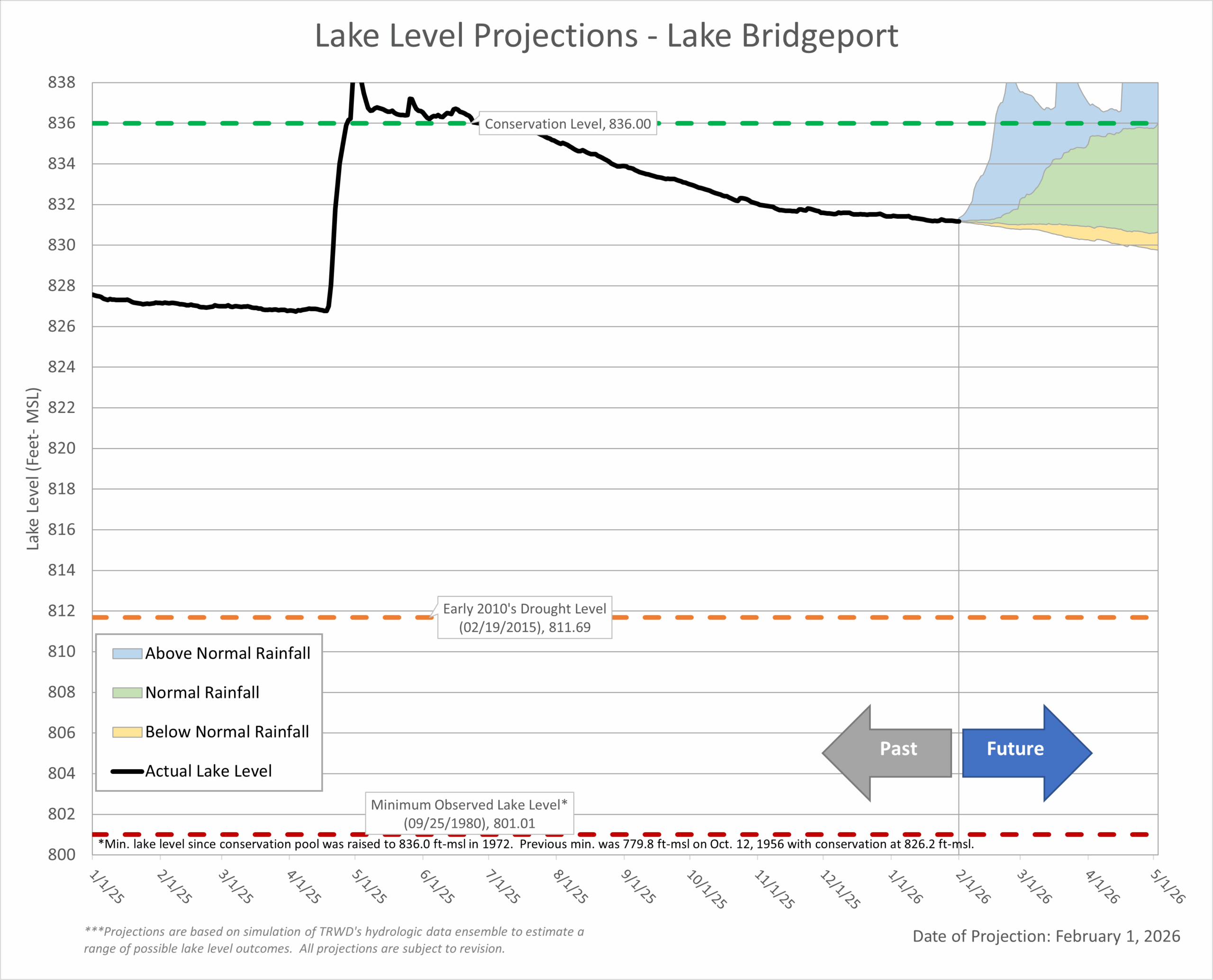 Last Month’s Projection | Historical Lake Levels
 Last Month’s Projections | Historical Lake Levels
 Last Month’s Projection | Historical Lake Levels
 Last Month’s Projection | Historical Lake Levels
Acknowledgments:
- Weather and Climate Insights: Special thanks to Vini de Oliveira and Craig Ottman.
- Reservoir Projections: A big thank you to Vini de Oliveira for his timely reservoir projections.
- Rainfall Analysis: Appreciation goes to Ashley Lowrie for her thorough analysis of observed rainfall.
- Editorial Review: Special thanks to Victoria Cason for her thorough editorial review.