Bottom Line
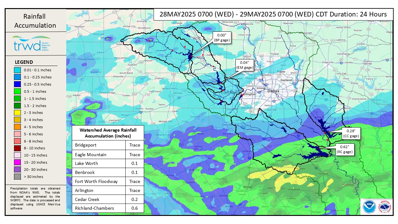
Spillway operations are ongoing at all four TRWD lakes. Graphic-1 shows about an inch of rain in the Richland-Chambers watershed yesterday which created additional inflow. Otherwise, little to no additional runoff has been generated in the last 24 hours.
Projections
- Bridgeport: The pool is receding, and spillway discharges will be reduced accordingly.
- Eagle Mountain: The spillway is releasing about 3,300 cubic feet per second (cfs) and will continue at this rate for the next 48 to 72 hours. The pool is rising due to the arrival of the 5,000 cfs peak flow recorded yesterday at the Boyd gage. The pool is expected to reach 650.3 feet above mean sea level (ft-msl). Lake Worth is expected to stay near 595.3 ft-msl.
- Cedar Creek: The pool is just above conservation level with a low spillway discharge.
- Richland-Chambers: Discharge was increased due to recent rain, and the pool is near its crest elevation but is expected to trend downward in the coming days.
*Projections are subject to change and are based on past precipitation.
Looking Forward
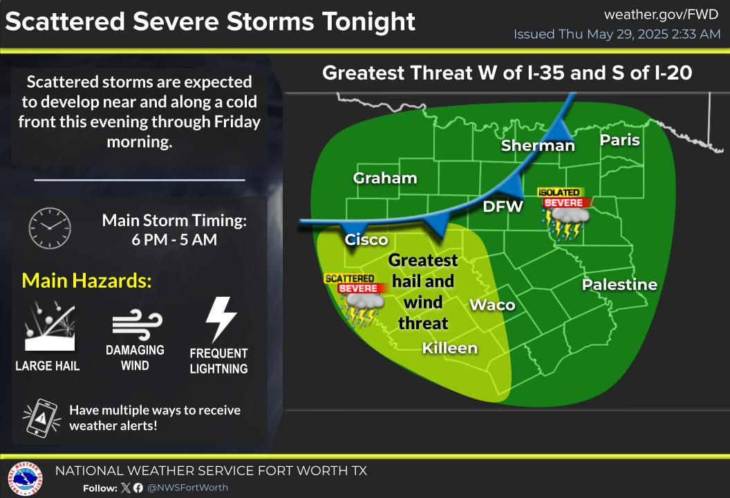
Scattered storms are expected to develop this evening through Friday morning near and along a cold front. Some storms may become severe, bringing hail, damaging winds, and frequent lightning. The greatest threat for severe weather is west of I-35 and south of I-20. See NWS Guidance below in Graphic 2.
Next Update: The next reservoir update will be posted as conditions warrant. TRWD staff will continue to monitor conditions 24/7 and are available to answer the flood line if there are any questions or concerns.
Graphic 1) Observed Rainfall
Graphic 2) NWS Guidance
Current Lake Conditions
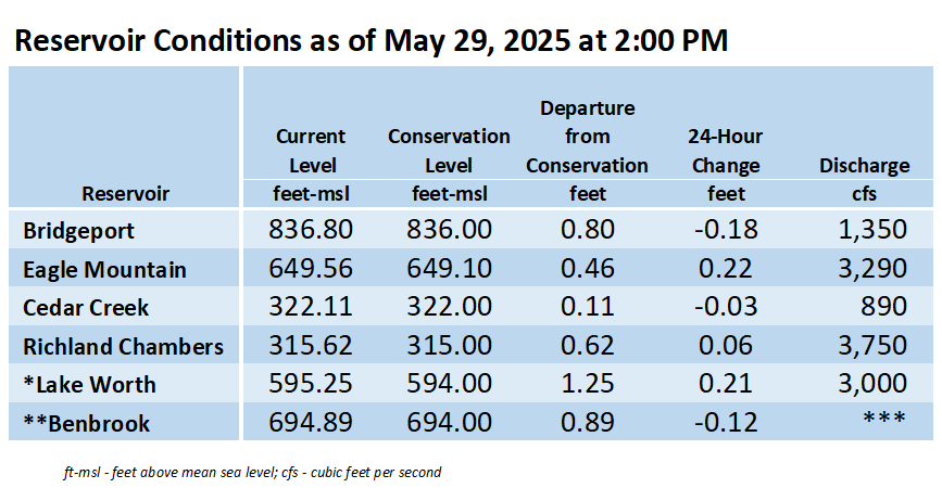
The information shown in the table above can also be found at trwd.onerain.com.
*Lake Worth is owned and operated by the City of Fort Worth. Please contact the City of Fort Worth and NWS forecast page for updates on Lake Worth.
**Benbrook Lake is owned and operated by the U.S. Army Corps of Engineers.
***See Benbrook Lake Home Page for current discharge.
Additional Information
TRWD staff will continue to monitor conditions and adjust flood discharges accordingly. Updates on reservoir conditions will be posted, and subscribers will receive email notifications of new blog posts. Also, visit our partners at the (NWS) and the River Forecast Center (RFC) for the latest information regarding weather and river conditions.
Contact Information
For questions, call the Flood Hotline at 817-720-4296 to leave a message for a TRWD Flood Team member.
Posted by CO.