Weather Update
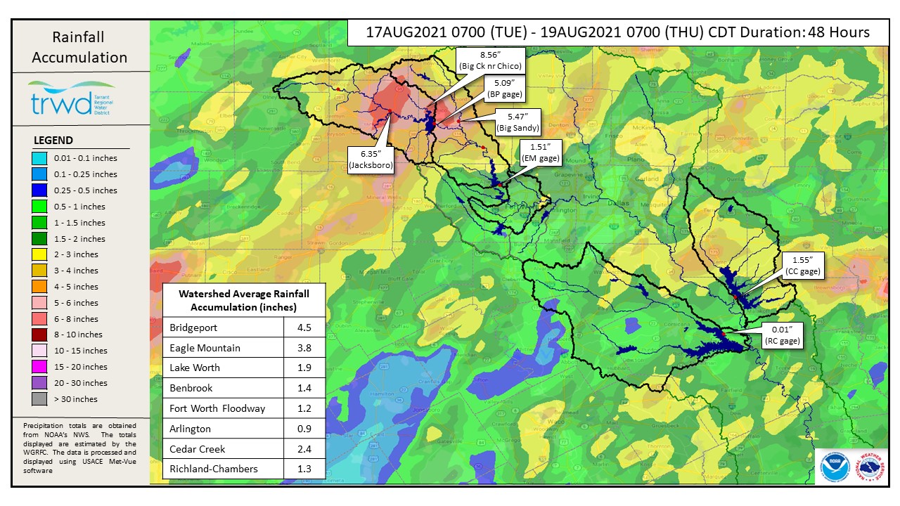
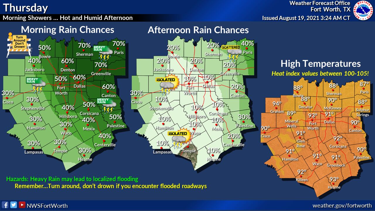
TRWD continues to monitor watershed conditions 24 hours a day. The West Fork Trinity watersheds received heavy rain in the past 48 hours. The runoff generated by this event has caused the lakes to rise, especially Bridgeport. The area near Chico, TX saw 8.56″ of rain in the past 48 hours, with 7.65″ falling in a period of 24 hours ending yesterday afternoon. This corresponds to a “50-year storm” according to the NOAA Atlas 14 Precipitation Frequency Analysis. See rainfall event information in TRWD’s One Rain. Notable rainfall amounts were also recorded in Jacksboro, Bridgeport and Big Sandy. See Graphic.1 for 48-Hour Rainfall Totals. There are chances of additional rain this morning and afternoon with isolated storms, but chances of heavy rain in TRWD watersheds are low. The greater chances are to the east of Fort Worth, but additional rain in the Bridgeport and Eagle Mountain watersheds cannot be ruled out. See Graphic-2 for National Weather Service (NWS) guidance on additional rainfall today.
Reservoir Conditions
Current reservoir conditions are shown below. The increase at Lake Bridgeport has slowed since the last update and TRWD monitoring staff does not anticipate the lake to reach conservation level (elevation 836) today without additional rainfall. The latest projection shows the potential for Bridgeport to reach conservation level by tomorrow morning as runoff from the outer parts of the watershed continues to flow into the lake. Eagle Mountain pool is rising and monitoring staff will continue to watch it. Staff will continue to monitor conditions and make discharges as needed to safely move excess water through the system. Updates to lake status and flood discharges will be posted here.
Please be advised that forecasts and projections are subject to change, and TRWD reservoir operations are based on observed rainfall conditions. The next update will come tomorrow morning, unless conditions dictate otherwise. Please check back. You can also follow @TRWD_News on Twitter to receive notification of any new posts to this Lake Level blog.
Current lake levels can be found in a variety of locations including TRWD.com, the TRWD watershed data viewer trwd.onerain.com, or download the TRWD Lake Level App for iOS or Android. You may also follow the NWS and the River Forecast Center (RFC) for the latest information regarding weather and river conditions, respectively.
Graphic-1. 48-Hour Rainfall Totals
Graphic-2. NWS Guidance
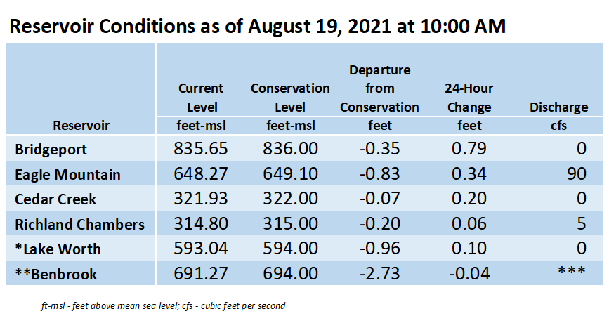
*Lake Worth is owned and operated by the City of Fort Worth. See the City of Fort Worth news feed and NWS forecast page for updates on Lake Worth.
**Benbrook Lake is owned and operated by the U.S. Army Corps of Engineers. ***See Benbrook Lake Home Page for current discharge.
****Please visit TRWD’s new watershed data viewer at www.trwd.onerain.com . You can see the same rain, stream, and lake gages the Flood Team monitors during an event. You can also check out this YouTube video to see what it is all about!
Please call the Flood Hotline for further information.
817-720-4296
If prompted to leave a message, the flood monitor on duty will return your message within 30 minutes.
Posted by VdO.