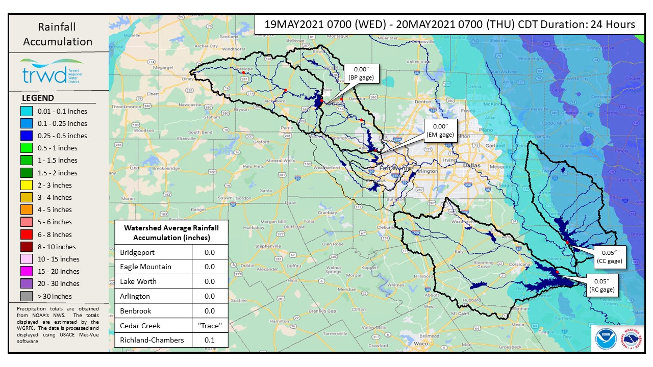
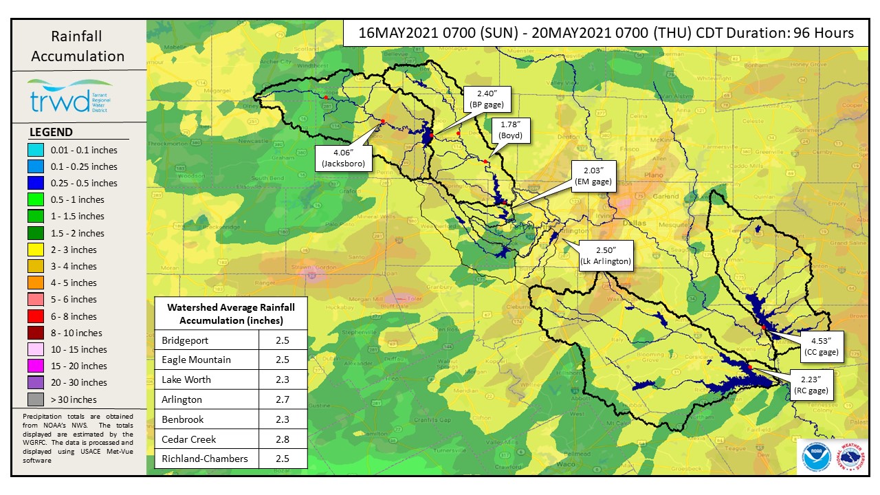
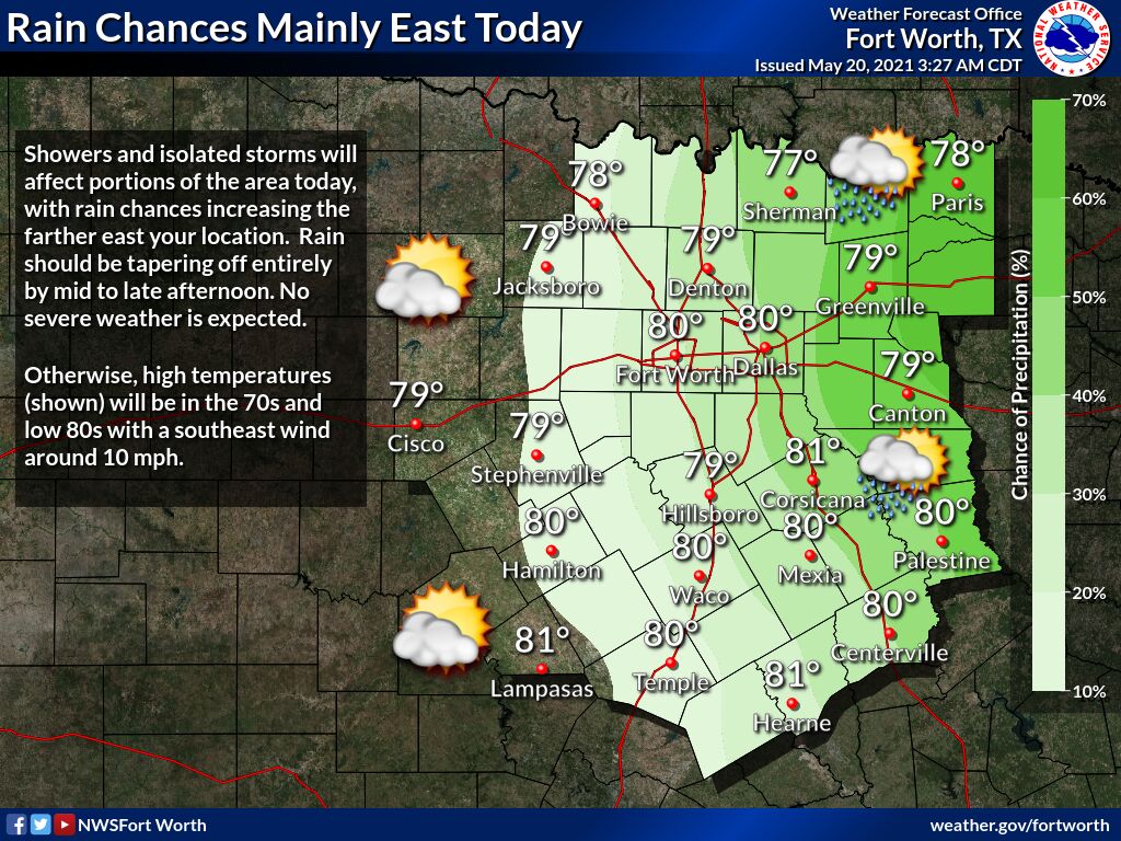
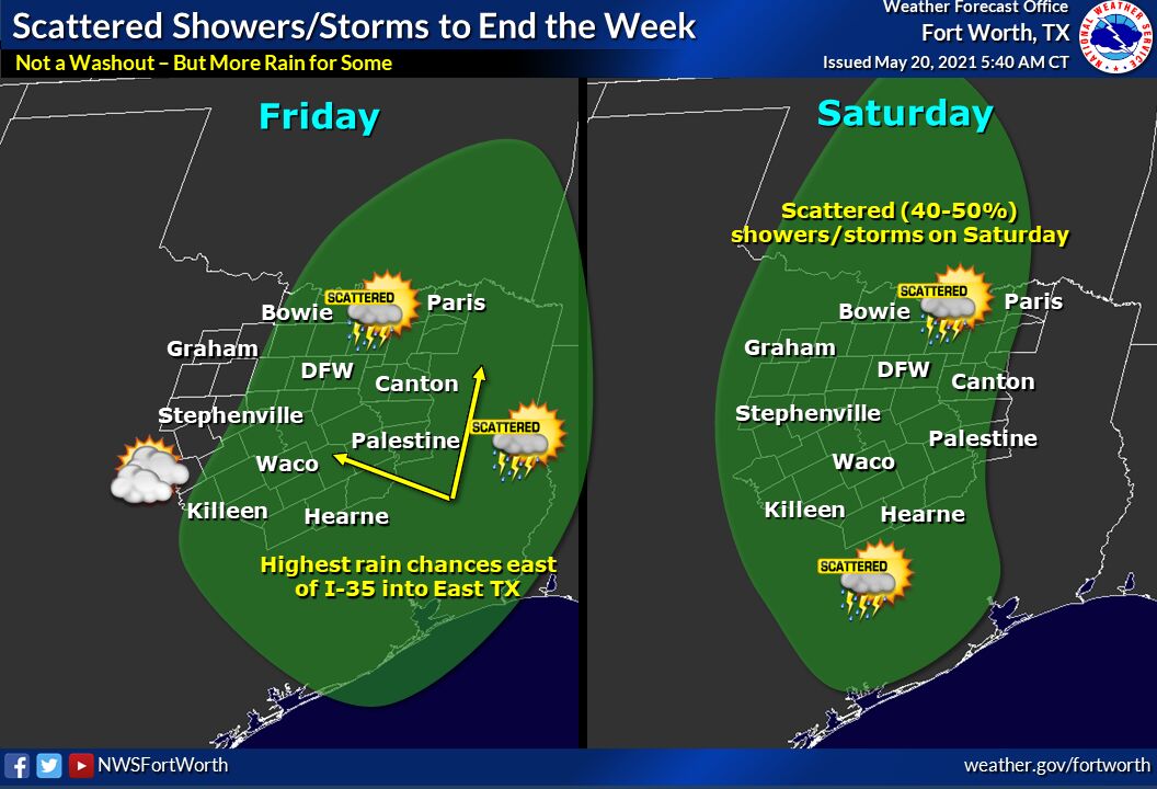
TRWD continues to monitor reservoir conditions 24 hours a day. Little to no rainfall in the TRWD watersheds yesterday, just traces in the Cedar Creek and Richland-Chambers watersheds, see Graphic-1 below. Graphic-2 shows the rainfall accumulation over the past 4 day (96 hours). It was not the 5 to 7 inches that was originally forecasted but was enough to fill all District lakes, except Bridgeport which will likely top out around 9 inches below full. The weather is starting to dry out in the Upper Trinity watershed, however additional rain is still possible through Saturday. National Weather Service (NWS) guidance for today shows no severe weather, but some isolated storms are possible, especially in the East. See Graphic-3 and Graphic-4 for guidance on today’s rain chances and expected rainfall through Saturday, respectively.
Current reservoir conditions are shown below. Richland-Chambers and Cedar Creek continue to make flood discharges. The Eagle Mountain pool has been slowly falling, down 0.06 feet (3/4 inches) since the crest yesterday morning. Discharges from Eagle Mountain will continue but staff will be looking for opportunities to reduce discharge as inflow decreases over the next few days. Bridgeport is not expected to reach conservation at this time. Staff will continue to monitor conditions and make discharges as needed to safely move excess water through the system. Updates to lake status and flood discharges will be posted here.
Please continue to follow the National Weather Service (NWS) and the River Forecast Center (RFC) for the latest information regarding weather and river conditions, respectively.
Please be advised that forecasts and projections are subject to change, and TRWD reservoir operations are based on observed rainfall conditions. The next update will come tomorrow morning, unless conditions dictate otherwise. Please check back.
***Please visit TRWD’s new watershed data viewer at www.trwd.onerain.com . You can see the same rain, stream, and lake gages the Flood Team monitors during an event. You can also check out this YouTube video to see what it is all about!
Graphic-1. Rainfall Accumulation for the Past 24 Hours
Graphic-2. Rainfall Accumulation for the Past 96 Hours (4 Days)
Graphic-3. NWS Guidance – Today through Tonight Rainfall Chances
Graphic-4. NWS Guidance – Scattered Storms through Saturday
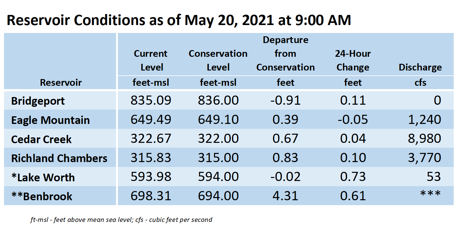
**Benbrook Lake is owned and operated by the U.S. Army Corps of Engineers. ***See Benbrook Lake Home Page for current discharge. *Lake Worth is owned and operated by the City of Fort Worth. See the City of Fort Worth news feed for updates on Lake Worth.
Please call the Flood Hotline for further information.
817-720-4296
If prompted to leave a message, the flood monitor on duty will return your message within 30 minutes.
Posted by CO