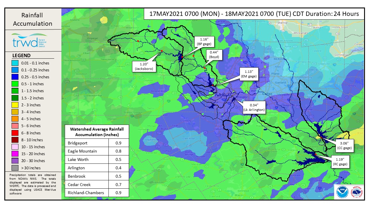
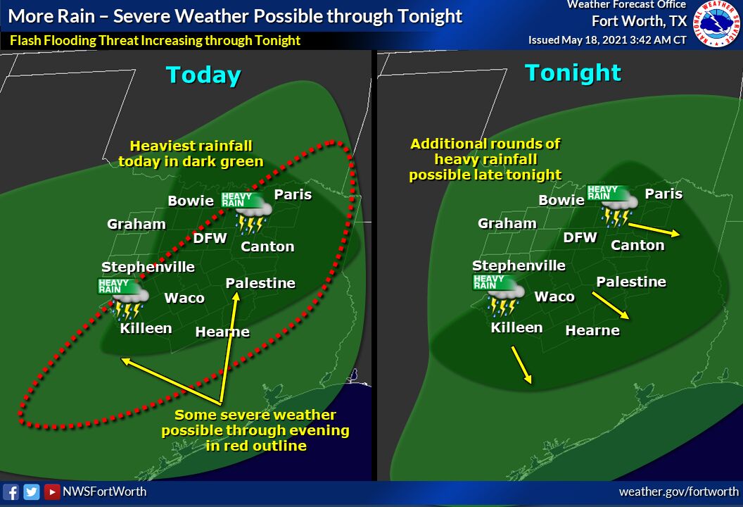
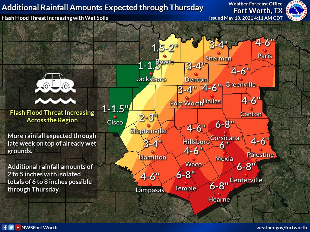
TRWD continues to monitor reservoir conditions 24 hours a day. Rainfall is expected to continue through the week bringing multiple additional inches of rain. The last rainfall events brought around 1″ of rain in the West Fork and additional 3″ in the Cedar Creek watershed. See Graphic-1 for rainfall totals for the last 24 hours. National Weather Service (NWS) guidance for today shows that another round of heavy rain is expected today through the evening, with additional heavy rainfall late tonight moving Southeast. See Graphic-2 for guidance on today’s rain. See Graphic-3 for the latest predictions of how much rain we can expect to receive through Thursday.
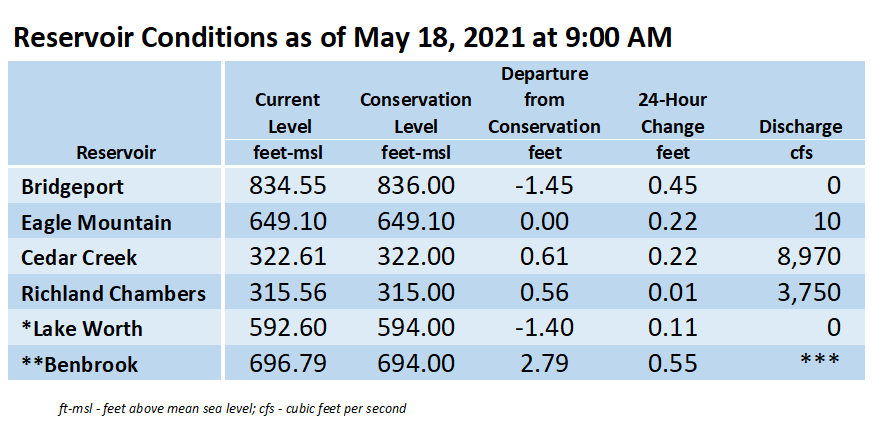
Current reservoir conditions are shown below. Richland-Chambers and Cedar Creek continue to make flood discharges. No flood discharges are being made from Bridgeport and Eagle Mountain at this time. Eagle Mountain is near conservation level of 649.1 ft-msl and once that level is reached a low level discharge will begin from the overflow spillway. Staff will continue to monitor conditions and make discharges as needed to safely move excess water through the system. Updates to lake status and flood discharges will be posted here.
Please continue to follow the National Weather Service (NWS) and the River Forecast Center (RFC) for the latest information regarding weather and river conditions, respectively.
Graphic-1. Rainfall Accumulation for the Past 24 hours
Graphic-2. NWS Guidance – Today through Tonight Rainfall
Graphic-3. NWS Guidance – Expected Rainfall Totals through Thursday
**Benbrook Lake is owned and operated by the U.S. Army Corps of Engineers. ***See Benbrook Lake Home Page for current discharge. *Lake Worth is owned and operated by the City of Fort Worth. See the City of Fort Worth news feed for updates on Lake Worth.
Please call the Flood Hotline for further information.
817-720-4296
If prompted to leave a message, the flood monitor on duty will return your message within 30 minutes.
Posted by VdO.