News

Trail improvements create detour on the north shore of Panther Island Pavilion.

By February 20, 2018
Trail Improvements Map | TRWD

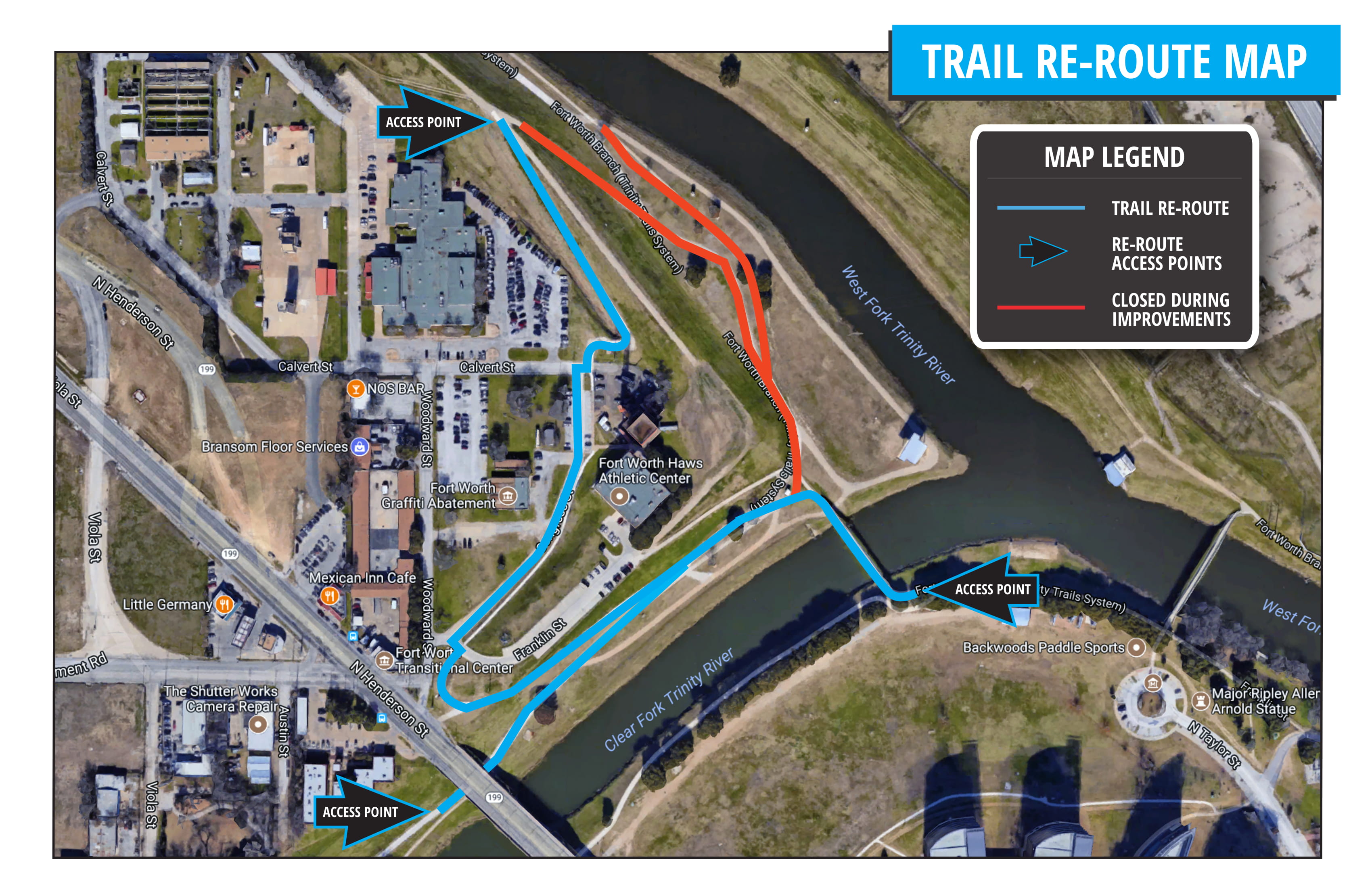
TRWD is making improvements to the grounds on the north shore of Panther Island Pavilion. As a part of these improvements, the existing narrow and broken 6 ft. concrete trail will be replaced with an 11 ft. concrete trail. Temporary fencing will be in place during construction and trail users are asked to use the trail re-route around the back side of the Haws Athletic Training Center. Please see attached map showing trail re-route. The estimated construction timeline is through mid-April.

To find information on the the Trinity Trails visit: http://www.trwd.com/recreation/map/
pip_trailre-route_map_feb-2018-1

Lake Current Level Conservation Level* Level Difference**
Arlington 550.66 550.00 0.66
Benbrook 694.36 694.00 0.36
Bridgeport 821.60 836.00 -14.40
Cedar Creek 322.41 322.00 0.41
Eagle Mountain 645.24 649.10 -3.86
Lake Worth 591.28 594.00 -2.72
Richland-Chambers 315.33 315.00 0.33
*Conservation Level: The permitted level of water an entity is allowed to hold in a lake. Any amount above the conservation level is used for the temporary storage of flood waters and must be released downstream.
**Difference: Amount above or below conservation level.
For more information read our daily reports or the TRWD Lake Level Blog.

Check out the TRWD OneRain portal for a visualization of this information and more.

Stay connected with TRWD!

Sign up for our newsletter!

Newsletter Sign Up