October brought near-normal rainfall across much of North Texas, following an exceptionally hot and dry September. DFW Airport recorded 3.99 inches of rainfall, slightly below the October normal of 4.37 inches. Despite the rainfall, temperatures remained well above normal, with an average temperature of 72.7°F, making it the 8th warmest October on record.
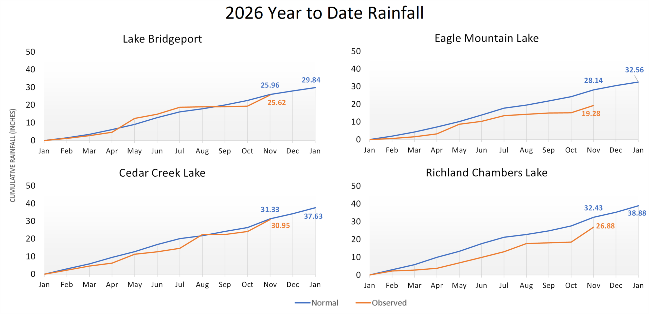
Across TRWD’s watersheds, Eagle Mountain, Cedar Creek, and Richland-Chambers received slightly below-normal rainfall, while Lake Bridgeport received slightly above-normal rainfall. Although rainfall varied across the region, it helped limit storage decline. Combined system storage declined by just 0.3 percentage points in October, compared to 3.3 percentage points in September, ending the month at approximately 80%.
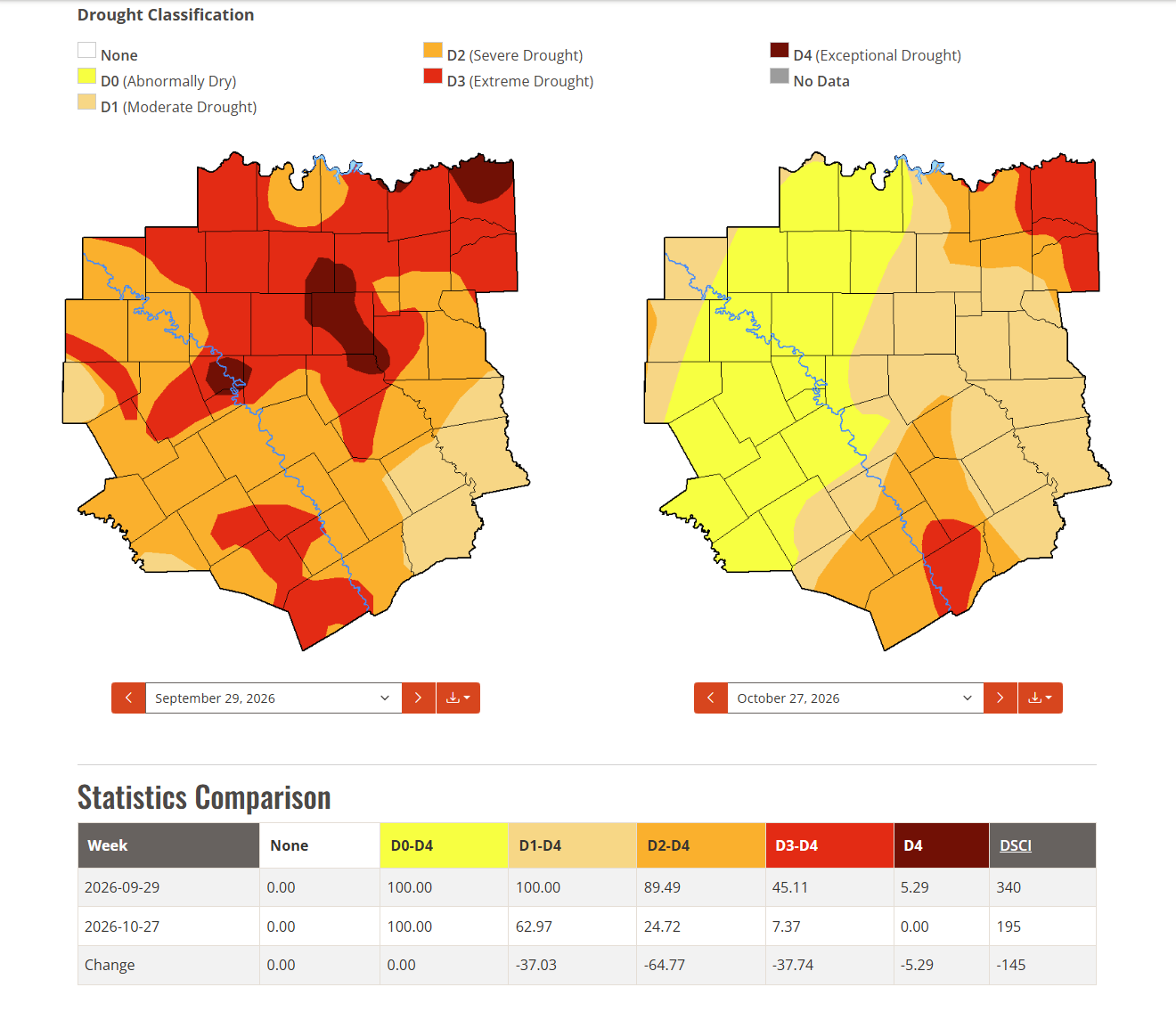
October’s rainfall helped improve drought conditions across much of TRWD’s watersheds following the exceptionally hot and dry summer. While dry conditions persist in portions of the region, recent rainfall has increased the potential for runoff into the reservoirs with additional rainfall.
What to Expect: As we move into November, cooler seasonal temperatures should help reduce evaporation and water demands. With longer-term outlooks favoring above-normal precipitation, additional rainfall could support increasing lake levels and help replenish storage lost during the summer. Lake levels are expected to generally follow the “Normal Rainfall” trends represented by the green shaded areas on the Lake Level Projection Plots, with the potential to trend toward the “Above Normal” blue shaded areas if wetter conditions develop.
October Highlights:
- Temperature: October was warmer than normal across North Texas, with an average temperature of 72.7°F at DFW Airport, 5.0°F above normal. Temperatures reached 95°F on October 13.
- Rainfall: October rainfall ranged from 3.5 inches at Eagle Mountain Lake to 4.3 inches at Cedar Creek Lake.
- Drought Conditions:
- Severe drought (D2) or worse decreased from 89% to 25% of the NWS Fort Worth forecast area during October, although dry conditions persist across the region.
- View the latest conditions on the NWS Drought Monitor.
Looking Ahead:
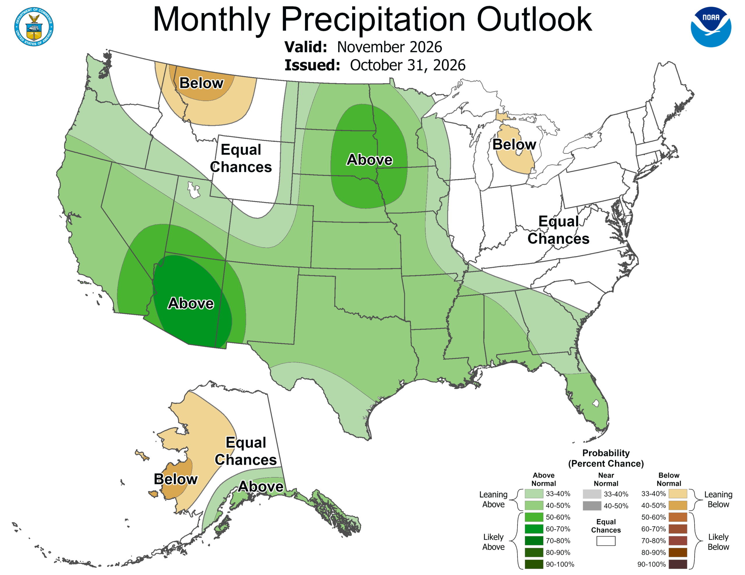
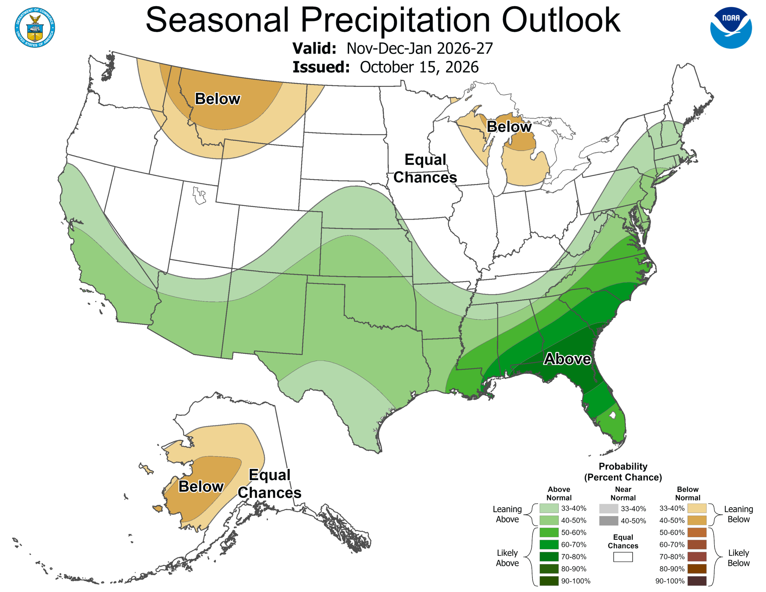
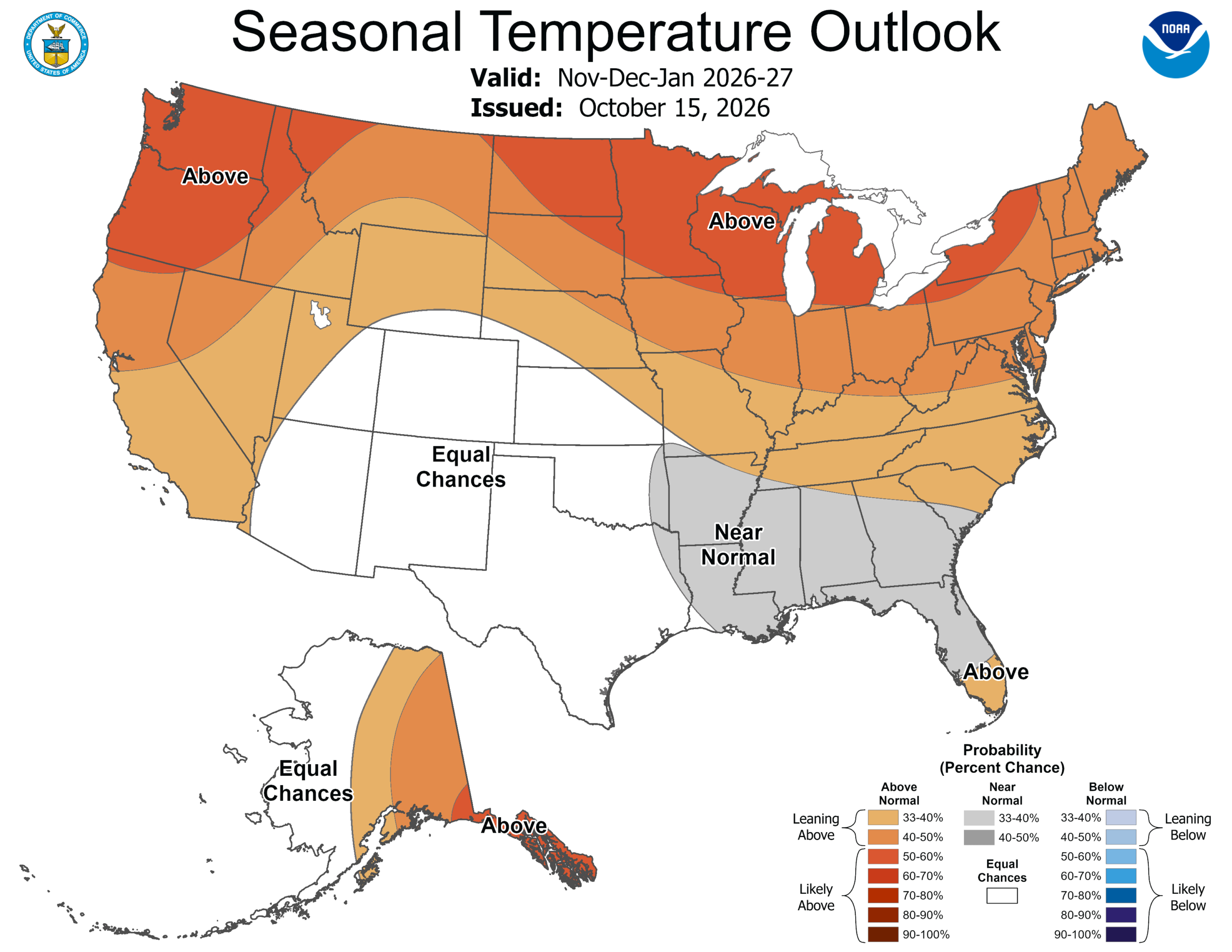
- Rainfall: The November outlook favors above-normal precipitation across North Texas. The November–January seasonal outlook also favors above-normal precipitation across much of Texas, providing a favorable signal for additional rainfall during the winter months.
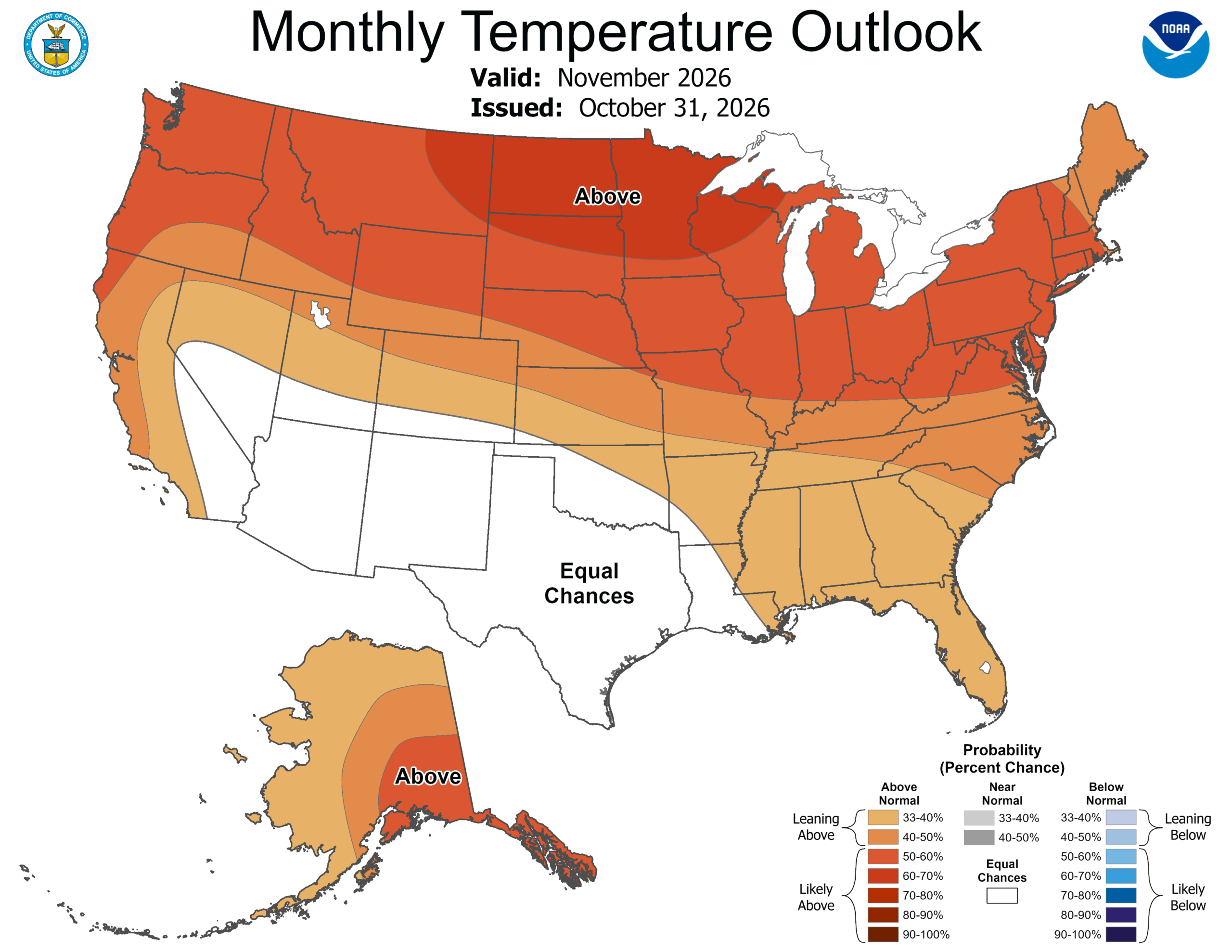
- Temperatures: The November temperature outlook indicates equal chances of above-, near-, or below-normal temperatures across North Texas. The November–January outlook also shows equal chances across much of the region.
- ENSO Conditions: El Niño continues to strengthen. NOAA’s Climate Prediction Center indicates a strong-to-very strong El Niño is likely through early 2027, with an 83% chance that the October–December event exceeds the strength of previous El Niño events dating back to 1950.
*Note: ENSO, or the El Niño-Southern Oscillation, is a recurring climate pattern that influences global weather. It has two main phases: El Niño, which often brings wetter conditions, and La Niña, which typically leads to drier and warmer weather in Texas, especially during fall and winter. This shift is important for water resource planning, as it can affect rainfall and reservoir levels.
Stay Informed by Checking Out the Following:
- TRWD’s quarterly watershed protection newsletter, The Tributary.
- The latest Lake Level Projections (see below).
- Links to historical lake level plots.
- Past projections compared to actual outcomes.
Thank you for following the Lake Level Blog. Check back next month for more updates!
TRWD Watershed Rainfall
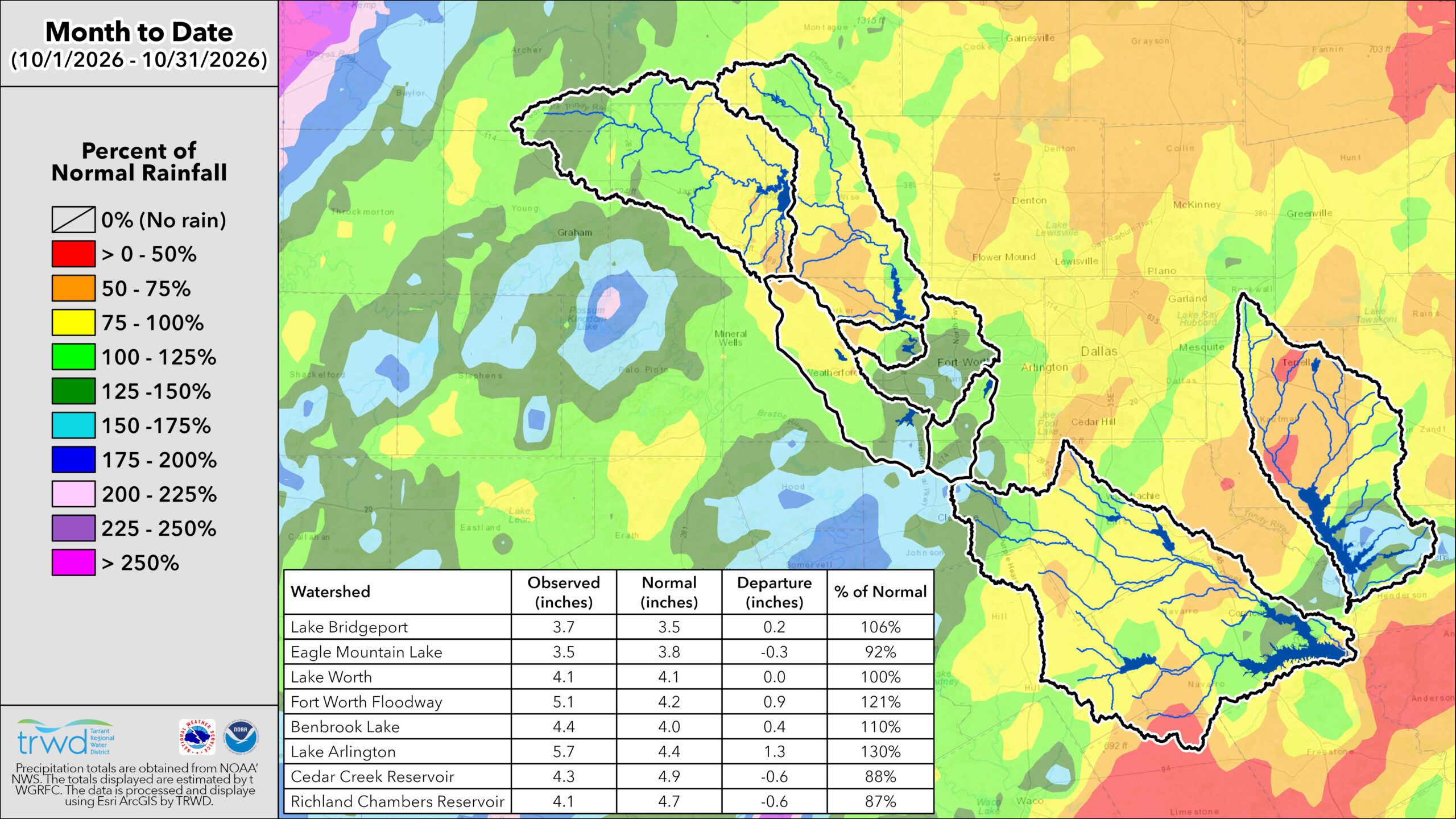
TRWD Lake Rainfall Totals through November 2, 2026
Lake Level Projections
Note: Lake level projections are based on expected climate conditions, water use demands, and planned operations, including releases and pumping. Actual lake levels may vary based on observed weather, actual water use, and operational responses to changing conditions.
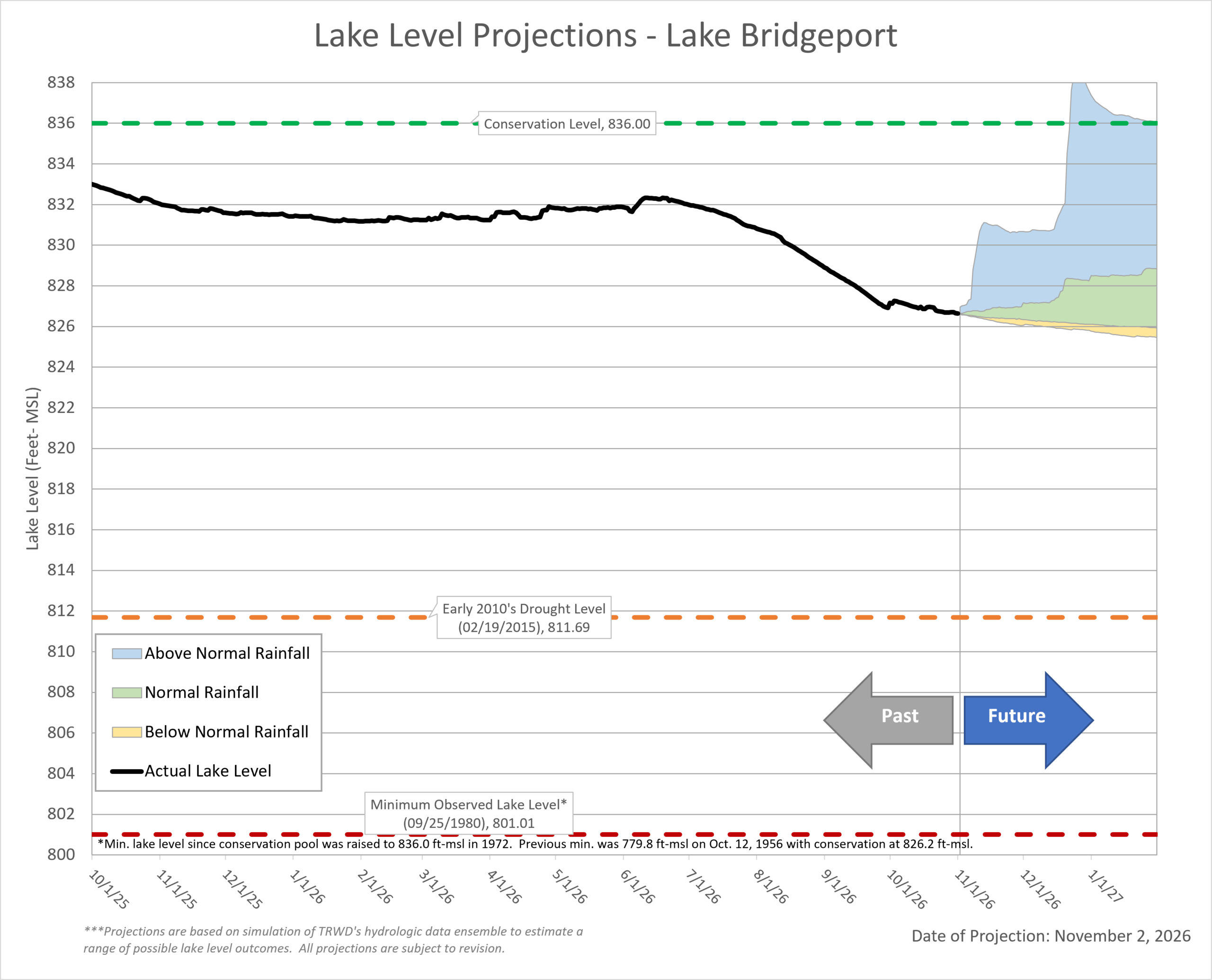 Last Month’s Projection | Historical Lake Levels
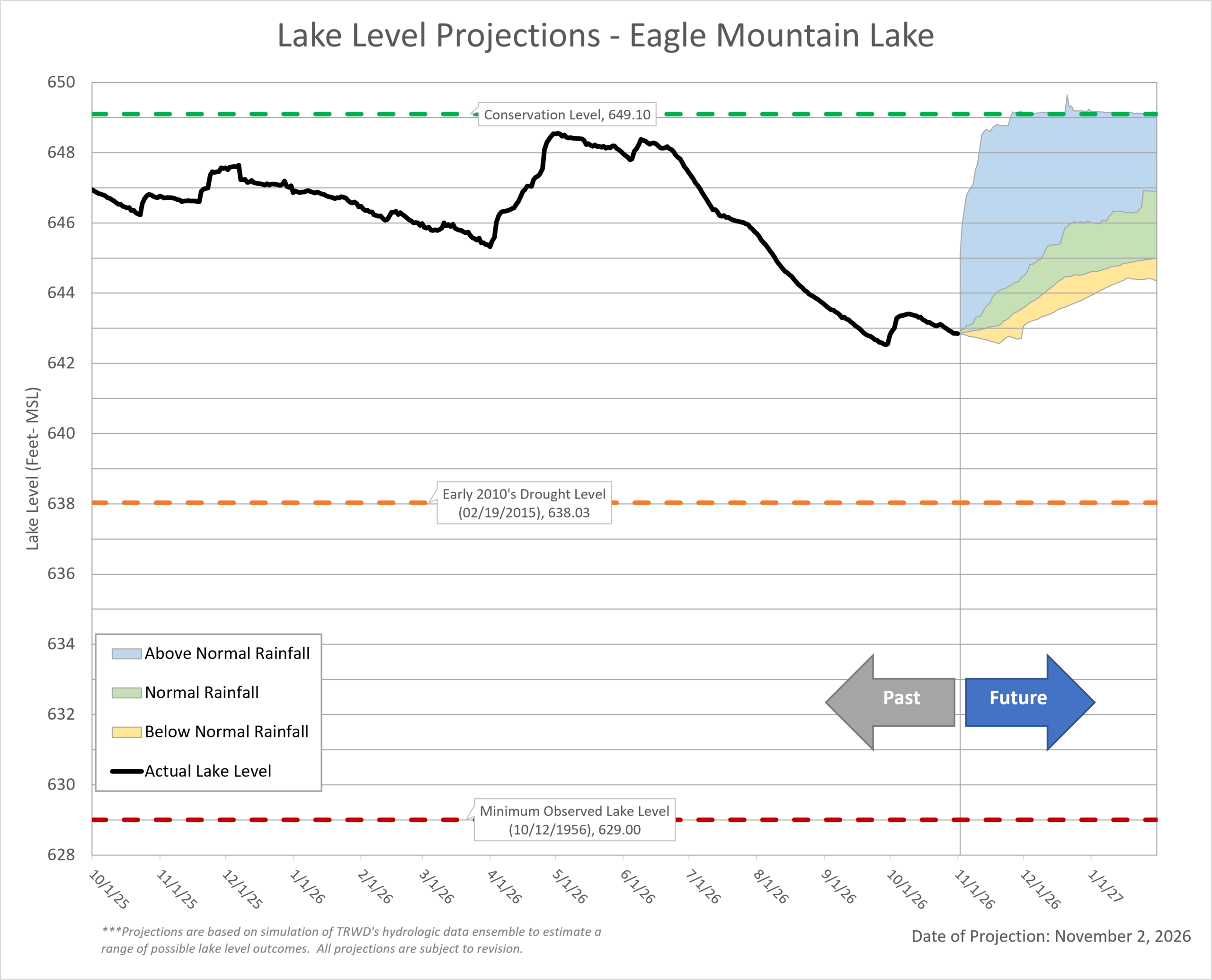 Last Month’s Projections | Historical Lake Levels
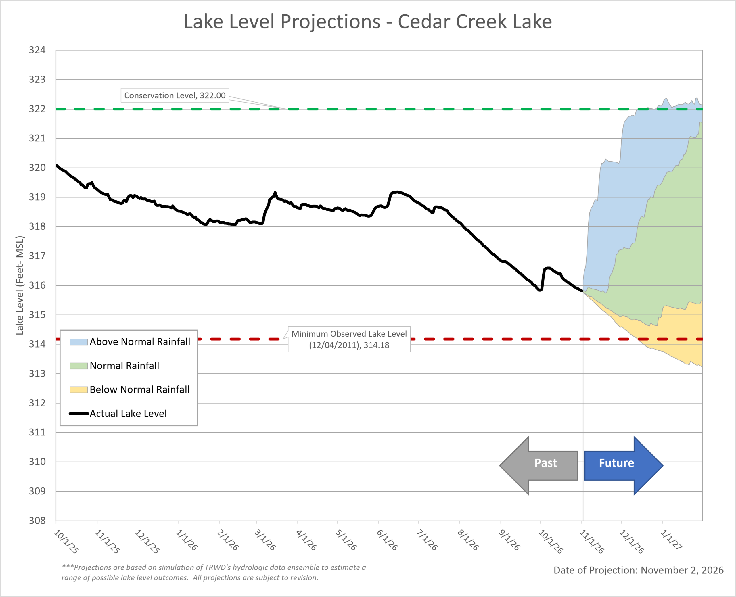 Last Month’s Projection | Historical Lake Levels
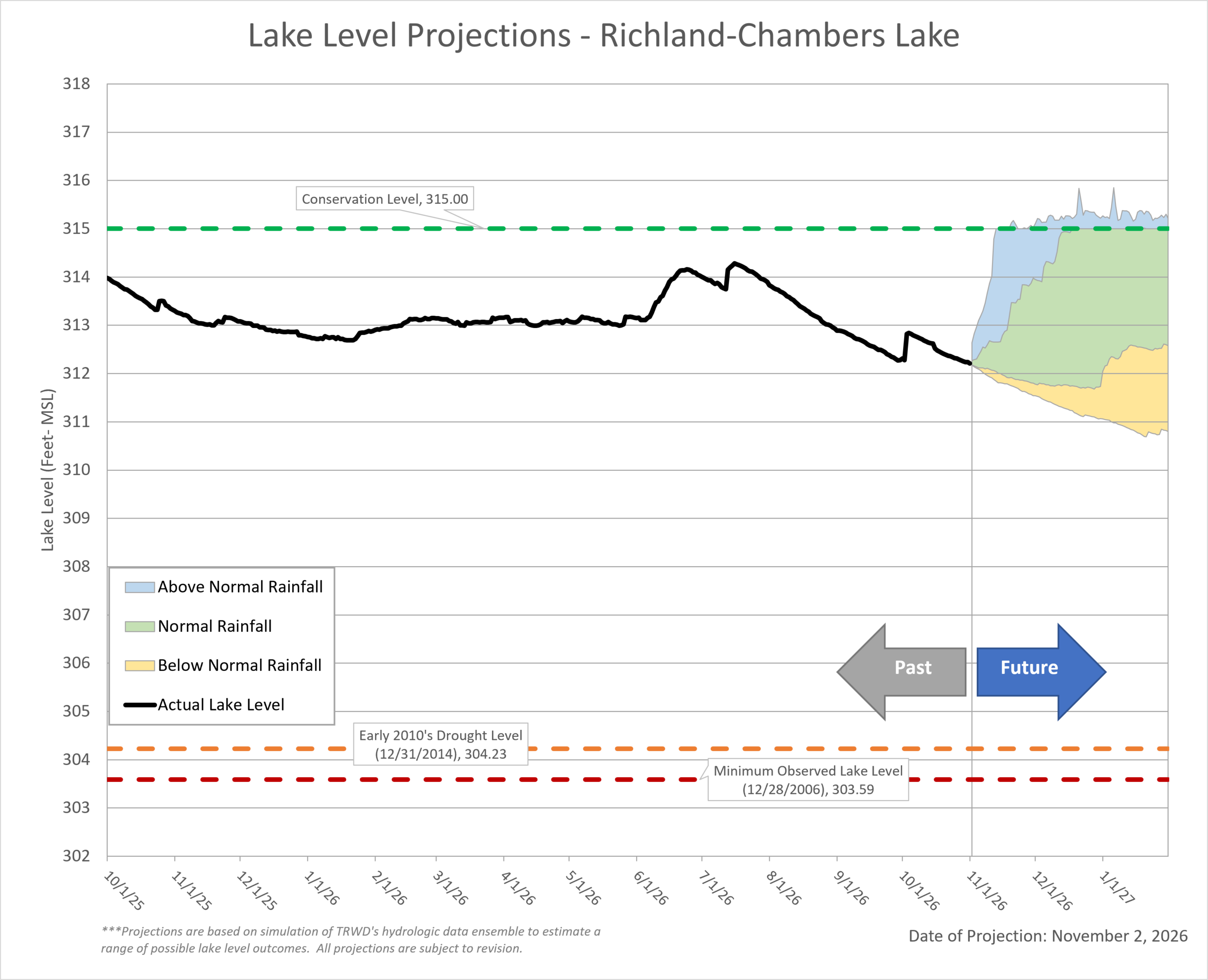 Last Month’s Projection | Historical Lake Levels
Disclaimer: These projections are based on typical operating conditions and expected weather patterns. Actual water use and weather can vary, so observed lake levels may occasionally be slightly higher or lower than the projected range.
Acknowledgments:
- Weather and Climate Insights: Special thanks to Olivia Whittaker and Craig Ottman.
- Reservoir Projections: A big thank you to Vini de Oliveira for his timely reservoir projections.
- Rainfall Analysis: Appreciation goes to Ashley Lowrie for her thorough analysis of observed rainfall.