Originally Published on October 3, 2016 by Urban Land Institute.
Rerouting the Trinity River
Fort Worth’s bold plan of dredging channels and tearing down levies would enhance flood control, connect people with the waterfront—and double the amount of land in the city’s downtown.
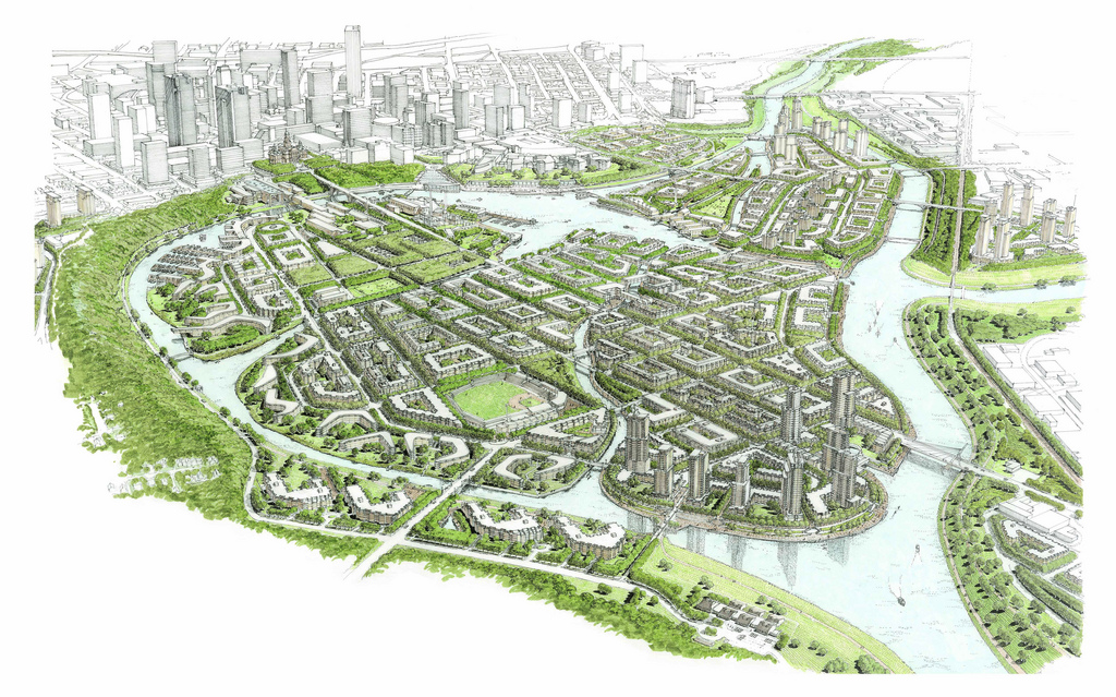
In an industrial area north of downtown Fort Worth, three bridges are under construction that, at least for now, serve little purpose. The bridges are going up over dry land in anticipation that they will someday span a 1.8-mile (3 km) channel off the Trinity River, part of an ambitious 13-year-old plan to transform the heart of the Texas city. The channel, which has not yet been dredged and still awaits federal funding, is the centerpiece of the $900 million development that combines flood control with the city’s dreams of creating a new urban district.
The new channel will create an 800-acre (324 ha) island that essentially will double the size of downtown Fort Worth. Specific plans for the island—dubbed Panther Island—call for high-density neighborhoods for more than 20,000 people, crisscrossed by canals and waterfront walkways. The project will create more than 12 miles (19 km) of developable waterfront and provide a city infamous for urban sprawl the chance to reshape its future.
“There’s not another city in North America that has this type of phase two opportunity in one swipe,” says J.D. Granger, the executive director of the Trinity River Vision Authority (TRVA), which is overseeing the project. “It’s a blank slate.”
Yet some people believe it will not happen. The bulk of the project relies on $370 million of federal funding, which has not been authorized yet. For now, the TRVA is spending money on cleaning up sites, acquiring land, and moving utilities. Construction of the bridges, at a cost of $65.5 million, represents a major step for the project, providing evidence that the plan is moving forward, if nothing else.
“It is an ambitious effort that many people see as unrealistic,” says Fernando Costa, assistant city manager of Fort Worth. “But it’s already taking shape.” The project may be the largest redevelopment effort in the country and, he adds, it all began with “a brainstorming idea in a workshop.
Read the full article at The Urban Land.