Lake Level BlogUncategorized

Reservoir Monitoring Update

By December 31, 2018

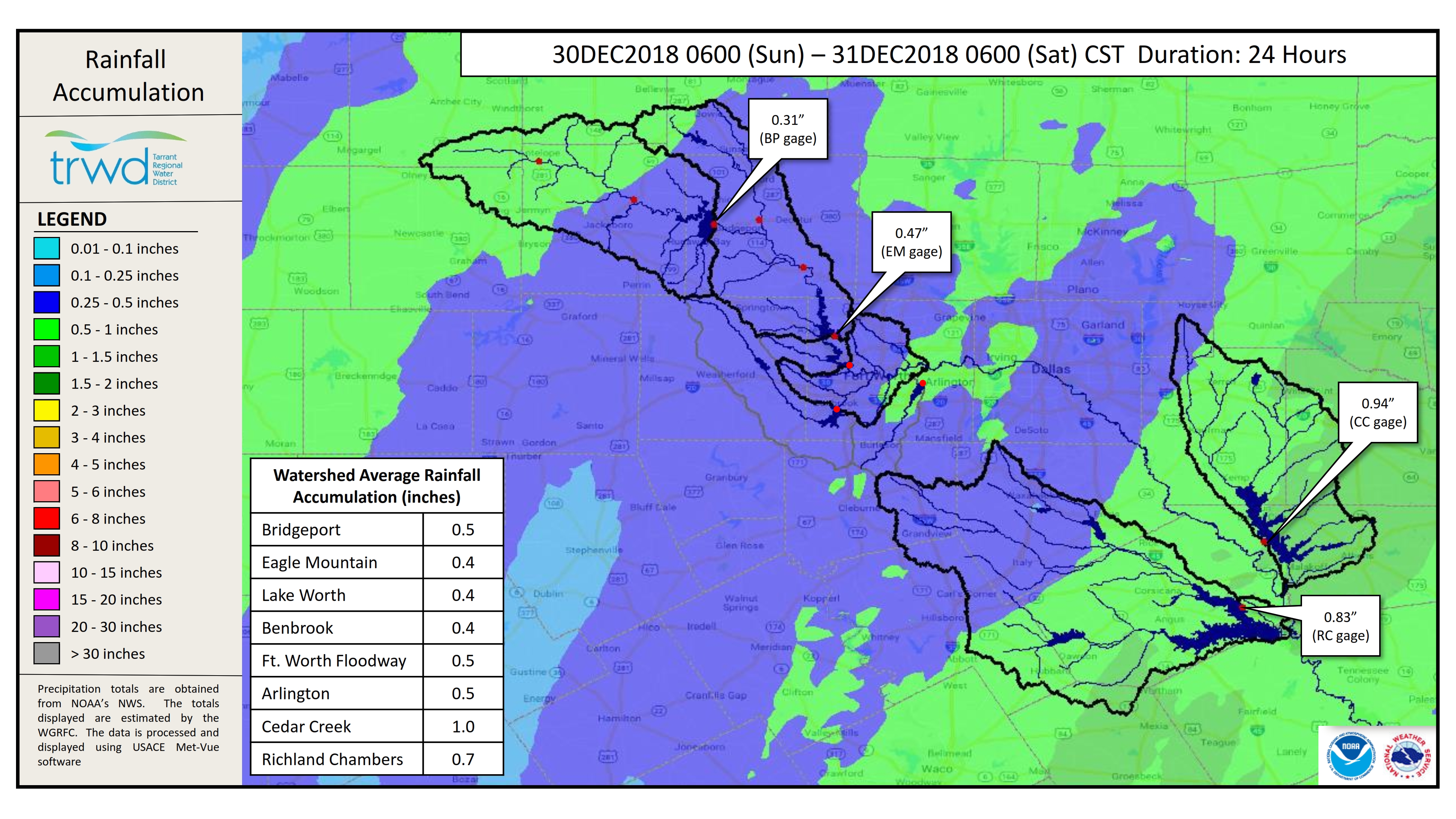
TRWD staff continues to monitor conditions in the TRWD reservoir watersheds 24 hours a day.  Rainfall is clearing out of the area.  A map showing the 24-hour rainfall accumulation can be seen in Graphic-1.  The rain resulted in small rises in the TRWD reservoir pool levels.  Discharges will continue as the reservoirs are being returned to conservation level.  Current lake levels can be viewed on the TRWD Home Page.  This will be the final post until conditions warrant an update. Please check back.

Graphic-1. 24-hour Rain Map

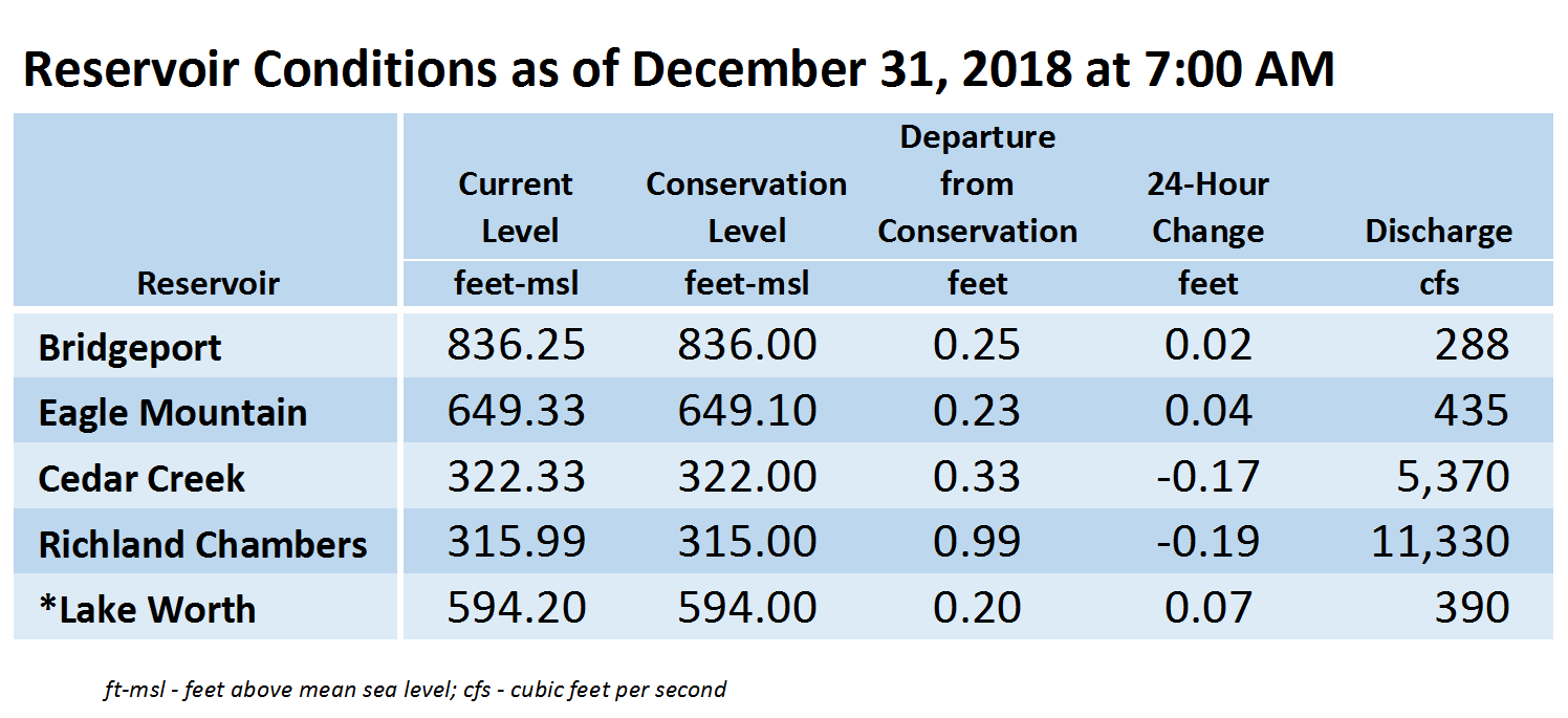
*Lake Worth owned and operated by the City of Fort Worth.  See City of Fort Worth news feed for updates on Lake Worth.

Please call the Flood Hotline for further information.

817-720-4296.

If prompted to leave a message, the flood monitor on duty will return your call within 30 minutes.

Lake Current Level Conservation Level* Level Difference**
Arlington 550.90 550.00 0.90
Benbrook 694.32 694.00 0.32
Bridgeport 821.55 836.00 -14.45
Cedar Creek 322.41 322.00 0.41
Eagle Mountain 645.16 649.10 -3.94
Lake Worth 591.29 594.00 -2.71
Richland-Chambers 315.35 315.00 0.35
*Conservation Level: The permitted level of water an entity is allowed to hold in a lake. Any amount above the conservation level is used for the temporary storage of flood waters and must be released downstream.
**Difference: Amount above or below conservation level.
For more information read our daily reports or the TRWD Lake Level Blog.

Check out the TRWD OneRain portal for a visualization of this information and more.

Stay connected with TRWD!

Sign up for our newsletter!

Newsletter Sign Up